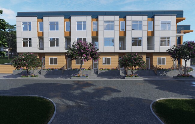
Property Record
10310 Ne 185Th St, Bothell, WA 98011


NEARBY LISTINGS FOR SALE OR LEASE
Property Detail
10310 Ne 185Th St
Seattle-Tacoma-Bellevue, WA
Woodys 1St Add To Bothell
956780-0030
King
Sfr
Washington
X
0.33 AC
53033C0064H
Bothell/Kenmore
1,310 SF
Seattle/Puget Sound
DEMOGRAPHICS near 10310 Ne 185Th St
1 Mile
3 Mile
5 Mile
2024 Total Population
14,310
108,242
258,998
2029 Population
14,620
110,147
264,670
Pop Growth 2024-2029
+ 2.17%
+ 1.76%
+ 2.19%
Average Age
41
39
39
2024 Total Households
6,539
42,295
99,591
HH Growth 2024-2029
+ 2.28%
+ 1.70%
+ 2.11%
Median Household Inc
$102,747
$127,376
$126,983
Avg Household Size
2.10
2.50
2.50
2024 Avg HH Vehicles
2.00
2.00
2.00
Median Home Value
$761,101
$791,495
$796,130
Median Year Built
1981
1984
1983
Nearby Places
Map Layers
Map Styles
 Street
 Aerial
- Restaurants
- Banks
- Shops
- Fitness
- Groceries
PUBLIC TRANSPORTATION
AIRPORT
Seattle Paine Field International
DRIVE
WALK
Distance
Seattle Paine Field International
22 min
14.4 mi
Seattle-Tacoma International
DRIVE
WALK
Distance
Seattle-Tacoma International
40 min
28.0 mi
Freight Ports
Port of Everett
DRIVE
WALK
Distance
Port of Everett
30 min
19.8 mi
SALE & LEASE HISTORY
LISTING DATE
SALE/LEASE

Mar 28, 2024
For Sale
Nearby Properties
Address
Land Use
TOTAL SIZE
Lot Size
Zoning
Address
Land Use
TOTAL SIZE
Lot Size
Zoning
50,400 SF
123.66 AC
C
Address
Land Use
TOTAL SIZE
Lot Size
Zoning
11.29 AC
R-AC, OP,
Address
Land Use
TOTAL SIZE
Lot Size
Zoning
2.60 AC
DN
Address
Land Use
TOTAL SIZE
Lot Size
Zoning
343,095 SF
39.09 AC
R 5,400A,
Address
Land Use
TOTAL SIZE
Lot Size
Zoning
295,920 SF
17.30 AC
R-18
Address
Land Use
TOTAL SIZE
Lot Size
Zoning
293,664 SF
38.51 AC
R 2800, OP
Address
Land Use
TOTAL SIZE
Lot Size
Zoning
190,512 SF
4.86 AC
CBD
Address
Land Use
TOTAL SIZE
Lot Size
Zoning
194,388 SF
1.65 AC
DC
Address
Land Use
TOTAL SIZE
Lot Size
Zoning
231,840 SF
22.82 AC
RMA 2.4
Address
Land Use
TOTAL SIZE
Lot Size
Zoning
226,192 SF
6.35 AC
CBD
Address
Land Use
TOTAL SIZE
Lot Size
Zoning
264,253 SF
29.11 AC
R 4,000
Address
Land Use
TOTAL SIZE
Lot Size
Zoning
170,520 SF
1.92 AC
DN
Address
Land Use
TOTAL SIZE
Lot Size
Zoning
394,152 SF
18 AC
E-M
Address
Land Use
TOTAL SIZE
Lot Size
Zoning
181,008 SF
9.76 AC
E-L
Address
Land Use
TOTAL SIZE
Lot Size
Zoning
217,877 SF
17.03 AC
R 2,800
Address
Land Use
TOTAL SIZE
Lot Size
Zoning
75,661 SF
30.54 AC
R 8400
Address
Land Use
TOTAL SIZE
Lot Size
Zoning
187,590 SF
17.20 AC
R 2800, OP
Address
Land Use
TOTAL SIZE
Lot Size
Zoning
47,176 SF
38.88 AC
R 9,600
Address
Land Use
TOTAL SIZE
Lot Size
Zoning
184,576 SF
9.56 AC
RMA 1.8
Address
Land Use
TOTAL SIZE
Lot Size
Zoning
122,766 SF
2 AC
GDC
Address
Land Use
TOTAL SIZE
Lot Size
Zoning
130,800 SF
2.28 AC
CBD
Address
Land Use
TOTAL SIZE
Lot Size
Zoning
182,875 SF
16.47 AC
R-AC, OP,
Address
Land Use
TOTAL SIZE
Lot Size
Zoning
204,428 SF
34.65 AC
R 9600
Address
Land Use
TOTAL SIZE
Lot Size
Zoning
119,470 SF
1.56 AC
DN
Address
Land Use
TOTAL SIZE
Lot Size
Zoning
189,700 SF
18.85 AC
OR-L
Address
Land Use
TOTAL SIZE
Lot Size
Zoning
126,522 SF
2.62 AC
CBD
Address
Land Use
TOTAL SIZE
Lot Size
Zoning
210,072 SF
13.89 AC
E-L
Address
Land Use
TOTAL SIZE
Lot Size
Zoning
173,130 SF
10.27 AC
E-L
Address
Land Use
TOTAL SIZE
Lot Size
Zoning
114,513 SF
2.35 AC
GDC
Address
Land Use
TOTAL SIZE
Lot Size
Zoning
113,880 SF
1.56 AC
GDC
The World's #1 Commercial Real Estate Marketplace
Connect with us
© 2026 CoStar Group
The information above has been obtained from sources believed reliable. While we do not doubt its accuracy we have not verified it and make no guarantee, warranty or representation about it. It is your responsibility to independently confirm its accuracy and completeness. Any projections, opinions, assumptions, or estimates used are for example only and do not represent the current or future performance of the property. The value of this transaction to you depends on tax and other factors which should be evaluated by your tax, financial, and legal advisors. You and your advisors should conduct a careful, independent investigation of the property to determine to your satisfaction the suitability of the property for your needs.