Property Record
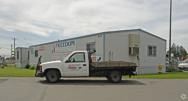
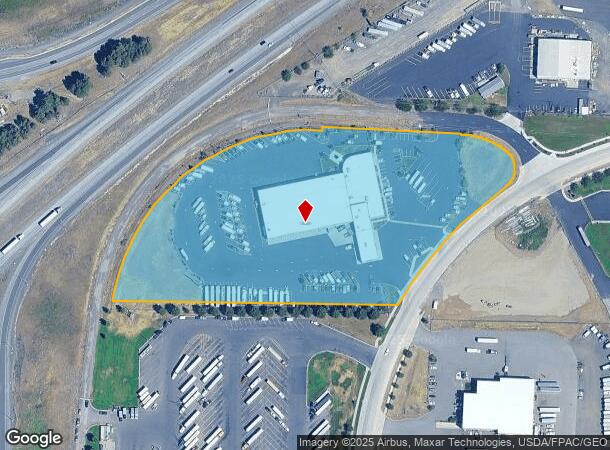
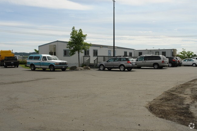
10310 W Westbow Rd, Spokane, WA 99224
NEARBY LISTINGS FOR SALE OR LEASE
-
-
View all Spokane listings for sale on LoopNet.com
Property Detail
10310 W Westbow Rd
Spokane-Spokane Valley, WA
Garden Acres
24072.9060
07-24-42 BEG AT NW COR OF NW1/4; TH S 89DEG 05MIN 20SDS E ALG N LN SD SEC, 1307.24FT; TH S 0DEG 54MIN 40SDS W, 30FT TO TRUE POB TH S 89DEG 05MIN 20SDS E ALG S R/W LN OF HALLETT RD, 369.06FT; TH THRU ANG TO RT 32DEG 33MIN 16SDS, RAD 220FT, LGTH 125FT;
Storebuilding
Spokane
X
Washington
53063C0700D
9
2025
8.93 AC
2025
West Plains
014100
Spokane
1,254 SF
DEMOGRAPHICS near 10310 W Westbow Rd
1 Mile
3 Mile
5 Mile
2024 Total Population
2,753
6,777
26,344
2029 Population
2,977
7,330
28,362
Pop Growth 2024-2029
+ 8.14%
+ 8.16%
+ 7.66%
Average Age
38
39
37
2024 Total Households
1,001
2,475
9,025
HH Growth 2024-2029
+ 8.29%
+ 8.32%
+ 7.99%
Median Household Inc
$77,925
$83,634
$69,334
Avg Household Size
2.70
2.70
2.60
2024 Avg HH Vehicles
2.00
2.00
2.00
Median Home Value
$360,025
$375,970
$360,950
Median Year Built
2005
2003
2003
Nearby Places
Map Layers
Map Styles
 Street
 Aerial
- Restaurants
- Banks
- Shops
- Fitness
- Groceries
PUBLIC TRANSPORTATION
COMMUTER RAIL
Spokane (Empire Builder - Amtrak)
DRIVE
WALK
Distance
Spokane (Empire Builder - Amtrak)
13 min
9.6 mi
AIRPORT
Spokane International
DRIVE
WALK
Distance
Spokane International
9 min
5.7 mi
Freight Ports
Port of Everett
DRIVE
WALK
Distance
Port of Everett
329 min
294.3 mi
Nearby Properties
Address
Land Use
TOTAL SIZE
Lot Size
Zoning
Address
Land Use
TOTAL SIZE
Lot Size
Zoning
2,689,133 SF
79.07 AC
LI
Address
Land Use
TOTAL SIZE
Lot Size
Zoning
808,710 SF
646.44 AC
Address
Land Use
TOTAL SIZE
Lot Size
Zoning
546,897 SF
27.69 AC
Address
Land Use
TOTAL SIZE
Lot Size
Zoning
306,250 SF
16.11 AC
LI
Address
Land Use
TOTAL SIZE
Lot Size
Zoning
562,448 SF
62 AC
LI
Address
Land Use
TOTAL SIZE
Lot Size
Zoning
218,400 SF
14.69 AC
Address
Land Use
TOTAL SIZE
Lot Size
Zoning
278,722 SF
44.44 AC
RC
Address
Land Use
TOTAL SIZE
Lot Size
Zoning
187,000 SF
12.43 AC
I-2
Address
Land Use
TOTAL SIZE
Lot Size
Zoning
147,774 SF
6.64 AC
RC
Address
Land Use
TOTAL SIZE
Lot Size
Zoning
78,801 SF
14.39 AC
RT
Address
Land Use
TOTAL SIZE
Lot Size
Zoning
263,013 SF
10.12 AC
LI
Address
Land Use
TOTAL SIZE
Lot Size
Zoning
141,000 SF
14.82 AC
Address
Land Use
TOTAL SIZE
Lot Size
Zoning
508,598 SF
28.78 AC
LI
Address
Land Use
TOTAL SIZE
Lot Size
Zoning
183,750 SF
21.40 AC
I-2
Address
Land Use
TOTAL SIZE
Lot Size
Zoning
108,962 SF
14.58 AC
Address
Land Use
TOTAL SIZE
Lot Size
Zoning
91,482 SF
5.13 AC
MDR
Address
Land Use
TOTAL SIZE
Lot Size
Zoning
155,344 SF
28.64 AC
LI
Address
Land Use
TOTAL SIZE
Lot Size
Zoning
287,334 SF
39.24 AC
I-2
Address
Land Use
TOTAL SIZE
Lot Size
Zoning
152,130 SF
35.26 AC
I-2
Address
Land Use
TOTAL SIZE
Lot Size
Zoning
23,494 SF
8.32 AC
LI
Address
Land Use
TOTAL SIZE
Lot Size
Zoning
82,446 SF
3.55 AC
RC
Address
Land Use
TOTAL SIZE
Lot Size
Zoning
55,719 SF
9.94 AC
LI
Address
Land Use
TOTAL SIZE
Lot Size
Zoning
84,183 SF
11.07 AC
LI
Address
Land Use
TOTAL SIZE
Lot Size
Zoning
96,000 SF
6.72 AC
LI
Address
Land Use
TOTAL SIZE
Lot Size
Zoning
70,404 SF
61.69 AC
Address
Land Use
TOTAL SIZE
Lot Size
Zoning
70,924 SF
22.62 AC
LI
Address
Land Use
TOTAL SIZE
Lot Size
Zoning
80,000 SF
5.04 AC
LI
Address
Land Use
TOTAL SIZE
Lot Size
Zoning
2,136,347 SF
228.86 AC
RT
Address
Land Use
TOTAL SIZE
Lot Size
Zoning
57,384 SF
2.73 AC
LI
Address
Land Use
TOTAL SIZE
Lot Size
Zoning
75,000 SF
5.71 AC
LI
The World's #1 Commercial Real Estate Marketplace
Connect with us
© 2026 CoStar Group
The information above has been obtained from sources believed reliable. While we do not doubt its accuracy we have not verified it and make no guarantee, warranty or representation about it. It is your responsibility to independently confirm its accuracy and completeness. Any projections, opinions, assumptions, or estimates used are for example only and do not represent the current or future performance of the property. The value of this transaction to you depends on tax and other factors which should be evaluated by your tax, financial, and legal advisors. You and your advisors should conduct a careful, independent investigation of the property to determine to your satisfaction the suitability of the property for your needs.