Property Record
10319 General Ave, Jacksonville, FL 32220


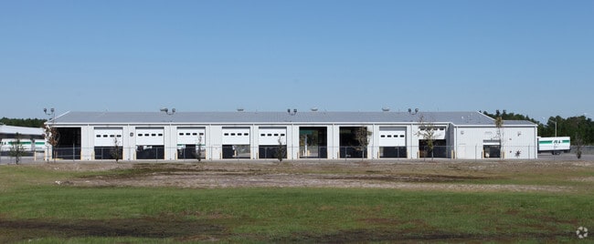
Property Detail
10319 General Ave
006829-9500
5-70 20-2S-25E 26.79 5-71 WHITE CITY S/D PT BLK 14,15 RECD O/R 17218-496
Warehouse
Duval
IL
Florida
B and X Area of moderate flood hazard, usually the area between the limits of the 100-year and 500-year floods.
25.46 AC
2025
Riverside
2026
Jacksonville (Florida)
011901
Jacksonville, FL
160,778 SF
NEARBY LISTINGS FOR SALE OR LEASE
-
-
View all Jacksonville listings for sale on LoopNet.com
DEMOGRAPHICS near 10319 General Ave
1 mile
3 mile
5 mile
2025 Total Population
4,109
34,395
77,860
2030 Population
4,352
36,650
83,093
Pop Growth 2025-2030
+ 5.91%
+ 6.56%
+ 6.72%
Average Age
41
39
38
2025 Total Households
1,499
12,259
28,406
HH Growth 2025-2030
+ 6.20%
+ 6.77%
+ 6.99%
Median Household Inc
$105,627
$86,626
$70,443
Avg Household Size
2.70
2.80
2.70
2025 Avg HH Vehicles
2.00
2.00
2.00
Median Home Value
$357,449
$316,968
$277,760
Median Year Built
1996
1998
1994
Nearby Places
Map Layers
Map Styles
 Street
 Aerial
Layers
 Traffic
 Biking
Places
Listings with unknown addresses are not visible on the map
- Restaurants
- Banks
- Shops
- Fitness
- Groceries
PUBLIC TRANSPORTATION
AIRPORT
Jacksonville International
Drive
Walk
Distance
Jacksonville International
37 min
23.6 mi
Freight Ports
Jacksonville Port
Drive
Walk
Distance
Jacksonville Port
29 min
17.4 mi
Nearby Properties
Address
Land Use
TOTAL SIZE
Lot Size
Zoning
Address
Land Use
TOTAL SIZE
Lot Size
Zoning
185,662 SF
1,416.80 AC
PBF-3
Address
Land Use
TOTAL SIZE
Lot Size
Zoning
421,500 SF
43.21 AC
PUD
Address
Land Use
TOTAL SIZE
Lot Size
Zoning
505,748 SF
94.71 AC
IL
Address
Land Use
TOTAL SIZE
Lot Size
Zoning
273,608 SF
23.15 AC
PUD
Address
Land Use
TOTAL SIZE
Lot Size
Zoning
509,686 SF
43.32 AC
IL
Address
Land Use
TOTAL SIZE
Lot Size
Zoning
139,435 SF
7.15 AC
CCG-2
Address
Land Use
TOTAL SIZE
Lot Size
Zoning
481,686 SF
43.54 AC
IL
Address
Land Use
TOTAL SIZE
Lot Size
Zoning
269,178 SF
129.93 AC
PBF-2
Address
Land Use
TOTAL SIZE
Lot Size
Zoning
878.69 AC
PUD
Address
Land Use
TOTAL SIZE
Lot Size
Zoning
30,789 SF
2.10 AC
PUD
Address
Land Use
TOTAL SIZE
Lot Size
Zoning
108,217 SF
178.52 AC
PBF-1
Address
Land Use
TOTAL SIZE
Lot Size
Zoning
153,549 SF
15.96 AC
PBF-1
Address
Land Use
TOTAL SIZE
Lot Size
Zoning
29,022 SF
3.17 AC
PUD
Address
Land Use
TOTAL SIZE
Lot Size
Zoning
33,424 SF
2.97 AC
PUD
Address
Land Use
TOTAL SIZE
Lot Size
Zoning
307.14 AC
PUD
Address
Land Use
TOTAL SIZE
Lot Size
Zoning
53,527 SF
10.89 AC
CCG-1
Address
Land Use
TOTAL SIZE
Lot Size
Zoning
53,405 SF
6.04 AC
PUD
Address
Land Use
TOTAL SIZE
Lot Size
Zoning
76,718 SF
8.89 AC
RR-ACRE
Address
Land Use
TOTAL SIZE
Lot Size
Zoning
73,426 SF
7.48 AC
PUD
Address
Land Use
TOTAL SIZE
Lot Size
Zoning
36,354 SF
3.72 AC
CCG-1
Address
Land Use
TOTAL SIZE
Lot Size
Zoning
23,532 SF
3.58 AC
CCG-2
Address
Land Use
TOTAL SIZE
Lot Size
Zoning
50,506 SF
9.44 AC
PBF-2
Address
Land Use
TOTAL SIZE
Lot Size
Zoning
153,671 SF
27.09 AC
IL
Address
Land Use
TOTAL SIZE
Lot Size
Zoning
26,961 SF
1.36 AC
PUD
Address
Land Use
TOTAL SIZE
Lot Size
Zoning
30,440 SF
25.01 AC
PUD
Address
Land Use
TOTAL SIZE
Lot Size
Zoning
12,384 SF
4.88 AC
RMD-MH
Address
Land Use
TOTAL SIZE
Lot Size
Zoning
35,821 SF
11.79 AC
IL
Address
Land Use
TOTAL SIZE
Lot Size
Zoning
14,722 SF
3.22 AC
CCG-2
Address
Land Use
TOTAL SIZE
Lot Size
Zoning
19,070 SF
8.06 AC
IL
The World's #1 Commercial Real Estate Marketplace
Connect with us
© 2026 CoStar Group
The information above has been obtained from sources believed reliable. While we do not doubt its accuracy we have not verified it and make no guarantee, warranty or representation about it. It is your responsibility to independently confirm its accuracy and completeness. Any projections, opinions, assumptions, or estimates used are for example only and do not represent the current or future performance of the property. The value of this transaction to you depends on tax and other factors which should be evaluated by your tax, financial, and legal advisors. You and your advisors should conduct a careful, independent investigation of the property to determine to your satisfaction the suitability of the property for your needs.