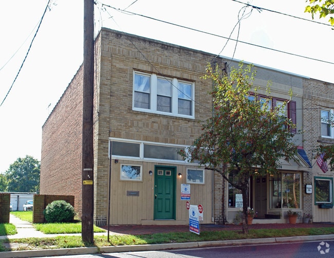
Property Record
1032 Collings Ave, Oaklyn, NJ 08107


NEARBY LISTINGS FOR SALE OR LEASE
Property Detail
1032 Collings Ave
12-00171-0000-00019
Camden
Commercialnec
New Jersey
X
19
34007C0037F
0.04 AC
2024
North Camden County
2025
Philadelphia
611600
Philadelphia-Camden-Wilmington, PA-NJ-DE-MD
DEMOGRAPHICS near 1032 Collings Ave
1 mile
3 mile
5 mile
2024 Total Population
23,534
151,678
469,741
2029 Population
23,626
152,539
464,368
Pop Growth 2024-2029
+ 0.39%
+ 0.57%
(1.14%)
Average Age
38
38
39
2024 Total Households
9,679
58,294
196,381
HH Growth 2024-2029
+ 0.38%
+ 0.51%
(1.41%)
Median Household Inc
$54,367
$64,120
$77,523
Avg Household Size
2.40
2.50
2.30
2024 Avg HH Vehicles
1.00
1.00
1.00
Median Home Value
$208,440
$234,262
$276,080
Median Year Built
1948
1949
1950
Nearby Places
Map Layers
Map Styles
 Street
 Aerial
Transit
 Traffic
 Biking
Places
Listings with unknown addresses are not visible on the map
- Restaurants
- Banks
- Shops
- Fitness
- Groceries
PUBLIC TRANSPORTATION
COMMUTER RAIL
Cherry Hill (Atlantic City Line - NJ Transit Commuter Rail (NJ Transit))
Drive
Walk
Distance
Cherry Hill (Atlantic City Line - NJ Transit Commuter Rail (NJ Transit))
8 min
4.1 mi
Drive
Walk
Distance
11 min
6.2 mi
AIRPORT
Philadelphia International
Drive
Walk
Distance
Philadelphia International
22 min
11.4 mi
Trenton Mercer
Drive
Walk
Distance
Trenton Mercer
54 min
35.8 mi
Atlantic City International
Drive
Walk
Distance
Atlantic City International
80 min
49.1 mi
Freight Ports
Broadway Terminal - Pier 5
Drive
Walk
Distance
Broadway Terminal - Pier 5
6 min
2.3 mi
Nearby Properties
Address
Land Use
TOTAL SIZE
Lot Size
Zoning
Address
Land Use
TOTAL SIZE
Lot Size
Zoning
1.17 AC
Address
Land Use
TOTAL SIZE
Lot Size
Zoning
7.17 AC
Address
Land Use
TOTAL SIZE
Lot Size
Zoning
124.13 AC
Address
Land Use
TOTAL SIZE
Lot Size
Zoning
Address
Land Use
TOTAL SIZE
Lot Size
Zoning
12.53 AC
Address
Land Use
TOTAL SIZE
Lot Size
Zoning
Address
Land Use
TOTAL SIZE
Lot Size
Zoning
11.06 AC
CMX3
Address
Land Use
TOTAL SIZE
Lot Size
Zoning
2.32 AC
Address
Land Use
TOTAL SIZE
Lot Size
Zoning
7.11 AC
Address
Land Use
TOTAL SIZE
Lot Size
Zoning
8.50 AC
Address
Land Use
TOTAL SIZE
Lot Size
Zoning
1.68 AC
Address
Land Use
TOTAL SIZE
Lot Size
Zoning
Address
Land Use
TOTAL SIZE
Lot Size
Zoning
31.99 AC
Address
Land Use
TOTAL SIZE
Lot Size
Zoning
16,872 SF
RH
Address
Land Use
TOTAL SIZE
Lot Size
Zoning
1,504 SF
61.44 AC
Address
Land Use
TOTAL SIZE
Lot Size
Zoning
4,431 SF
18.60 AC
C2
Address
Land Use
TOTAL SIZE
Lot Size
Zoning
1.48 AC
PCR
Address
Land Use
TOTAL SIZE
Lot Size
Zoning
17.62 AC
Address
Land Use
TOTAL SIZE
Lot Size
Zoning
35 AC
R1
Address
Land Use
TOTAL SIZE
Lot Size
Zoning
14.11 AC
RG
Address
Land Use
TOTAL SIZE
Lot Size
Zoning
315,375 SF
20.41 AC
CMX3
Address
Land Use
TOTAL SIZE
Lot Size
Zoning
12.68 AC
RG
Address
Land Use
TOTAL SIZE
Lot Size
Zoning
16,796 SF
RH
Address
Land Use
TOTAL SIZE
Lot Size
Zoning
16,796 SF
20.22 AC
RH
Address
Land Use
TOTAL SIZE
Lot Size
Zoning
2.32 AC
Address
Land Use
TOTAL SIZE
Lot Size
Zoning
Address
Land Use
TOTAL SIZE
Lot Size
Zoning
5.20 AC
Address
Land Use
TOTAL SIZE
Lot Size
Zoning
1.53 AC
Address
Land Use
TOTAL SIZE
Lot Size
Zoning
5.24 AC
Address
Land Use
TOTAL SIZE
Lot Size
Zoning
1.15 AC
The World's #1 Commercial Real Estate Marketplace
Connect with us
© 2026 CoStar Group
The information above has been obtained from sources believed reliable. While we do not doubt its accuracy we have not verified it and make no guarantee, warranty or representation about it. It is your responsibility to independently confirm its accuracy and completeness. Any projections, opinions, assumptions, or estimates used are for example only and do not represent the current or future performance of the property. The value of this transaction to you depends on tax and other factors which should be evaluated by your tax, financial, and legal advisors. You and your advisors should conduct a careful, independent investigation of the property to determine to your satisfaction the suitability of the property for your needs.