Property Record
1032 Northside Ct, High Point, NC 27265
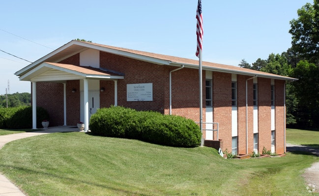

Property Detail
1032 Northside Ct
0197361
47&111&PT45-46 BB 1032 OLD WINST
Governmentalpublicusegeneral
GUILFORD
R-5
North Carolina
B and X Area of moderate flood hazard, usually the area between the limits of the 100-year and 500-year floods.
47
0
0.83 AC
2025
High Point/SW Guilford Cty
014409
Greensboro/Winston-Salem
4,216 SF
Greensboro-High Point, NC
NEARBY LISTINGS FOR SALE OR LEASE
-
-
View all High Point listings for sale on LoopNet.com
DEMOGRAPHICS near 1032 Northside Ct
1 mile
3 mile
5 mile
2025 Total Population
6,548
45,076
110,696
2030 Population
6,694
46,429
114,935
Pop Growth 2025-2030
+ 2.23%
+ 3.00%
+ 3.83%
Average Age
40
40
40
2025 Total Households
2,870
17,445
42,976
HH Growth 2025-2030
+ 2.37%
+ 3.27%
+ 4.06%
Median Household Inc
$57,575
$66,518
$63,356
Avg Household Size
2.30
2.30
2.40
2025 Avg HH Vehicles
2.00
2.00
2.00
Median Home Value
$230,351
$250,235
$255,301
Median Year Built
1986
1979
1984
Nearby Places
Map Layers
Map Styles
 Street
 Aerial
Transit
 Traffic
 Biking
Places
Listings with unknown addresses are not visible on the map
- Restaurants
- Banks
- Shops
- Fitness
- Groceries
PUBLIC TRANSPORTATION
COMMUTER RAIL
High Point Station (Piedmont - North Carolina by Train (NC Train))
Drive
Walk
Distance
High Point Station (Piedmont - North Carolina by Train (NC Train))
8 min
3.5 mi
AIRPORT
Piedmont Triad International
Drive
Walk
Distance
Piedmont Triad International
25 min
15.6 mi
Nearby Properties
Address
Land Use
TOTAL SIZE
Lot Size
Zoning
Address
Land Use
TOTAL SIZE
Lot Size
Zoning
264,860 SF
62.75 AC
PI
Address
Land Use
TOTAL SIZE
Lot Size
Zoning
418,654 SF
17.20 AC
PI
Address
Land Use
TOTAL SIZE
Lot Size
Zoning
1,045,775 SF
114.96 AC
CZ-LI-HP
Address
Land Use
TOTAL SIZE
Lot Size
Zoning
236,597 SF
13.83 AC
CU-PI
Address
Land Use
TOTAL SIZE
Lot Size
Zoning
139,254 SF
0.01 AC
PI
Address
Land Use
TOTAL SIZE
Lot Size
Zoning
25,648 SF
40.16 AC
PDR
Address
Land Use
TOTAL SIZE
Lot Size
Zoning
100,121 SF
0.01 AC
PI
Address
Land Use
TOTAL SIZE
Lot Size
Zoning
215,222 SF
15.14 AC
RC
Address
Land Use
TOTAL SIZE
Lot Size
Zoning
1.32 AC
PNR
Address
Land Use
TOTAL SIZE
Lot Size
Zoning
185,320 SF
15.08 AC
PI
Address
Land Use
TOTAL SIZE
Lot Size
Zoning
170,183 SF
13.94 AC
RM-16
Address
Land Use
TOTAL SIZE
Lot Size
Zoning
166,196 SF
19.99 AC
RM-16
Address
Land Use
TOTAL SIZE
Lot Size
Zoning
164,027 SF
12.52 AC
RM-16
Address
Land Use
TOTAL SIZE
Lot Size
Zoning
90,060 SF
3.15 AC
CZ-I
Address
Land Use
TOTAL SIZE
Lot Size
Zoning
56,029 SF
9.36 AC
CU-GB
Address
Land Use
TOTAL SIZE
Lot Size
Zoning
250,573 SF
48.53 AC
R-5
Address
Land Use
TOTAL SIZE
Lot Size
Zoning
87,488 SF
0.01 AC
PI
Address
Land Use
TOTAL SIZE
Lot Size
Zoning
181,106 SF
16.23 AC
RM-16
Address
Land Use
TOTAL SIZE
Lot Size
Zoning
161,377 SF
16.36 AC
CU-SC
Address
Land Use
TOTAL SIZE
Lot Size
Zoning
244,197 SF
14.76 AC
RM-26
Address
Land Use
TOTAL SIZE
Lot Size
Zoning
133,710 SF
8.70 AC
RM-16
Address
Land Use
TOTAL SIZE
Lot Size
Zoning
145,571 SF
11.01 AC
RC
Address
Land Use
TOTAL SIZE
Lot Size
Zoning
132,012 SF
12.99 AC
RM-16
Address
Land Use
TOTAL SIZE
Lot Size
Zoning
184,724 SF
15.71 AC
RM-16
Address
Land Use
TOTAL SIZE
Lot Size
Zoning
65,520 SF
3.88 AC
MS
Address
Land Use
TOTAL SIZE
Lot Size
Zoning
11,116 SF
2.60 AC
MS
Address
Land Use
TOTAL SIZE
Lot Size
Zoning
125,037 SF
13.89 AC
CU-GO-M
Address
Land Use
TOTAL SIZE
Lot Size
Zoning
74,786 SF
10.61 AC
GB
Address
Land Use
TOTAL SIZE
Lot Size
Zoning
666,462 SF
44.09 AC
RC
Address
Land Use
TOTAL SIZE
Lot Size
Zoning
67,497 SF
5.95 AC
RC
The World's #1 Commercial Real Estate Marketplace
Connect with us
© 2026 CoStar Group
The information above has been obtained from sources believed reliable. While we do not doubt its accuracy we have not verified it and make no guarantee, warranty or representation about it. It is your responsibility to independently confirm its accuracy and completeness. Any projections, opinions, assumptions, or estimates used are for example only and do not represent the current or future performance of the property. The value of this transaction to you depends on tax and other factors which should be evaluated by your tax, financial, and legal advisors. You and your advisors should conduct a careful, independent investigation of the property to determine to your satisfaction the suitability of the property for your needs.