Property Record
10320 Cascade Xing, Cleveland, OH 44144
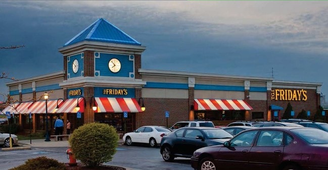


Property Detail
10320 Cascade Xing
433-10-007
1 CASCADE CROSSING SUBD PCLC
Restaurantbuilding
CUYAHOGA
L-I
Ohio
A Areas with a 1% annual chance of flooding and a 26% chance of flooding over the life of a 30-year mortgage.
1
2025
2.07 AC
2025
Southwest
137103
Cleveland
7,314 SF
Cleveland-Elyria, OH
NEARBY LISTINGS FOR SALE OR LEASE
DEMOGRAPHICS near 10320 Cascade Xing
1 mile
3 mile
5 mile
2025 Total Population
9,316
130,742
333,586
2030 Population
9,237
127,971
328,180
Pop Growth 2025-2030
(0.85%)
(2.12%)
(1.62%)
Average Age
42
40
41
2025 Total Households
4,279
55,707
149,619
HH Growth 2025-2030
(1.05%)
(2.24%)
(1.68%)
Median Household Inc
$61,938
$58,781
$59,476
Avg Household Size
2.10
2.20
2.10
2025 Avg HH Vehicles
2.00
2.00
2.00
Median Home Value
$153,146
$144,177
$166,645
Median Year Built
1960
1952
1952
Nearby Places
Map Layers
Map Styles
 Street
 Aerial
Layers
 Traffic
 Biking
Places
Listings with unknown addresses are not visible on the map
- Restaurants
- Banks
- Shops
- Fitness
- Groceries
PUBLIC TRANSPORTATION
COMMUTER RAIL
Drive
Walk
Distance
16 min
8.9 mi
AIRPORT
Cleveland-Hopkins International
Drive
Walk
Distance
Cleveland-Hopkins International
13 min
5.9 mi
SALE & LEASE HISTORY
LISTING DATE
SALE/LEASE

Apr 30, 2024
For Sale
Nearby Properties
Address
Land Use
TOTAL SIZE
Lot Size
Zoning
Address
Land Use
TOTAL SIZE
Lot Size
Zoning
70.02 AC
GI
Address
Land Use
TOTAL SIZE
Lot Size
Zoning
208,209 SF
12.10 AC
1F
Address
Land Use
TOTAL SIZE
Lot Size
Zoning
809,240 SF
36.27 AC
L-I
Address
Land Use
TOTAL SIZE
Lot Size
Zoning
33.27 AC
IA
Address
Land Use
TOTAL SIZE
Lot Size
Zoning
355,701 SF
16.35 AC
OB
Address
Land Use
TOTAL SIZE
Lot Size
Zoning
519,592 SF
69.70 AC
L-I
Address
Land Use
TOTAL SIZE
Lot Size
Zoning
372,486 SF
3.98 AC
GR
Address
Land Use
TOTAL SIZE
Lot Size
Zoning
361,287 SF
86.50 AC
2F
Address
Land Use
TOTAL SIZE
Lot Size
Zoning
78,622 SF
11.78 AC
CB
Address
Land Use
TOTAL SIZE
Lot Size
Zoning
132.06 AC
IA
Address
Land Use
TOTAL SIZE
Lot Size
Zoning
389,067 SF
12.05 AC
A-H
Address
Land Use
TOTAL SIZE
Lot Size
Zoning
86,081 SF
14.45 AC
B
Address
Land Use
TOTAL SIZE
Lot Size
Zoning
111,220 SF
23.65 AC
IA
Address
Land Use
TOTAL SIZE
Lot Size
Zoning
76,288 SF
258.02 AC
PG
Address
Land Use
TOTAL SIZE
Lot Size
Zoning
340,593 SF
10.10 AC
G-1
Address
Land Use
TOTAL SIZE
Lot Size
Zoning
87,489 SF
8.01 AC
Address
Land Use
TOTAL SIZE
Lot Size
Zoning
32,820 SF
3.60 AC
U7-B
Address
Land Use
TOTAL SIZE
Lot Size
Zoning
74,731 SF
15.23 AC
A
Address
Land Use
TOTAL SIZE
Lot Size
Zoning
88,328 SF
35.11 AC
RM
Address
Land Use
TOTAL SIZE
Lot Size
Zoning
16,023 SF
18.41 AC
SF-DH
Address
Land Use
TOTAL SIZE
Lot Size
Zoning
239,222 SF
22.87 AC
G-B
Address
Land Use
TOTAL SIZE
Lot Size
Zoning
181,049 SF
7.76 AC
GI
Address
Land Use
TOTAL SIZE
Lot Size
Zoning
208,675 SF
17.33 AC
G-B
Address
Land Use
TOTAL SIZE
Lot Size
Zoning
154,579 SF
18.46 AC
A
Address
Land Use
TOTAL SIZE
Lot Size
Zoning
250,995 SF
15.94 AC
IP
Address
Land Use
TOTAL SIZE
Lot Size
Zoning
107,240 SF
19.19 AC
MF-1
Address
Land Use
TOTAL SIZE
Lot Size
Zoning
137,686 SF
12.02 AC
A-H
Address
Land Use
TOTAL SIZE
Lot Size
Zoning
160,436 SF
11.99 AC
U3-A5
Address
Land Use
TOTAL SIZE
Lot Size
Zoning
166,370 SF
8.64 AC
HB
Address
Land Use
TOTAL SIZE
Lot Size
Zoning
21,333 SF
17.61 AC
MF-1
The World's #1 Commercial Real Estate Marketplace
Connect with us
© 2026 CoStar Group
The information above has been obtained from sources believed reliable. While we do not doubt its accuracy we have not verified it and make no guarantee, warranty or representation about it. It is your responsibility to independently confirm its accuracy and completeness. Any projections, opinions, assumptions, or estimates used are for example only and do not represent the current or future performance of the property. The value of this transaction to you depends on tax and other factors which should be evaluated by your tax, financial, and legal advisors. You and your advisors should conduct a careful, independent investigation of the property to determine to your satisfaction the suitability of the property for your needs.