Property Record
10311 S Post Oak Rd, Houston, TX 77035
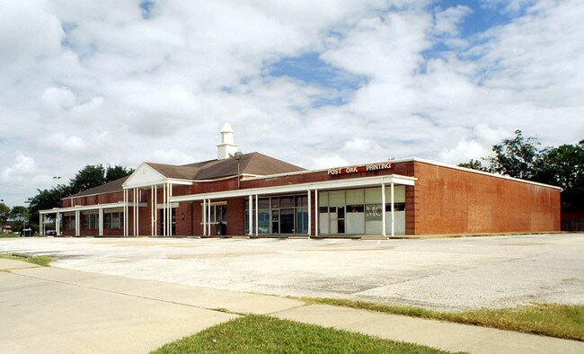

Property Detail
10311 S Post Oak Rd
0440360000028
TRS 2R ABST 612 J D OWEN
Commercialacreage
HARRIS
AE The base floodplain where base flood elevations are provided. AE Zones are now used on new format FIRMs instead of A1-A30 Zones.
Texas
2024
1 AC
2025
Southwest
420300
Houston
9,064 SF
Houston-Pasadena-The Woodlands, TX
NEARBY LISTINGS FOR SALE OR LEASE
DEMOGRAPHICS near 10311 S Post Oak Rd
1 mile
3 mile
5 mile
2025 Total Population
14,050
165,091
482,906
2030 Population
15,074
176,593
516,999
Pop Growth 2025-2030
+ 7.29%
+ 6.97%
+ 7.06%
Average Age
40
38
37
2025 Total Households
5,657
62,773
191,242
HH Growth 2025-2030
+ 7.34%
+ 7.24%
+ 7.32%
Median Household Inc
$116,229
$71,944
$64,753
Avg Household Size
2.40
2.60
2.50
2025 Avg HH Vehicles
2.00
2.00
2.00
Median Home Value
$437,002
$406,914
$332,634
Median Year Built
1963
1977
1981
Nearby Places
Map Layers
Map Styles
 Street
 Aerial
Layers
 Traffic
 Biking
Places
Listings with unknown addresses are not visible on the map
- Restaurants
- Banks
- Shops
- Fitness
- Groceries
PUBLIC TRANSPORTATION
AIRPORT
William P Hobby
Drive
Walk
Distance
William P Hobby
27 min
15.6 mi
George Bush Intcntl/Houston
Drive
Walk
Distance
George Bush Intcntl/Houston
38 min
30.7 mi
Freight Ports
Port of Houston
Drive
Walk
Distance
Port of Houston
24 min
15.9 mi
SALE & LEASE HISTORY
LISTING DATE
SALE/LEASE

Feb 23, 2017
For Lease
Nearby Properties
Address
Land Use
TOTAL SIZE
Lot Size
Zoning
Address
Land Use
TOTAL SIZE
Lot Size
Zoning
777,791 SF
47.90 AC
Address
Land Use
TOTAL SIZE
Lot Size
Zoning
507,499 SF
7.66 AC
Address
Land Use
TOTAL SIZE
Lot Size
Zoning
1,202,191 SF
39.08 AC
Address
Land Use
TOTAL SIZE
Lot Size
Zoning
15.46 AC
Address
Land Use
TOTAL SIZE
Lot Size
Zoning
550,115 SF
6.38 AC
Address
Land Use
TOTAL SIZE
Lot Size
Zoning
284,836 SF
4.22 AC
Address
Land Use
TOTAL SIZE
Lot Size
Zoning
335,626 SF
4.22 AC
Address
Land Use
TOTAL SIZE
Lot Size
Zoning
544,698 SF
15.66 AC
Address
Land Use
TOTAL SIZE
Lot Size
Zoning
640,860 SF
5.31 AC
Address
Land Use
TOTAL SIZE
Lot Size
Zoning
398,772 SF
2.97 AC
Address
Land Use
TOTAL SIZE
Lot Size
Zoning
297,620 SF
11.01 AC
Address
Land Use
TOTAL SIZE
Lot Size
Zoning
422,115 SF
6.18 AC
Address
Land Use
TOTAL SIZE
Lot Size
Zoning
292,644 SF
15.47 AC
Address
Land Use
TOTAL SIZE
Lot Size
Zoning
432,938 SF
4.31 AC
Address
Land Use
TOTAL SIZE
Lot Size
Zoning
534,800 SF
33.43 AC
Address
Land Use
TOTAL SIZE
Lot Size
Zoning
426,919 SF
12.62 AC
Address
Land Use
TOTAL SIZE
Lot Size
Zoning
290,624 SF
3.17 AC
Address
Land Use
TOTAL SIZE
Lot Size
Zoning
388,566 SF
3.38 AC
Address
Land Use
TOTAL SIZE
Lot Size
Zoning
255,680 SF
13.42 AC
Address
Land Use
TOTAL SIZE
Lot Size
Zoning
301,360 SF
11.97 AC
Address
Land Use
TOTAL SIZE
Lot Size
Zoning
242,982 SF
11.56 AC
Address
Land Use
TOTAL SIZE
Lot Size
Zoning
456,076 SF
19.09 AC
Address
Land Use
TOTAL SIZE
Lot Size
Zoning
363,134 SF
18.52 AC
Address
Land Use
TOTAL SIZE
Lot Size
Zoning
87,017 SF
3.19 AC
Address
Land Use
TOTAL SIZE
Lot Size
Zoning
543,903 SF
5.11 AC
Address
Land Use
TOTAL SIZE
Lot Size
Zoning
414,014 SF
7.77 AC
Address
Land Use
TOTAL SIZE
Lot Size
Zoning
253,163 SF
8.66 AC
Address
Land Use
TOTAL SIZE
Lot Size
Zoning
623,343 SF
22.89 AC
Address
Land Use
TOTAL SIZE
Lot Size
Zoning
371,335 SF
31.65 AC
Address
Land Use
TOTAL SIZE
Lot Size
Zoning
287,776 SF
4.84 AC
The World's #1 Commercial Real Estate Marketplace
Connect with us
© 2026 CoStar Group
The information above has been obtained from sources believed reliable. While we do not doubt its accuracy we have not verified it and make no guarantee, warranty or representation about it. It is your responsibility to independently confirm its accuracy and completeness. Any projections, opinions, assumptions, or estimates used are for example only and do not represent the current or future performance of the property. The value of this transaction to you depends on tax and other factors which should be evaluated by your tax, financial, and legal advisors. You and your advisors should conduct a careful, independent investigation of the property to determine to your satisfaction the suitability of the property for your needs.