Property Record
1033 Bells Hwy, Walterboro, SC 29488


NEARBY LISTINGS FOR SALE OR LEASE
Property Detail
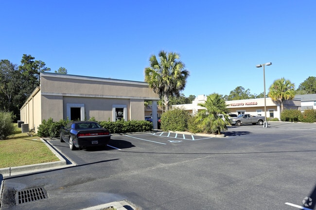
1033 Bells Hwy
147-14-00-090
Dmjh Land Management
Stripcommercialcenter
SC64 PLANTERS TRACE CTR MAPPLATB 911 MAPPLATP 3 MAPPLATB 33 MAPPLATP 546 PLANTER S TRACE 1009,1013,1017,1021,1025,1029,1033
X
Colleton
45029C0316G
South Carolina
2023
1.40 AC
2024
I-95 Walterboro/Hardeeville
970402
Other Market Areas
15,700 SF
DEMOGRAPHICS near 1033 Bells Hwy
1 Mile
3 Mile
5 Mile
2024 Total Population
2,369
9,862
15,832
2029 Population
2,310
9,741
15,663
Pop Growth 2024-2029
(2.49%)
(1.23%)
(1.07%)
Average Age
42
41
41
2024 Total Households
1,025
4,079
6,362
HH Growth 2024-2029
(2.63%)
(1.40%)
(1.21%)
Median Household Inc
$62,160
$42,474
$42,008
Avg Household Size
2.30
2.40
2.40
2024 Avg HH Vehicles
2.00
2.00
2.00
Median Home Value
$150,779
$126,454
$109,587
Median Year Built
1973
1978
1983
Nearby Places
Map Layers
Map Styles
 Street
 Aerial
- Restaurants
- Banks
- Shops
- Fitness
- Groceries
SALE & LEASE HISTORY
LISTING DATE
SALE/LEASE

Oct 24, 2017
For Lease
Nearby Properties
Address
Land Use
TOTAL SIZE
Lot Size
Zoning
Address
Land Use
TOTAL SIZE
Lot Size
Zoning
96,635 SF
15 AC
UD
Address
Land Use
TOTAL SIZE
Lot Size
Zoning
208,320 SF
26.80 AC
UD
Address
Land Use
TOTAL SIZE
Lot Size
Zoning
1,973 SF
8.30 AC
UD
Address
Land Use
TOTAL SIZE
Lot Size
Zoning
200,549 SF
2.90 AC
Address
Land Use
TOTAL SIZE
Lot Size
Zoning
53,300 SF
7.40 AC
Address
Land Use
TOTAL SIZE
Lot Size
Zoning
8,400 SF
5.31 AC
Address
Land Use
TOTAL SIZE
Lot Size
Zoning
47,968 SF
4.70 AC
UD
Address
Land Use
TOTAL SIZE
Lot Size
Zoning
3,189 SF
7 AC
UD
Address
Land Use
TOTAL SIZE
Lot Size
Zoning
14,628 SF
2.20 AC
UD
Address
Land Use
TOTAL SIZE
Lot Size
Zoning
1,577 SF
5.60 AC
UD
Address
Land Use
TOTAL SIZE
Lot Size
Zoning
3,273 SF
1,539 AC
ID
Address
Land Use
TOTAL SIZE
Lot Size
Zoning
10,616 SF
1.73 AC
UD
Address
Land Use
TOTAL SIZE
Lot Size
Zoning
15,811 SF
3.30 AC
UD
Address
Land Use
TOTAL SIZE
Lot Size
Zoning
30,258 SF
13 AC
UD
Address
Land Use
TOTAL SIZE
Lot Size
Zoning
3,370 SF
0.63 AC
Address
Land Use
TOTAL SIZE
Lot Size
Zoning
33,376 SF
2.10 AC
UD
Address
Land Use
TOTAL SIZE
Lot Size
Zoning
34,695 SF
1.48 AC
UD
Address
Land Use
TOTAL SIZE
Lot Size
Zoning
14,518 SF
3.10 AC
UD
Address
Land Use
TOTAL SIZE
Lot Size
Zoning
7,266 SF
3.30 AC
UD
Address
Land Use
TOTAL SIZE
Lot Size
Zoning
33,034 SF
2.75 AC
UD
Address
Land Use
TOTAL SIZE
Lot Size
Zoning
58,973 SF
3.43 AC
UD
Address
Land Use
TOTAL SIZE
Lot Size
Zoning
206,250 SF
33.20 AC
ID
Address
Land Use
TOTAL SIZE
Lot Size
Zoning
52,977 SF
5.10 AC
UD
Address
Land Use
TOTAL SIZE
Lot Size
Zoning
52,348 SF
0.70 AC
UD
Address
Land Use
TOTAL SIZE
Lot Size
Zoning
6,197 SF
1.20 AC
UD
Address
Land Use
TOTAL SIZE
Lot Size
Zoning
15,400 SF
3.20 AC
UD
Address
Land Use
TOTAL SIZE
Lot Size
Zoning
10,223 SF
3.42 AC
UD
Address
Land Use
TOTAL SIZE
Lot Size
Zoning
24,714 SF
1.50 AC
UD
Address
Land Use
TOTAL SIZE
Lot Size
Zoning
10,080 SF
4.80 AC
UD
Address
Land Use
TOTAL SIZE
Lot Size
Zoning
86,169 SF
9 AC
UD
The World's #1 Commercial Real Estate Marketplace
Connect with us
© 2026 CoStar Group
The information above has been obtained from sources believed reliable. While we do not doubt its accuracy we have not verified it and make no guarantee, warranty or representation about it. It is your responsibility to independently confirm its accuracy and completeness. Any projections, opinions, assumptions, or estimates used are for example only and do not represent the current or future performance of the property. The value of this transaction to you depends on tax and other factors which should be evaluated by your tax, financial, and legal advisors. You and your advisors should conduct a careful, independent investigation of the property to determine to your satisfaction the suitability of the property for your needs.