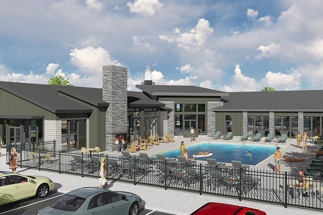
Property Record
1033 E Bearing Dr, Saratoga Springs, UT 84045

NEARBY LISTINGS FOR SALE OR LEASE
-
-
View all Saratoga Springs listings for sale on LoopNet.com
Property Detail
1033 E Bearing Dr
Salt Lake City
Northshore Sub
Provo-Orem-Lehi, UT
LOT 1, PLAT F-2, NORTHSHORE SUB AREA 9.600 AC.
47-383-0001
Utah
Apartment
Utah
2024
1
2025
9.60 AC
010126
Silicon Slopes
293,170 SF
DEMOGRAPHICS near 1033 E Bearing Dr
1 Mile
3 Mile
5 Mile
2024 Total Population
3,008
57,584
159,731
2029 Population
3,580
67,820
188,376
Pop Growth 2024-2029
+ 19.02%
+ 17.78%
+ 17.93%
Average Age
28
28
29
2024 Total Households
692
14,909
41,699
HH Growth 2024-2029
+ 19.65%
+ 18.28%
+ 18.39%
Median Household Inc
$130,201
$110,611
$110,020
Avg Household Size
4.30
3.80
3.80
2024 Avg HH Vehicles
3.00
2.00
2.00
Median Home Value
$537,660
$482,996
$478,687
Median Year Built
2008
2010
2009
Nearby Places
Map Layers
Map Styles
 Street
 Aerial
- Restaurants
- Banks
- Shops
- Fitness
- Groceries
PUBLIC TRANSPORTATION
COMMUTER RAIL
Lehi Station (FrontRunner - Utah Transit Authority (UTA))
DRIVE
WALK
Distance
Lehi Station (FrontRunner - Utah Transit Authority (UTA))
12 min
4.5 mi
American Fork Station (FrontRunner - Utah Transit Authority (UTA))
DRIVE
WALK
Distance
American Fork Station (FrontRunner - Utah Transit Authority (UTA))
11 min
5.0 mi
AIRPORT
Provo Municipal
DRIVE
WALK
Distance
Provo Municipal
30 min
20.6 mi
Salt Lake City International
DRIVE
WALK
Distance
Salt Lake City International
45 min
34.1 mi
Freight Ports
Port of Stockton
DRIVE
WALK
Distance
Port of Stockton
744 min
715.6 mi
Nearby Properties
Address
Land Use
TOTAL SIZE
Lot Size
Zoning
Address
Land Use
TOTAL SIZE
Lot Size
Zoning
266,041 SF
11.28 AC
Address
Land Use
TOTAL SIZE
Lot Size
Zoning
61,537 SF
3 AC
Address
Land Use
TOTAL SIZE
Lot Size
Zoning
198,068 SF
20.72 AC
Address
Land Use
TOTAL SIZE
Lot Size
Zoning
123,381 SF
12.30 AC
Address
Land Use
TOTAL SIZE
Lot Size
Zoning
134,637 SF
16.98 AC
Address
Land Use
TOTAL SIZE
Lot Size
Zoning
99,862 SF
10.92 AC
Address
Land Use
TOTAL SIZE
Lot Size
Zoning
102,380 SF
9.10 AC
Address
Land Use
TOTAL SIZE
Lot Size
Zoning
64,605 SF
8.11 AC
Address
Land Use
TOTAL SIZE
Lot Size
Zoning
43,638 SF
40.32 AC
Address
Land Use
TOTAL SIZE
Lot Size
Zoning
90,049 SF
5.99 AC
Address
Land Use
TOTAL SIZE
Lot Size
Zoning
11,050 SF
19.23 AC
Address
Land Use
TOTAL SIZE
Lot Size
Zoning
120,431 SF
7.92 AC
Address
Land Use
TOTAL SIZE
Lot Size
Zoning
59,672 SF
3.24 AC
Address
Land Use
TOTAL SIZE
Lot Size
Zoning
96,361 SF
7.86 AC
Address
Land Use
TOTAL SIZE
Lot Size
Zoning
58,277 SF
7.49 AC
Address
Land Use
TOTAL SIZE
Lot Size
Zoning
54,965 SF
9.42 AC
Address
Land Use
TOTAL SIZE
Lot Size
Zoning
119,128 SF
3.78 AC
Address
Land Use
TOTAL SIZE
Lot Size
Zoning
36,089 SF
4.29 AC
Address
Land Use
TOTAL SIZE
Lot Size
Zoning
117,669 SF
3.47 AC
Address
Land Use
TOTAL SIZE
Lot Size
Zoning
55,229 SF
4.61 AC
Address
Land Use
TOTAL SIZE
Lot Size
Zoning
29,506 SF
10.10 AC
Address
Land Use
TOTAL SIZE
Lot Size
Zoning
25,547 SF
3.93 AC
Address
Land Use
TOTAL SIZE
Lot Size
Zoning
101,235 SF
4.83 AC
Address
Land Use
TOTAL SIZE
Lot Size
Zoning
Address
Land Use
TOTAL SIZE
Lot Size
Zoning
65,368 SF
3.17 AC
Address
Land Use
TOTAL SIZE
Lot Size
Zoning
20,990 SF
3.59 AC
Address
Land Use
TOTAL SIZE
Lot Size
Zoning
73,038 SF
3.61 AC
Address
Land Use
TOTAL SIZE
Lot Size
Zoning
21,615 SF
1.99 AC
The World's #1 Commercial Real Estate Marketplace
Connect with us
© 2026 CoStar Group
The information above has been obtained from sources believed reliable. While we do not doubt its accuracy we have not verified it and make no guarantee, warranty or representation about it. It is your responsibility to independently confirm its accuracy and completeness. Any projections, opinions, assumptions, or estimates used are for example only and do not represent the current or future performance of the property. The value of this transaction to you depends on tax and other factors which should be evaluated by your tax, financial, and legal advisors. You and your advisors should conduct a careful, independent investigation of the property to determine to your satisfaction the suitability of the property for your needs.