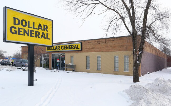
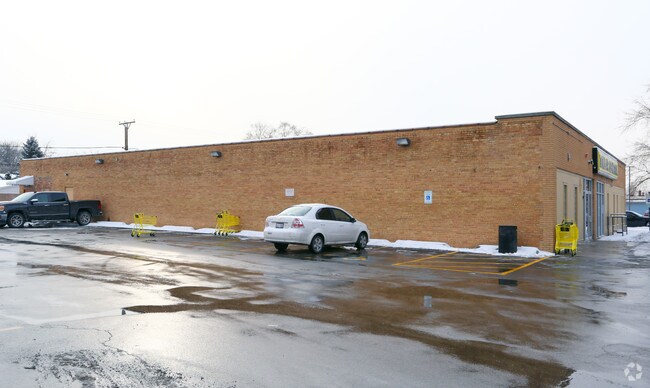
Property Record
1033 E Galena Blvd, Aurora, IL 60505
NEARBY LISTINGS FOR SALE OR LEASE
Property Detail
1033 E Galena Blvd
Chicago-Naperville-Elgin, IL-IN
Main Street Addn
15-26-203-007
MAIN STREET ADDN : LOTS 2,3 & 4 BLOCK 6 LOT DIMENSIONS: 158.35 IRREG APPROX LOT SQ FT 158 SUBDIVISION: MAIN STREET ADDN RANGE CODE: 001
Commercialnec
Kane
X
Illinois
17089C0343H
2,3,4
2024
174 SF
2024
Western East/West Corr
853602
Chicago
9,120 SF
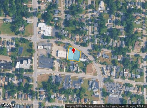
DEMOGRAPHICS near 1033 E Galena Blvd
1 mile
3 mile
5 mile
2024 Total Population
23,159
125,136
257,103
2029 Population
22,778
124,904
258,964
Pop Growth 2024-2029
(1.65%)
(0.19%)
+ 0.72%
Average Age
35
36
37
2024 Total Households
6,559
40,737
87,857
HH Growth 2024-2029
(1.65%)
(0.12%)
+ 0.74%
Median Household Inc
$61,511
$72,883
$84,643
Avg Household Size
3.40
3.00
2.80
2024 Avg HH Vehicles
2.00
2.00
2.00
Median Home Value
$151,763
$205,068
$243,889
Median Year Built
1954
1976
1989
Nearby Places
Map Layers
Map Styles
 Street
 Aerial
Transit
 Traffic
 Biking
Places
Listings with unknown addresses are not visible on the map
- Restaurants
- Banks
- Shops
- Fitness
- Groceries
PUBLIC TRANSPORTATION
COMMUTER RAIL
Aurora Station (Burlington Northern-Santa Fe Railway Line - Northeast Illinois Regional Commuter Railroad (Metra))
Drive
Walk
Distance
Aurora Station (Burlington Northern-Santa Fe Railway Line - Northeast Illinois Regional Commuter Railroad (Metra))
4 min
1.7 mi
Route 59 Station (Burlington Northern-Santa Fe Railway Line - Northeast Illinois Regional Commuter Railroad (Metra))
Drive
Walk
Distance
Route 59 Station (Burlington Northern-Santa Fe Railway Line - Northeast Illinois Regional Commuter Railroad (Metra))
13 min
6.3 mi
AIRPORT
Chicago Midway International
Drive
Walk
Distance
Chicago Midway International
60 min
31.5 mi
Chicago O'Hare International
Drive
Walk
Distance
Chicago O'Hare International
68 min
35.7 mi
Nearby Properties
Address
Land Use
TOTAL SIZE
Lot Size
Zoning
Address
Land Use
TOTAL SIZE
Lot Size
Zoning
28.52 AC
R
Address
Land Use
TOTAL SIZE
Lot Size
Zoning
272,948 SF
16.10 AC
Address
Land Use
TOTAL SIZE
Lot Size
Zoning
283,844 SF
16.06 AC
M
Address
Land Use
TOTAL SIZE
Lot Size
Zoning
11.02 AC
M
Address
Land Use
TOTAL SIZE
Lot Size
Zoning
9.83 AC
C
Address
Land Use
TOTAL SIZE
Lot Size
Zoning
173,303 SF
19.53 AC
Address
Land Use
TOTAL SIZE
Lot Size
Zoning
244,494 SF
16.08 AC
Address
Land Use
TOTAL SIZE
Lot Size
Zoning
320,874 SF
1.49 AC
Address
Land Use
TOTAL SIZE
Lot Size
Zoning
233,437 SF
13.11 AC
Address
Land Use
TOTAL SIZE
Lot Size
Zoning
100,340 SF
1.80 AC
Address
Land Use
TOTAL SIZE
Lot Size
Zoning
73,880 SF
0.75 AC
Address
Land Use
TOTAL SIZE
Lot Size
Zoning
8.87 AC
Address
Land Use
TOTAL SIZE
Lot Size
Zoning
6.31 AC
M
Address
Land Use
TOTAL SIZE
Lot Size
Zoning
Address
Land Use
TOTAL SIZE
Lot Size
Zoning
93,771 SF
10.33 AC
C
Address
Land Use
TOTAL SIZE
Lot Size
Zoning
85,440 SF
0.58 AC
Address
Land Use
TOTAL SIZE
Lot Size
Zoning
51,375 SF
8.73 AC
Address
Land Use
TOTAL SIZE
Lot Size
Zoning
2.73 AC
Address
Land Use
TOTAL SIZE
Lot Size
Zoning
89,188 SF
3.70 AC
Address
Land Use
TOTAL SIZE
Lot Size
Zoning
82,150 SF
23.67 AC
Address
Land Use
TOTAL SIZE
Lot Size
Zoning
0.46 AC
Address
Land Use
TOTAL SIZE
Lot Size
Zoning
70,780 SF
10.91 AC
Address
Land Use
TOTAL SIZE
Lot Size
Zoning
9.25 AC
Address
Land Use
TOTAL SIZE
Lot Size
Zoning
3.46 AC
M
Address
Land Use
TOTAL SIZE
Lot Size
Zoning
201,713 SF
16.55 AC
Address
Land Use
TOTAL SIZE
Lot Size
Zoning
108,589 SF
0.10 AC
Address
Land Use
TOTAL SIZE
Lot Size
Zoning
2.58 AC
Address
Land Use
TOTAL SIZE
Lot Size
Zoning
58,074 SF
6.41 AC
Address
Land Use
TOTAL SIZE
Lot Size
Zoning
34,560 SF
4.82 AC
Address
Land Use
TOTAL SIZE
Lot Size
Zoning
91,764 SF
5.86 AC
The World's #1 Commercial Real Estate Marketplace
Connect with us
© 2026 CoStar Group
The information above has been obtained from sources believed reliable. While we do not doubt its accuracy we have not verified it and make no guarantee, warranty or representation about it. It is your responsibility to independently confirm its accuracy and completeness. Any projections, opinions, assumptions, or estimates used are for example only and do not represent the current or future performance of the property. The value of this transaction to you depends on tax and other factors which should be evaluated by your tax, financial, and legal advisors. You and your advisors should conduct a careful, independent investigation of the property to determine to your satisfaction the suitability of the property for your needs.