Property Record
1033 Ush 41 S, Sturtevant, WI 53177


Save to a Folder
{{folder.Name}}
{{folder.ListingIds.length}} Properties
{{folder.ListingIds.length}} Property
Create a New Folder
Property Detail
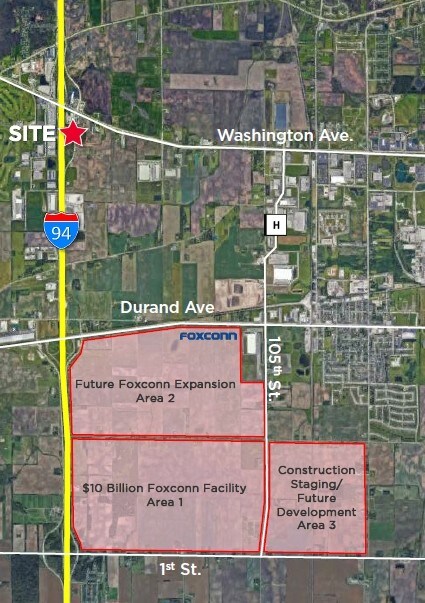
1033 Ush 41 S
Racine-Mount Pleasant, WI
PT W1/2 NW1/4 COM 2047 S OF NW COR OF SEC E476 N65 E129 S305 W605 N240 TO POB & COM W1/4 COR E659 N70 W50 NW320 TO POB W115 S
151-032218012000
RACINE
Commercialnec
Wisconsin
B and X Area of moderate flood hazard, usually the area between the limits of the 100-year and 500-year floods.
2.88 AC
2025
Janesville/Racine
2025
Milwaukee/Madison
001703
NEARBY LISTINGS FOR SALE OR LEASE
-
-
View all Sturtevant listings for sale on LoopNet.com
DEMOGRAPHICS near 1033 Ush 41 S
1 mile
3 mile
5 mile
2025 Total Population
239
4,952
25,374
2030 Population
238
5,004
25,628
Pop Growth 2025-2030
(0.42%)
+ 1.05%
+ 1.00%
Average Age
43
44
43
2025 Total Households
87
1,493
9,783
HH Growth 2025-2030
(1.15%)
+ 1.21%
+ 1.08%
Median Household Inc
$111,111
$85,714
$89,596
Avg Household Size
2.70
2.40
2.40
2025 Avg HH Vehicles
2.00
2.00
2.00
Median Home Value
$394,444
$292,685
$291,029
Median Year Built
1970
1977
1985
Nearby Places
Map Layers
Map Styles
 Street
 Aerial
Layers
 Traffic
 Biking
Places
Listings with unknown addresses are not visible on the map
- Restaurants
- Banks
- Shops
- Fitness
- Groceries
PUBLIC TRANSPORTATION
COMMUTER RAIL
Sturtevant Amtrak Station (Hiawatha Service - Amtrak)
Drive
Walk
Distance
Sturtevant Amtrak Station (Hiawatha Service - Amtrak)
5 min
2.7 mi
AIRPORT
General Mitchell International
Drive
Walk
Distance
General Mitchell International
23 min
17.6 mi
Freight Ports
Port Milwaukee
Drive
Walk
Distance
Port Milwaukee
28 min
21.5 mi
SALE & LEASE HISTORY
LISTING DATE
SALE/LEASE

Sep 24, 2016
For Sale
May 16, 2019
For Sale
May 16, 2018
For Sale
Jan 12, 2021
For Sale
Nearby Properties
Address
Land Use
TOTAL SIZE
Lot Size
Zoning
Address
Land Use
TOTAL SIZE
Lot Size
Zoning
Address
Land Use
TOTAL SIZE
Lot Size
Zoning
Address
Land Use
TOTAL SIZE
Lot Size
Zoning
32.55 AC
Address
Land Use
TOTAL SIZE
Lot Size
Zoning
23.10 AC
Address
Land Use
TOTAL SIZE
Lot Size
Zoning
37.55 AC
Address
Land Use
TOTAL SIZE
Lot Size
Zoning
26.79 AC
Address
Land Use
TOTAL SIZE
Lot Size
Zoning
23.21 AC
Address
Land Use
TOTAL SIZE
Lot Size
Zoning
20.61 AC
Address
Land Use
TOTAL SIZE
Lot Size
Zoning
30.45 AC
002
Address
Land Use
TOTAL SIZE
Lot Size
Zoning
Address
Land Use
TOTAL SIZE
Lot Size
Zoning
Address
Land Use
TOTAL SIZE
Lot Size
Zoning
Address
Land Use
TOTAL SIZE
Lot Size
Zoning
13.04 AC
Address
Land Use
TOTAL SIZE
Lot Size
Zoning
19.33 AC
002
Address
Land Use
TOTAL SIZE
Lot Size
Zoning
31.50 AC
Address
Land Use
TOTAL SIZE
Lot Size
Zoning
22.93 AC
Address
Land Use
TOTAL SIZE
Lot Size
Zoning
18.33 AC
Address
Land Use
TOTAL SIZE
Lot Size
Zoning
32.99 AC
002
Address
Land Use
TOTAL SIZE
Lot Size
Zoning
Address
Land Use
TOTAL SIZE
Lot Size
Zoning
Address
Land Use
TOTAL SIZE
Lot Size
Zoning
5.74 AC
Address
Land Use
TOTAL SIZE
Lot Size
Zoning
16.91 AC
Address
Land Use
TOTAL SIZE
Lot Size
Zoning
Address
Land Use
TOTAL SIZE
Lot Size
Zoning
Address
Land Use
TOTAL SIZE
Lot Size
Zoning
Address
Land Use
TOTAL SIZE
Lot Size
Zoning
16.97 AC
Address
Land Use
TOTAL SIZE
Lot Size
Zoning
12.92 AC
Address
Land Use
TOTAL SIZE
Lot Size
Zoning
72.05 AC
Address
Land Use
TOTAL SIZE
Lot Size
Zoning
71.23 AC
Address
Land Use
TOTAL SIZE
Lot Size
Zoning
14.34 AC
The World's #1 Commercial Real Estate Marketplace
Connect with us
© 2026 CoStar Group
The information above has been obtained from sources believed reliable. While we do not doubt its accuracy we have not verified it and make no guarantee, warranty or representation about it. It is your responsibility to independently confirm its accuracy and completeness. Any projections, opinions, assumptions, or estimates used are for example only and do not represent the current or future performance of the property. The value of this transaction to you depends on tax and other factors which should be evaluated by your tax, financial, and legal advisors. You and your advisors should conduct a careful, independent investigation of the property to determine to your satisfaction the suitability of the property for your needs.