Property Record
10330 S Loop 1604 S, San Antonio, TX 78263

Property Detail
10330 S Loop 1604 S
San Antonio-New Braunfels, TX
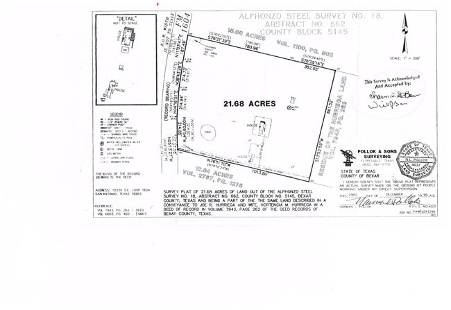
CB 5145 P-54 (21.155AC) & P-55 (.525AC) ABS 662
05145-000-0540
BEXAR
Farms
Texas
B and X Area of moderate flood hazard, usually the area between the limits of the 100-year and 500-year floods.
54
2024
21.68 AC
2025
South
141900
San Antonio
2,106 SF
NEARBY LISTINGS FOR SALE OR LEASE
DEMOGRAPHICS near 10330 S Loop 1604 S
1 mile
3 mile
5 mile
2025 Total Population
309
2,996
14,304
2030 Population
317
3,177
15,354
Pop Growth 2025-2030
+ 2.59%
+ 6.04%
+ 7.34%
Average Age
44
43
43
2025 Total Households
117
1,094
5,069
HH Growth 2025-2030
+ 2.56%
+ 6.03%
+ 7.30%
Median Household Inc
$67,500
$89,746
$88,525
Avg Household Size
2.60
2.70
2.80
2025 Avg HH Vehicles
3.00
3.00
3.00
Median Home Value
$369,999
$358,115
$343,948
Median Year Built
1992
1995
1996
Nearby Places
Map Layers
Map Styles
 Street
 Aerial
Transit
 Traffic
 Biking
Places
Listings with unknown addresses are not visible on the map
- Restaurants
- Banks
- Shops
- Fitness
- Groceries
PUBLIC TRANSPORTATION
AIRPORT
San Antonio International
Drive
Walk
Distance
San Antonio International
36 min
29.1 mi
Freight Ports
Calhoun Port
Drive
Walk
Distance
Calhoun Port
160 min
133.5 mi
SALE & LEASE HISTORY
LISTING DATE
SALE/LEASE

Feb 22, 2022
For Sale
Nearby Properties
Address
Land Use
TOTAL SIZE
Lot Size
Zoning
Address
Land Use
TOTAL SIZE
Lot Size
Zoning
114.59 AC
Address
Land Use
TOTAL SIZE
Lot Size
Zoning
187.06 AC
Address
Land Use
TOTAL SIZE
Lot Size
Zoning
1,254 SF
227.94 AC
Address
Land Use
TOTAL SIZE
Lot Size
Zoning
175.05 AC
Address
Land Use
TOTAL SIZE
Lot Size
Zoning
126.97 AC
Address
Land Use
TOTAL SIZE
Lot Size
Zoning
77.90 AC
Address
Land Use
TOTAL SIZE
Lot Size
Zoning
86.27 AC
Address
Land Use
TOTAL SIZE
Lot Size
Zoning
44,950 SF
4.56 AC
Address
Land Use
TOTAL SIZE
Lot Size
Zoning
51.95 AC
Address
Land Use
TOTAL SIZE
Lot Size
Zoning
2,946 SF
122.54 AC
Address
Land Use
TOTAL SIZE
Lot Size
Zoning
Address
Land Use
TOTAL SIZE
Lot Size
Zoning
74.05 AC
Address
Land Use
TOTAL SIZE
Lot Size
Zoning
19,848 SF
40.47 AC
Address
Land Use
TOTAL SIZE
Lot Size
Zoning
1,131 SF
62.44 AC
Address
Land Use
TOTAL SIZE
Lot Size
Zoning
125.50 AC
Address
Land Use
TOTAL SIZE
Lot Size
Zoning
Address
Land Use
TOTAL SIZE
Lot Size
Zoning
70.01 AC
Address
Land Use
TOTAL SIZE
Lot Size
Zoning
51.22 AC
Address
Land Use
TOTAL SIZE
Lot Size
Zoning
54.14 AC
Address
Land Use
TOTAL SIZE
Lot Size
Zoning
Address
Land Use
TOTAL SIZE
Lot Size
Zoning
80.20 AC
Address
Land Use
TOTAL SIZE
Lot Size
Zoning
50 AC
Address
Land Use
TOTAL SIZE
Lot Size
Zoning
952 SF
86.94 AC
Address
Land Use
TOTAL SIZE
Lot Size
Zoning
3,409 SF
20 AC
Address
Land Use
TOTAL SIZE
Lot Size
Zoning
102.70 AC
Address
Land Use
TOTAL SIZE
Lot Size
Zoning
60.68 AC
Address
Land Use
TOTAL SIZE
Lot Size
Zoning
19,954 SF
32.67 AC
Address
Land Use
TOTAL SIZE
Lot Size
Zoning
2,512 SF
31.80 AC
Address
Land Use
TOTAL SIZE
Lot Size
Zoning
51.13 AC
Address
Land Use
TOTAL SIZE
Lot Size
Zoning
96.09 AC
The World's #1 Commercial Real Estate Marketplace
Connect with us
© 2026 CoStar Group
The information above has been obtained from sources believed reliable. While we do not doubt its accuracy we have not verified it and make no guarantee, warranty or representation about it. It is your responsibility to independently confirm its accuracy and completeness. Any projections, opinions, assumptions, or estimates used are for example only and do not represent the current or future performance of the property. The value of this transaction to you depends on tax and other factors which should be evaluated by your tax, financial, and legal advisors. You and your advisors should conduct a careful, independent investigation of the property to determine to your satisfaction the suitability of the property for your needs.