Property Record
10330 Jaybird Rd, Rancho Cucamonga, CA 91730


Property Detail
10330 Jaybird Rd
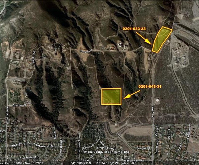
0201-043-31
PARCEL MAP 3915 PARCEL 3
Vacantlandnec
SAN BERNARDINO
RL5
California
A Areas with a 1% annual chance of flooding and a 26% chance of flooding over the life of a 30-year mortgage.
19.08 AC
2025
Airport Area
2025
Inland Empire (California)
002107
Riverside-San Bernardino-Ontario, CA
NEARBY LISTINGS FOR SALE OR LEASE
DEMOGRAPHICS near 10330 Jaybird Rd
1 mile
3 mile
5 mile
2025 Total Population
2,813
48,260
162,229
2030 Population
2,814
48,428
163,031
Pop Growth 2025-2030
+ 0.04%
+ 0.35%
+ 0.49%
Average Age
44
41
40
2025 Total Households
902
16,023
55,167
HH Growth 2025-2030
(0.11%)
+ 0.34%
+ 0.46%
Median Household Inc
$164,539
$126,871
$120,296
Avg Household Size
3.10
3.00
2.90
2025 Avg HH Vehicles
3.00
2.00
2.00
Median Home Value
$1,099,116
$818,959
$784,107
Median Year Built
1984
1983
1985
Nearby Places
Map Layers
Map Styles
 Street
 Aerial
Layers
 Traffic
 Biking
Places
Listings with unknown addresses are not visible on the map
- Restaurants
- Banks
- Shops
- Fitness
- Groceries
PUBLIC TRANSPORTATION
COMMUTER RAIL
Rancho Cucamonga (San Bernardino Line - Southern California Regional Rail Authority (Metrolink))
Drive
Walk
Distance
Rancho Cucamonga (San Bernardino Line - Southern California Regional Rail Authority (Metrolink))
14 min
7.0 mi
Upland (San Bernardino Line - Southern California Regional Rail Authority (Metrolink))
Drive
Walk
Distance
Upland (San Bernardino Line - Southern California Regional Rail Authority (Metrolink))
17 min
8.4 mi
AIRPORT
Ontario International
Drive
Walk
Distance
Ontario International
17 min
8.4 mi
Freight Ports
Port of Long Beach
Drive
Walk
Distance
Port of Long Beach
75 min
58.8 mi
Nearby Properties
Address
Land Use
TOTAL SIZE
Lot Size
Zoning
Address
Land Use
TOTAL SIZE
Lot Size
Zoning
122,563 SF
5.76 AC
Address
Land Use
TOTAL SIZE
Lot Size
Zoning
95,240 SF
8.42 AC
Address
Land Use
TOTAL SIZE
Lot Size
Zoning
133,847 SF
7.52 AC
Address
Land Use
TOTAL SIZE
Lot Size
Zoning
79,319 SF
4.47 AC
Address
Land Use
TOTAL SIZE
Lot Size
Zoning
54,444 SF
4.71 AC
Address
Land Use
TOTAL SIZE
Lot Size
Zoning
187,841 SF
6.14 AC
Address
Land Use
TOTAL SIZE
Lot Size
Zoning
119,924 SF
8.50 AC
Address
Land Use
TOTAL SIZE
Lot Size
Zoning
125,452 SF
4.07 AC
Address
Land Use
TOTAL SIZE
Lot Size
Zoning
57,260 SF
3.43 AC
Address
Land Use
TOTAL SIZE
Lot Size
Zoning
91,796 SF
3.10 AC
Address
Land Use
TOTAL SIZE
Lot Size
Zoning
17,984 SF
9.07 AC
Address
Land Use
TOTAL SIZE
Lot Size
Zoning
68,410 SF
5.39 AC
L24
Address
Land Use
TOTAL SIZE
Lot Size
Zoning
48,306 SF
2.47 AC
Address
Land Use
TOTAL SIZE
Lot Size
Zoning
42,168 SF
3.93 AC
Address
Land Use
TOTAL SIZE
Lot Size
Zoning
94,080 SF
4.63 AC
Address
Land Use
TOTAL SIZE
Lot Size
Zoning
31,334 SF
1.91 AC
Address
Land Use
TOTAL SIZE
Lot Size
Zoning
31,704 SF
2.58 AC
Address
Land Use
TOTAL SIZE
Lot Size
Zoning
27,920 SF
2.46 AC
Address
Land Use
TOTAL SIZE
Lot Size
Zoning
27,920 SF
1.27 AC
R1
Address
Land Use
TOTAL SIZE
Lot Size
Zoning
27,540 SF
1.65 AC
Address
Land Use
TOTAL SIZE
Lot Size
Zoning
22,972 SF
2.01 AC
Address
Land Use
TOTAL SIZE
Lot Size
Zoning
25,120 SF
1.42 AC
Address
Land Use
TOTAL SIZE
Lot Size
Zoning
25,120 SF
1.41 AC
Address
Land Use
TOTAL SIZE
Lot Size
Zoning
99,144 SF
8.55 AC
Address
Land Use
TOTAL SIZE
Lot Size
Zoning
22,020 SF
1.97 AC
Address
Land Use
TOTAL SIZE
Lot Size
Zoning
20,940 SF
1.11 AC
Address
Land Use
TOTAL SIZE
Lot Size
Zoning
45,162 SF
4.97 AC
Address
Land Use
TOTAL SIZE
Lot Size
Zoning
42,562 SF
3.91 AC
Address
Land Use
TOTAL SIZE
Lot Size
Zoning
18,078 SF
1.67 AC
Address
Land Use
TOTAL SIZE
Lot Size
Zoning
9,633 SF
0.88 AC
The World's #1 Commercial Real Estate Marketplace
Connect with us
© 2026 CoStar Group
The information above has been obtained from sources believed reliable. While we do not doubt its accuracy we have not verified it and make no guarantee, warranty or representation about it. It is your responsibility to independently confirm its accuracy and completeness. Any projections, opinions, assumptions, or estimates used are for example only and do not represent the current or future performance of the property. The value of this transaction to you depends on tax and other factors which should be evaluated by your tax, financial, and legal advisors. You and your advisors should conduct a careful, independent investigation of the property to determine to your satisfaction the suitability of the property for your needs.