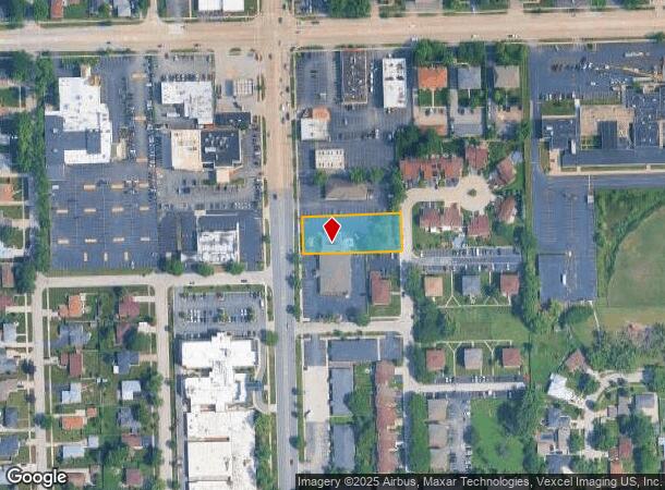
Property Record
10331 S Roberts Rd, Palos Hills, IL 60465
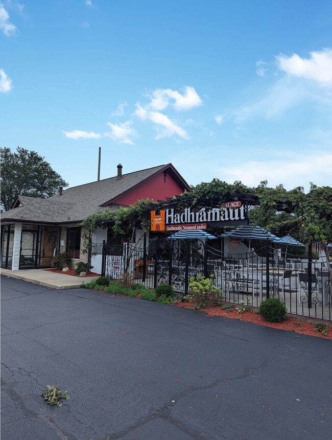
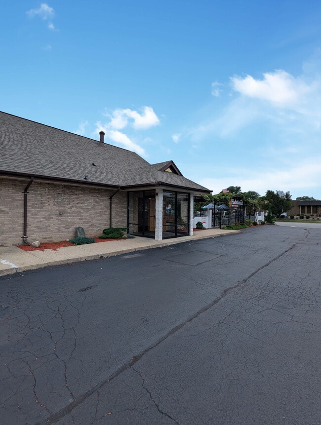
This Property Is For Sale
NEARBY LISTINGS FOR SALE OR LEASE
Property Detail
10331 S Roberts Rd
Chicago-Naperville-Elgin, IL-IN-WI
Delugachs 80Th
23-13-102-080-0000
FRANK (DELUGACHS) (80TH) AVE ACS A SUB OF WH WH NW SEC 13-37-12
Commercialbuilding
Cook
X
Illinois
17031C0604J
19
2023
0.60 AC
2024
South Route 45
823803
Chicago
2,777 SF
DEMOGRAPHICS near 10331 S Roberts Rd
1 Mile
3 Mile
5 Mile
2024 Total Population
13,221
103,251
235,034
2029 Population
12,836
100,387
228,279
Pop Growth 2024-2029
(2.91%)
(2.77%)
(2.87%)
Average Age
41
41
41
2024 Total Households
5,095
38,620
87,501
HH Growth 2024-2029
(3.26%)
(3.07%)
(3.15%)
Median Household Inc
$70,358
$64,703
$72,045
Avg Household Size
2.50
2.60
2.60
2024 Avg HH Vehicles
2.00
2.00
2.00
Median Home Value
$258,497
$240,128
$249,983
Median Year Built
1974
1973
1971
Nearby Places
- Restaurants
- Banks
- Shops
- Fitness
- Groceries
PUBLIC TRANSPORTATION
COMMUTER RAIL
Palos Heights Station (SouthWest Service - Northeast Illinois Regional Commuter Railroad (Metra))
DRIVE
WALK
Distance
Palos Heights Station (SouthWest Service - Northeast Illinois Regional Commuter Railroad (Metra))
6 min
2.3 mi
Worth Station (SouthWest Service - Northeast Illinois Regional Commuter Railroad (Metra))
DRIVE
WALK
Distance
Worth Station (SouthWest Service - Northeast Illinois Regional Commuter Railroad (Metra))
5 min
2.3 mi
AIRPORT
Chicago Midway International
DRIVE
WALK
Distance
Chicago Midway International
18 min
9.9 mi
Chicago O'Hare International
DRIVE
WALK
Distance
Chicago O'Hare International
39 min
27.9 mi
Freight Ports
Port Milwaukee
DRIVE
WALK
Distance
Port Milwaukee
120 min
99.6 mi
Nearby Properties
Address
Land Use
TOTAL SIZE
Lot Size
Zoning
Address
Land Use
TOTAL SIZE
Lot Size
Zoning
Address
Land Use
TOTAL SIZE
Lot Size
Zoning
23.81 AC
Address
Land Use
TOTAL SIZE
Lot Size
Zoning
252,973 SF
11.68 AC
Address
Land Use
TOTAL SIZE
Lot Size
Zoning
51,762 SF
4 AC
Address
Land Use
TOTAL SIZE
Lot Size
Zoning
191,763 SF
15.63 AC
Address
Land Use
TOTAL SIZE
Lot Size
Zoning
111,830 SF
2.16 AC
Address
Land Use
TOTAL SIZE
Lot Size
Zoning
198,190 SF
15 AC
Address
Land Use
TOTAL SIZE
Lot Size
Zoning
96,469 SF
6.77 AC
Address
Land Use
TOTAL SIZE
Lot Size
Zoning
28,406 SF
1.42 AC
Address
Land Use
TOTAL SIZE
Lot Size
Zoning
61,388 SF
2 AC
Address
Land Use
TOTAL SIZE
Lot Size
Zoning
Address
Land Use
TOTAL SIZE
Lot Size
Zoning
45,196 SF
1.28 AC
Address
Land Use
TOTAL SIZE
Lot Size
Zoning
869,275 SF
24.34 AC
Address
Land Use
TOTAL SIZE
Lot Size
Zoning
127,984 SF
12.76 AC
Address
Land Use
TOTAL SIZE
Lot Size
Zoning
43,271 SF
2.09 AC
Address
Land Use
TOTAL SIZE
Lot Size
Zoning
115,850 SF
10.08 AC
Address
Land Use
TOTAL SIZE
Lot Size
Zoning
Address
Land Use
TOTAL SIZE
Lot Size
Zoning
50,151 SF
2.85 AC
Address
Land Use
TOTAL SIZE
Lot Size
Zoning
169,100 SF
4.43 AC
Address
Land Use
TOTAL SIZE
Lot Size
Zoning
64,494 SF
4.52 AC
Address
Land Use
TOTAL SIZE
Lot Size
Zoning
210,651 SF
15.30 AC
Address
Land Use
TOTAL SIZE
Lot Size
Zoning
122,619 SF
18.30 AC
Address
Land Use
TOTAL SIZE
Lot Size
Zoning
76,891 SF
4.69 AC
Address
Land Use
TOTAL SIZE
Lot Size
Zoning
144,653 SF
6.66 AC
Address
Land Use
TOTAL SIZE
Lot Size
Zoning
164,473 SF
6.93 AC
Address
Land Use
TOTAL SIZE
Lot Size
Zoning
72,037 SF
7.07 AC
Address
Land Use
TOTAL SIZE
Lot Size
Zoning
13.61 AC
Address
Land Use
TOTAL SIZE
Lot Size
Zoning
64,233 SF
1.47 AC
Address
Land Use
TOTAL SIZE
Lot Size
Zoning
391,115 SF
25.70 AC
Address
Land Use
TOTAL SIZE
Lot Size
Zoning
65,504 SF
2.66 AC
The World's #1 Commercial Real Estate Marketplace
Connect with us
© 2025 CoStar Group
The information above has been obtained from sources believed reliable. While we do not doubt its accuracy we have not verified it and make no guarantee, warranty or representation about it. It is your responsibility to independently confirm its accuracy and completeness. Any projections, opinions, assumptions, or estimates used are for example only and do not represent the current or future performance of the property. The value of this transaction to you depends on tax and other factors which should be evaluated by your tax, financial, and legal advisors. You and your advisors should conduct a careful, independent investigation of the property to determine to your satisfaction the suitability of the property for your needs.