Property Record
10333 Prosperity Cir, Camby, IN 46113
NEARBY LISTINGS FOR SALE OR LEASE
Property Detail
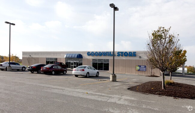
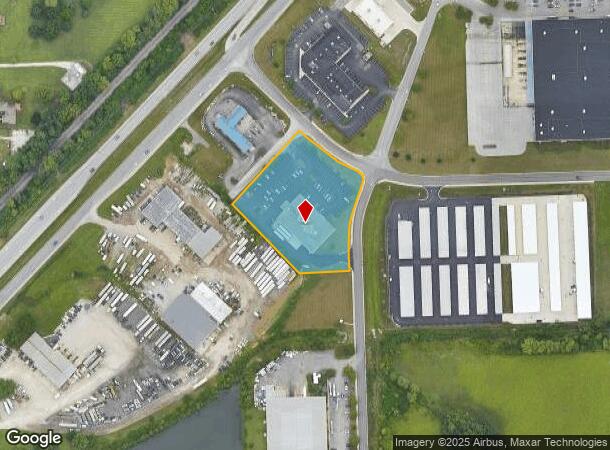
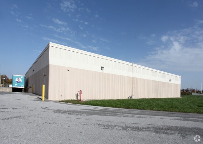
10333 Prosperity Cir
32-16-20-351-004.000-011
HEARLTAND CROSSING BUSINESS PARK SEC 1 PTS 1 7 2 LOT 83 2.32AC
Wholesaleoutletdiscountstore
Hendricks
X
Indiana
18097C0215F
83
2024
2.32 AC
2024
Hendricks County
210608
Indianapolis
14,912 SF
Indianapolis-Carmel-Anderson, IN
DEMOGRAPHICS near 10333 Prosperity Cir
1 Mile
3 Mile
5 Mile
2024 Total Population
3,457
26,477
54,023
2029 Population
3,663
27,139
56,088
Pop Growth 2024-2029
+ 5.96%
+ 2.50%
+ 3.82%
Average Age
35
38
39
2024 Total Households
1,279
9,822
19,502
HH Growth 2024-2029
+ 6.49%
+ 2.56%
+ 3.72%
Median Household Inc
$81,152
$73,010
$75,926
Avg Household Size
2.70
2.60
2.60
2024 Avg HH Vehicles
2.00
2.00
2.00
Median Home Value
$178,813
$184,694
$198,418
Median Year Built
1999
1994
1992
Nearby Places
Map Layers
Map Styles
 Street
 Aerial
- Restaurants
- Banks
- Shops
- Fitness
- Groceries
PUBLIC TRANSPORTATION
AIRPORT
Indianapolis International
DRIVE
WALK
Distance
Indianapolis International
16 min
8.4 mi
Freight Ports
Port of Toledo
DRIVE
WALK
Distance
Port of Toledo
290 min
240.0 mi
Nearby Properties
Address
Land Use
TOTAL SIZE
Lot Size
Zoning
Address
Land Use
TOTAL SIZE
Lot Size
Zoning
86,017 SF
26.95 AC
Address
Land Use
TOTAL SIZE
Lot Size
Zoning
650,960 SF
31.95 AC
Address
Land Use
TOTAL SIZE
Lot Size
Zoning
24.62 AC
Address
Land Use
TOTAL SIZE
Lot Size
Zoning
695,702 SF
39.68 AC
ZO03
Address
Land Use
TOTAL SIZE
Lot Size
Zoning
462,275 SF
25.83 AC
ZO01
Address
Land Use
TOTAL SIZE
Lot Size
Zoning
482,016 SF
26.70 AC
Address
Land Use
TOTAL SIZE
Lot Size
Zoning
423,757 SF
28.71 AC
Address
Land Use
TOTAL SIZE
Lot Size
Zoning
5,881 SF
17.35 AC
Address
Land Use
TOTAL SIZE
Lot Size
Zoning
168,574 SF
8.30 AC
Address
Land Use
TOTAL SIZE
Lot Size
Zoning
11,404 SF
12.58 AC
Address
Land Use
TOTAL SIZE
Lot Size
Zoning
274,534 SF
13.47 AC
Address
Land Use
TOTAL SIZE
Lot Size
Zoning
12.57 AC
Address
Land Use
TOTAL SIZE
Lot Size
Zoning
3,815 SF
30.37 AC
ZO01
Address
Land Use
TOTAL SIZE
Lot Size
Zoning
76,295 SF
6.22 AC
Address
Land Use
TOTAL SIZE
Lot Size
Zoning
16.33 AC
Address
Land Use
TOTAL SIZE
Lot Size
Zoning
214,991 SF
24.91 AC
Address
Land Use
TOTAL SIZE
Lot Size
Zoning
3,155 SF
13.02 AC
ZO01
Address
Land Use
TOTAL SIZE
Lot Size
Zoning
100,720 SF
15.79 AC
Address
Land Use
TOTAL SIZE
Lot Size
Zoning
193,909 SF
18.43 AC
Address
Land Use
TOTAL SIZE
Lot Size
Zoning
1,660 SF
13.18 AC
ZO01
Address
Land Use
TOTAL SIZE
Lot Size
Zoning
235,506 SF
17.85 AC
Address
Land Use
TOTAL SIZE
Lot Size
Zoning
48,454 SF
6.70 AC
Address
Land Use
TOTAL SIZE
Lot Size
Zoning
138,838 SF
16.27 AC
Address
Land Use
TOTAL SIZE
Lot Size
Zoning
9,765 SF
9.21 AC
ZO01
Address
Land Use
TOTAL SIZE
Lot Size
Zoning
98,014 SF
30.50 AC
Address
Land Use
TOTAL SIZE
Lot Size
Zoning
6,184 SF
8.53 AC
Address
Land Use
TOTAL SIZE
Lot Size
Zoning
71,799 SF
1.67 AC
Address
Land Use
TOTAL SIZE
Lot Size
Zoning
43,017 SF
7.75 AC
Address
Land Use
TOTAL SIZE
Lot Size
Zoning
3,000 SF
7 AC
Address
Land Use
TOTAL SIZE
Lot Size
Zoning
50,672 SF
0.71 AC
The World's #1 Commercial Real Estate Marketplace
Connect with us
© 2025 CoStar Group
The information above has been obtained from sources believed reliable. While we do not doubt its accuracy we have not verified it and make no guarantee, warranty or representation about it. It is your responsibility to independently confirm its accuracy and completeness. Any projections, opinions, assumptions, or estimates used are for example only and do not represent the current or future performance of the property. The value of this transaction to you depends on tax and other factors which should be evaluated by your tax, financial, and legal advisors. You and your advisors should conduct a careful, independent investigation of the property to determine to your satisfaction the suitability of the property for your needs.