Property Record
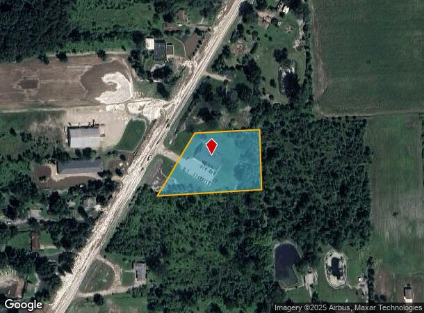
10335 Gratiot Ave, Columbus, MI 48063

NEARBY LISTINGS FOR SALE OR LEASE
Property Detail
10335 Gratiot Ave
Detroit-Warren-Dearborn, MI
Mk Kolodezak Plat
16-450-0002-000
LOTS 2,3 & 4 M.K. KOLODCZAK PLAT ACCORDING TO THE PLAT RECORDED IN LIBER 56 OF PLATS PG 19 ST CLAIR COUNTY REGISTER OF DEEDS
Animalhospitalvet
St. Clair
X
Michigan
26147C0425D
2-4
2024
2.39 AC
2025
St Clair & Lapeer Counties
651600
Detroit
5,200 SF
DEMOGRAPHICS near 10335 Gratiot Ave
1 Mile
3 Mile
5 Mile
2024 Total Population
233
9,004
13,734
2029 Population
231
8,900
13,587
Pop Growth 2024-2029
(0.86%)
(1.16%)
(1.07%)
Average Age
44
43
42
2024 Total Households
92
3,612
5,375
HH Growth 2024-2029
(1.09%)
(1.25%)
(1.13%)
Median Household Inc
$81,250
$72,617
$75,200
Avg Household Size
2.50
2.50
2.50
2024 Avg HH Vehicles
2.00
2.00
2.00
Median Home Value
$264,705
$242,726
$247,231
Median Year Built
1977
1981
1981
Nearby Places
Map Layers
Map Styles
 Street
 Aerial
- Restaurants
- Banks
- Shops
- Fitness
- Groceries
Nearby Properties
Address
Land Use
TOTAL SIZE
Lot Size
Zoning
Address
Land Use
TOTAL SIZE
Lot Size
Zoning
102,913 SF
B-3
Address
Land Use
TOTAL SIZE
Lot Size
Zoning
86,155 SF
17.46 AC
RM-1
Address
Land Use
TOTAL SIZE
Lot Size
Zoning
83,316 SF
11.93 AC
B-3
Address
Land Use
TOTAL SIZE
Lot Size
Zoning
218,105 SF
12.09 AC
I-1
Address
Land Use
TOTAL SIZE
Lot Size
Zoning
21,520 SF
5.54 AC
B-3
Address
Land Use
TOTAL SIZE
Lot Size
Zoning
20,070 SF
5 AC
CG
Address
Land Use
TOTAL SIZE
Lot Size
Zoning
50,854 SF
3.79 AC
RM-1
Address
Land Use
TOTAL SIZE
Lot Size
Zoning
64,565 SF
16.60 AC
IND20KSF
Address
Land Use
TOTAL SIZE
Lot Size
Zoning
37,807 SF
4.41 AC
B-3
Address
Land Use
TOTAL SIZE
Lot Size
Zoning
31,170 SF
8.16 AC
B-3
Address
Land Use
TOTAL SIZE
Lot Size
Zoning
99,504 SF
10.40 AC
B-3
Address
Land Use
TOTAL SIZE
Lot Size
Zoning
1,104 SF
79.25 AC
CG
Address
Land Use
TOTAL SIZE
Lot Size
Zoning
21,200 SF
22.25 AC
CG
Address
Land Use
TOTAL SIZE
Lot Size
Zoning
27,754 SF
2.58 AC
RM-1
Address
Land Use
TOTAL SIZE
Lot Size
Zoning
26,479 SF
2.95 AC
RM-1
Address
Land Use
TOTAL SIZE
Lot Size
Zoning
25.07 AC
I-1
Address
Land Use
TOTAL SIZE
Lot Size
Zoning
91,910 SF
11.64 AC
B-3
Address
Land Use
TOTAL SIZE
Lot Size
Zoning
17,995 SF
2.66 AC
O
Address
Land Use
TOTAL SIZE
Lot Size
Zoning
4,416 SF
52.54 AC
RLD
Address
Land Use
TOTAL SIZE
Lot Size
Zoning
27,616 SF
1.86 AC
RM-1
Address
Land Use
TOTAL SIZE
Lot Size
Zoning
30,000 SF
10 AC
INDUSTR
Address
Land Use
TOTAL SIZE
Lot Size
Zoning
21,420 SF
5.11 AC
RM-1
Address
Land Use
TOTAL SIZE
Lot Size
Zoning
13,367 SF
1.22 AC
B-3
Address
Land Use
TOTAL SIZE
Lot Size
Zoning
9,525 SF
6.56 AC
O
Address
Land Use
TOTAL SIZE
Lot Size
Zoning
47,074 SF
6.47 AC
I-1
Address
Land Use
TOTAL SIZE
Lot Size
Zoning
1.57 AC
Address
Land Use
TOTAL SIZE
Lot Size
Zoning
3,146 SF
16.48 AC
R-4
Address
Land Use
TOTAL SIZE
Lot Size
Zoning
19,360 SF
1.25 AC
RM-1
Address
Land Use
TOTAL SIZE
Lot Size
Zoning
8,838 SF
1.16 AC
RM-1
Address
Land Use
TOTAL SIZE
Lot Size
Zoning
5,312 SF
5 AC
CG
The World's #1 Commercial Real Estate Marketplace
Connect with us
© 2026 CoStar Group
The information above has been obtained from sources believed reliable. While we do not doubt its accuracy we have not verified it and make no guarantee, warranty or representation about it. It is your responsibility to independently confirm its accuracy and completeness. Any projections, opinions, assumptions, or estimates used are for example only and do not represent the current or future performance of the property. The value of this transaction to you depends on tax and other factors which should be evaluated by your tax, financial, and legal advisors. You and your advisors should conduct a careful, independent investigation of the property to determine to your satisfaction the suitability of the property for your needs.