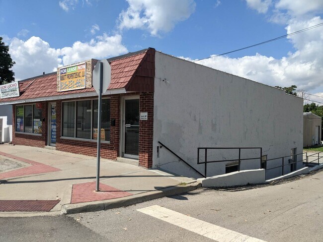
Property Record
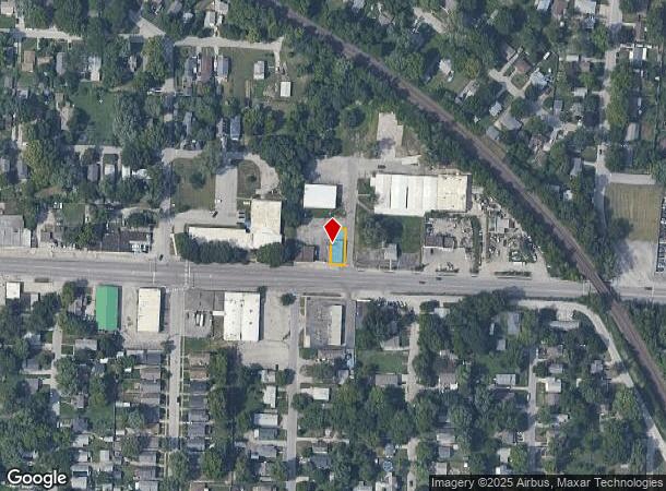
10338 E Truman Rd, Independence, MO 64052
NEARBY LISTINGS FOR SALE OR LEASE
-
-
-
-
-
-
-
No Photo
-
View all Independence listings for sale on LoopNet.com
Property Detail
10338 E Truman Rd
Kansas City, MO-KS
Hutchins Park
27-120-28-17-00-0-00-000
HUTCHINS PARK LOT M BLK 15
Storebuilding
Jackson
X
Missouri
29095C0277H
m
2024
0.09 AC
2025
East Jackson County
011002
Kansas City
2,400 SF
DEMOGRAPHICS near 10338 E Truman Rd
1 Mile
3 Mile
5 Mile
2024 Total Population
11,855
58,027
154,685
2029 Population
11,886
58,089
155,029
Pop Growth 2024-2029
+ 0.26%
+ 0.11%
+ 0.22%
Average Age
38
39
39
2024 Total Households
4,932
23,563
60,731
HH Growth 2024-2029
+ 0.16%
(0.03%)
(0.02%)
Median Household Inc
$47,590
$47,555
$47,283
Avg Household Size
2.30
2.30
2.40
2024 Avg HH Vehicles
2.00
2.00
2.00
Median Home Value
$77,110
$111,446
$128,357
Median Year Built
1948
1953
1959
Nearby Places
Map Layers
Map Styles
 Street
 Aerial
- Restaurants
- Banks
- Shops
- Fitness
- Groceries
PUBLIC TRANSPORTATION
COMMUTER RAIL
DRIVE
WALK
Distance
5 min
2.0 mi
DRIVE
WALK
Distance
17 min
8.2 mi
AIRPORT
Kansas City International
DRIVE
WALK
Distance
Kansas City International
37 min
28.0 mi
SALE & LEASE HISTORY
LISTING DATE
SALE/LEASE

Sep 25, 2016
For Lease
Aug 22, 2022
For Sale
Nearby Properties
Address
Land Use
TOTAL SIZE
Lot Size
Zoning
Address
Land Use
TOTAL SIZE
Lot Size
Zoning
519,315 SF
28.47 AC
Address
Land Use
TOTAL SIZE
Lot Size
Zoning
7,962 SF
7.80 AC
Address
Land Use
TOTAL SIZE
Lot Size
Zoning
253,472 SF
396.83 AC
Address
Land Use
TOTAL SIZE
Lot Size
Zoning
44,274 SF
9.40 AC
Address
Land Use
TOTAL SIZE
Lot Size
Zoning
32,777 SF
21.40 AC
Address
Land Use
TOTAL SIZE
Lot Size
Zoning
123,305 SF
15.51 AC
Address
Land Use
TOTAL SIZE
Lot Size
Zoning
213,615 SF
15.50 AC
Address
Land Use
TOTAL SIZE
Lot Size
Zoning
74,801 SF
8.93 AC
Address
Land Use
TOTAL SIZE
Lot Size
Zoning
138,353 SF
23.03 AC
Address
Land Use
TOTAL SIZE
Lot Size
Zoning
157,666 SF
18.54 AC
Address
Land Use
TOTAL SIZE
Lot Size
Zoning
139,713 SF
15.70 AC
Address
Land Use
TOTAL SIZE
Lot Size
Zoning
13,227 SF
287 AC
Address
Land Use
TOTAL SIZE
Lot Size
Zoning
76,410 SF
49.60 AC
Address
Land Use
TOTAL SIZE
Lot Size
Zoning
71,339 SF
0.68 AC
Address
Land Use
TOTAL SIZE
Lot Size
Zoning
113,667 SF
6.31 AC
Address
Land Use
TOTAL SIZE
Lot Size
Zoning
55,985 SF
20.93 AC
Address
Land Use
TOTAL SIZE
Lot Size
Zoning
70,555 SF
32.97 AC
Address
Land Use
TOTAL SIZE
Lot Size
Zoning
36,883 SF
14.60 AC
Address
Land Use
TOTAL SIZE
Lot Size
Zoning
229,425 SF
15.68 AC
Address
Land Use
TOTAL SIZE
Lot Size
Zoning
286,490 SF
37.30 AC
Address
Land Use
TOTAL SIZE
Lot Size
Zoning
9,768 SF
0.87 AC
Address
Land Use
TOTAL SIZE
Lot Size
Zoning
43,504 SF
Address
Land Use
TOTAL SIZE
Lot Size
Zoning
129,315 SF
15.90 AC
Address
Land Use
TOTAL SIZE
Lot Size
Zoning
79,609 SF
2.91 AC
Address
Land Use
TOTAL SIZE
Lot Size
Zoning
39,120 SF
1.87 AC
Address
Land Use
TOTAL SIZE
Lot Size
Zoning
50,900 SF
13.80 AC
Address
Land Use
TOTAL SIZE
Lot Size
Zoning
58,946 SF
0.98 AC
Address
Land Use
TOTAL SIZE
Lot Size
Zoning
621,400 SF
Address
Land Use
TOTAL SIZE
Lot Size
Zoning
67,282 SF
4 AC
Address
Land Use
TOTAL SIZE
Lot Size
Zoning
552,135 SF
39.60 AC
The World's #1 Commercial Real Estate Marketplace
Connect with us
© 2025 CoStar Group
The information above has been obtained from sources believed reliable. While we do not doubt its accuracy we have not verified it and make no guarantee, warranty or representation about it. It is your responsibility to independently confirm its accuracy and completeness. Any projections, opinions, assumptions, or estimates used are for example only and do not represent the current or future performance of the property. The value of this transaction to you depends on tax and other factors which should be evaluated by your tax, financial, and legal advisors. You and your advisors should conduct a careful, independent investigation of the property to determine to your satisfaction the suitability of the property for your needs.