Property Record
1034 Massachusetts Ave, Boxborough, MA 01719


NEARBY LISTINGS FOR SALE OR LEASE
Property Detail
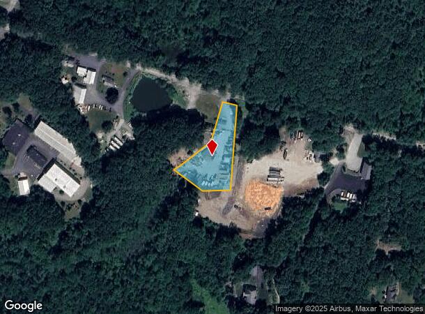
1034 Massachusetts Ave
Industrialgeneral
Middlesex
X
Massachusetts
25017C0332G
1.10 AC
2025
Concord/Maynard
2025
Boston
388100
Boston-Cambridge-Newton, MA-NH
2,616 SF
BOXB-000014-000002
DEMOGRAPHICS near 1034 Massachusetts Ave
1 Mile
3 Mile
5 Mile
2024 Total Population
1,935
13,958
44,049
2029 Population
1,927
13,851
43,804
Pop Growth 2024-2029
(0.41%)
(0.77%)
(0.56%)
Average Age
42
42
42
2024 Total Households
793
5,287
16,549
HH Growth 2024-2029
(0.50%)
(0.83%)
(0.66%)
Median Household Inc
$183,620
$162,562
$153,088
Avg Household Size
2.40
2.60
2.60
2024 Avg HH Vehicles
2.00
2.00
2.00
Median Home Value
$724,206
$691,420
$658,519
Median Year Built
1993
1974
1973
Nearby Places
Map Layers
Map Styles
 Street
 Aerial
- Restaurants
- Banks
- Shops
- Fitness
- Groceries
PUBLIC TRANSPORTATION
COMMUTER RAIL
Littleton/Route 495 (Fitchburg/South Acton Line - Massachusetts Bay Transportation Authority Commuter Rail (Purple Line))
DRIVE
WALK
Distance
Littleton/Route 495 (Fitchburg/South Acton Line - Massachusetts Bay Transportation Authority Commuter Rail (Purple Line))
10 min
3.9 mi
South Acton (Fitchburg/South Acton Line - Massachusetts Bay Transportation Authority Commuter Rail (Purple Line))
DRIVE
WALK
Distance
South Acton (Fitchburg/South Acton Line - Massachusetts Bay Transportation Authority Commuter Rail (Purple Line))
10 min
4.5 mi
AIRPORT
Worcester Regional
DRIVE
WALK
Distance
Worcester Regional
42 min
29.4 mi
General Edward Lawrence Logan International
DRIVE
WALK
Distance
General Edward Lawrence Logan International
52 min
32.5 mi
Manchester Boston Regional
DRIVE
WALK
Distance
Manchester Boston Regional
58 min
39.9 mi
Freight Ports
Port of Boston
DRIVE
WALK
Distance
Port of Boston
51 min
30.8 mi
SALE & LEASE HISTORY
LISTING DATE
SALE/LEASE

Mar 15, 2022
For Sale
Nearby Properties
Address
Land Use
TOTAL SIZE
Lot Size
Zoning
Address
Land Use
TOTAL SIZE
Lot Size
Zoning
197,727 SF
31.55 AC
R2
Address
Land Use
TOTAL SIZE
Lot Size
Zoning
312,503 SF
54.44 AC
AR
Address
Land Use
TOTAL SIZE
Lot Size
Zoning
2,295.68 AC
Address
Land Use
TOTAL SIZE
Lot Size
Zoning
260,475 SF
70.94 AC
OP
Address
Land Use
TOTAL SIZE
Lot Size
Zoning
143,640 SF
29.44 AC
IA
Address
Land Use
TOTAL SIZE
Lot Size
Zoning
210,620 SF
12.97 AC
Address
Land Use
TOTAL SIZE
Lot Size
Zoning
180,143 SF
41.70 AC
OP
Address
Land Use
TOTAL SIZE
Lot Size
Zoning
131,607 SF
36.01 AC
Address
Land Use
TOTAL SIZE
Lot Size
Zoning
150,515 SF
36.95 AC
OP
Address
Land Use
TOTAL SIZE
Lot Size
Zoning
110,150 SF
18.44 AC
Address
Land Use
TOTAL SIZE
Lot Size
Zoning
122,184 SF
8.14 AC
Address
Land Use
TOTAL SIZE
Lot Size
Zoning
154,436 SF
18.86 AC
IA
Address
Land Use
TOTAL SIZE
Lot Size
Zoning
55.50 AC
ARC
Address
Land Use
TOTAL SIZE
Lot Size
Zoning
103,680 SF
9.30 AC
Address
Land Use
TOTAL SIZE
Lot Size
Zoning
97,210 SF
8.28 AC
Address
Land Use
TOTAL SIZE
Lot Size
Zoning
40 AC
R2
Address
Land Use
TOTAL SIZE
Lot Size
Zoning
71,395 SF
8.37 AC
C
Address
Land Use
TOTAL SIZE
Lot Size
Zoning
98,125 SF
8.97 AC
IA
Address
Land Use
TOTAL SIZE
Lot Size
Zoning
120,612 SF
16.42 AC
Address
Land Use
TOTAL SIZE
Lot Size
Zoning
108,992 SF
23.90 AC
IA
Address
Land Use
TOTAL SIZE
Lot Size
Zoning
102,793 SF
11.56 AC
OP
Address
Land Use
TOTAL SIZE
Lot Size
Zoning
948 AC
AR
Address
Land Use
TOTAL SIZE
Lot Size
Zoning
40.44 AC
ARC
Address
Land Use
TOTAL SIZE
Lot Size
Zoning
101,328 SF
13.97 AC
OP
Address
Land Use
TOTAL SIZE
Lot Size
Zoning
64,142 SF
9.15 AC
Address
Land Use
TOTAL SIZE
Lot Size
Zoning
49,080 SF
2.48 AC
Address
Land Use
TOTAL SIZE
Lot Size
Zoning
95,634 SF
22.16 AC
OP
Address
Land Use
TOTAL SIZE
Lot Size
Zoning
3,121 SF
3.92 AC
WAV
Address
Land Use
TOTAL SIZE
Lot Size
Zoning
100,994 SF
19.54 AC
IA
Address
Land Use
TOTAL SIZE
Lot Size
Zoning
41,916 SF
10.14 AC
AR
The World's #1 Commercial Real Estate Marketplace
Connect with us
© 2026 CoStar Group
The information above has been obtained from sources believed reliable. While we do not doubt its accuracy we have not verified it and make no guarantee, warranty or representation about it. It is your responsibility to independently confirm its accuracy and completeness. Any projections, opinions, assumptions, or estimates used are for example only and do not represent the current or future performance of the property. The value of this transaction to you depends on tax and other factors which should be evaluated by your tax, financial, and legal advisors. You and your advisors should conduct a careful, independent investigation of the property to determine to your satisfaction the suitability of the property for your needs.