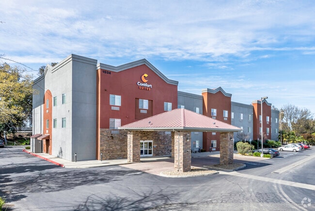
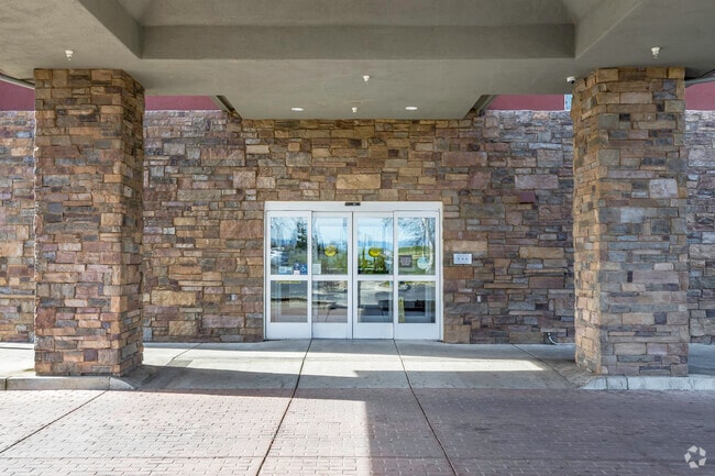
Property Record
1034 N Beale Rd, Marysville, CA 95901

NEARBY LISTINGS FOR SALE OR LEASE
-
-
View all Marysville listings for sale on LoopNet.com
Property Detail
1034 N Beale Rd
020-140-038-000
P-2 PM 99-01A
Hotel
Yuba
X
California
06115C0340D
2
2024
1.38 AC
2025
California North Rural Area
040302
Sacramento
40,045 SF
Yuba City, CA
DEMOGRAPHICS near 1034 N Beale Rd
1 Mile
3 Mile
5 Mile
2024 Total Population
6,733
72,283
129,079
2029 Population
7,484
76,650
134,396
Pop Growth 2024-2029
+ 11.15%
+ 6.04%
+ 4.12%
Average Age
35
36
37
2024 Total Households
2,084
24,015
42,469
HH Growth 2024-2029
+ 11.66%
+ 6.28%
+ 4.24%
Median Household Inc
$50,949
$56,504
$61,150
Avg Household Size
3.00
2.90
2.90
2024 Avg HH Vehicles
2.00
2.00
2.00
Median Home Value
$235,274
$291,670
$324,476
Median Year Built
1980
1976
1981
Nearby Places
Map Layers
Map Styles
 Street
 Aerial
- Restaurants
- Banks
- Shops
- Fitness
- Groceries
PUBLIC TRANSPORTATION
AIRPORT
Sacramento International
DRIVE
WALK
Distance
Sacramento International
47 min
36.9 mi
SALE & LEASE HISTORY
LISTING DATE
SALE/LEASE

Mar 23, 2017
For Sale
Jun 08, 2022
For Sale
Nearby Properties
Address
Land Use
TOTAL SIZE
Lot Size
Zoning
Address
Land Use
TOTAL SIZE
Lot Size
Zoning
18,410 SF
0.77 AC
C-3
Address
Land Use
TOTAL SIZE
Lot Size
Zoning
30,734 SF
1.38 AC
C-3
Address
Land Use
TOTAL SIZE
Lot Size
Zoning
154,480 SF
13.44 AC
C
Address
Land Use
TOTAL SIZE
Lot Size
Zoning
98,830 SF
0.40 AC
C-3
Address
Land Use
TOTAL SIZE
Lot Size
Zoning
48,348 SF
3.25 AC
Address
Land Use
TOTAL SIZE
Lot Size
Zoning
51,371 SF
10.13 AC
Address
Land Use
TOTAL SIZE
Lot Size
Zoning
120,622 SF
2.25 AC
Address
Land Use
TOTAL SIZE
Lot Size
Zoning
150,742 SF
7.91 AC
R3
Address
Land Use
TOTAL SIZE
Lot Size
Zoning
107,749 SF
9.33 AC
C
Address
Land Use
TOTAL SIZE
Lot Size
Zoning
203,353 SF
11.49 AC
C
Address
Land Use
TOTAL SIZE
Lot Size
Zoning
55,702 SF
3.16 AC
Address
Land Use
TOTAL SIZE
Lot Size
Zoning
18,675 SF
2.98 AC
C3
Address
Land Use
TOTAL SIZE
Lot Size
Zoning
50,270 SF
4.16 AC
CO
Address
Land Use
TOTAL SIZE
Lot Size
Zoning
48,117 SF
1.81 AC
R1
Address
Land Use
TOTAL SIZE
Lot Size
Zoning
Address
Land Use
TOTAL SIZE
Lot Size
Zoning
1.67 AC
Address
Land Use
TOTAL SIZE
Lot Size
Zoning
2.53 AC
Address
Land Use
TOTAL SIZE
Lot Size
Zoning
1,800 SF
6 AC
M-1
Address
Land Use
TOTAL SIZE
Lot Size
Zoning
79,817 SF
1.64 AC
M-1
Address
Land Use
TOTAL SIZE
Lot Size
Zoning
63,320 SF
3.88 AC
R-03
Address
Land Use
TOTAL SIZE
Lot Size
Zoning
19,950 SF
7.66 AC
M-1
Address
Land Use
TOTAL SIZE
Lot Size
Zoning
47,686 SF
2 AC
R2
Address
Land Use
TOTAL SIZE
Lot Size
Zoning
41,279 SF
5.18 AC
Address
Land Use
TOTAL SIZE
Lot Size
Zoning
4.79 AC
R-2
Address
Land Use
TOTAL SIZE
Lot Size
Zoning
41,920 SF
2.41 AC
R-4
Address
Land Use
TOTAL SIZE
Lot Size
Zoning
105,352 SF
4.90 AC
PD
Address
Land Use
TOTAL SIZE
Lot Size
Zoning
2.57 AC
R-4
Address
Land Use
TOTAL SIZE
Lot Size
Zoning
36,760 SF
3.06 AC
Address
Land Use
TOTAL SIZE
Lot Size
Zoning
29,062 SF
1.55 AC
C3
The World's #1 Commercial Real Estate Marketplace
Connect with us
© 2026 CoStar Group
The information above has been obtained from sources believed reliable. While we do not doubt its accuracy we have not verified it and make no guarantee, warranty or representation about it. It is your responsibility to independently confirm its accuracy and completeness. Any projections, opinions, assumptions, or estimates used are for example only and do not represent the current or future performance of the property. The value of this transaction to you depends on tax and other factors which should be evaluated by your tax, financial, and legal advisors. You and your advisors should conduct a careful, independent investigation of the property to determine to your satisfaction the suitability of the property for your needs.