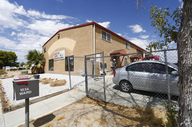
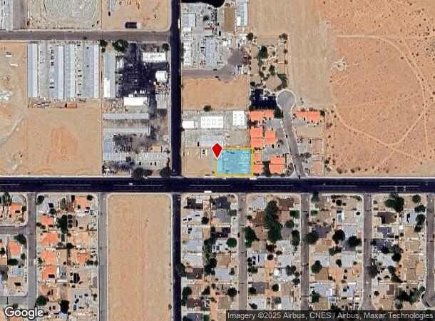
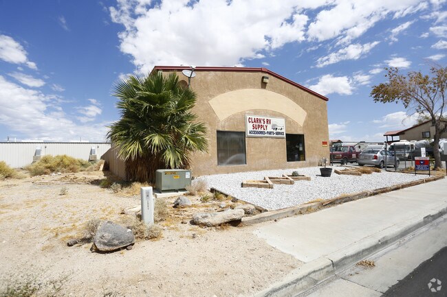
Property Record
1034 W Ward Ave, Ridgecrest, CA 93555

NEARBY LISTINGS FOR SALE OR LEASE
Property Detail
1034 W Ward Ave
Bakersfield, CA
Parcel Map No. 4010
453-013-15-00-0
PARCEL MAP 4010 , LOT 4
Autorepair
Kern
X
California
06029C1039E
4
2024
0.46 AC
2025
NE Outlying Kern County
005405
Bakersfield
4,000 SF
DEMOGRAPHICS near 1034 W Ward Ave
1 Mile
3 Mile
5 Mile
2024 Total Population
8,731
28,399
35,750
2029 Population
8,920
28,924
36,427
Pop Growth 2024-2029
+ 2.16%
+ 1.85%
+ 1.89%
Average Age
39
37
38
2024 Total Households
3,631
11,523
14,336
HH Growth 2024-2029
+ 2.18%
+ 1.78%
+ 1.83%
Median Household Inc
$85,553
$73,469
$72,996
Avg Household Size
2.40
2.40
2.40
2024 Avg HH Vehicles
2.00
2.00
2.00
Median Home Value
$264,004
$240,279
$246,391
Median Year Built
1981
1980
1980
Nearby Places
Map Layers
Map Styles
 Street
 Aerial
- Restaurants
- Banks
- Shops
- Fitness
- Groceries
SALE & LEASE HISTORY
LISTING DATE
SALE/LEASE

Aug 30, 2017
For Sale
Nearby Properties
Address
Land Use
TOTAL SIZE
Lot Size
Zoning
Address
Land Use
TOTAL SIZE
Lot Size
Zoning
24,013 SF
7.01 AC
Address
Land Use
TOTAL SIZE
Lot Size
Zoning
58,542 SF
2.85 AC
CS
Address
Land Use
TOTAL SIZE
Lot Size
Zoning
25,800 SF
2.38 AC
PO
Address
Land Use
TOTAL SIZE
Lot Size
Zoning
80,620 SF
2.51 AC
CG
Address
Land Use
TOTAL SIZE
Lot Size
Zoning
58,053 SF
2.77 AC
CS
Address
Land Use
TOTAL SIZE
Lot Size
Zoning
68,077 SF
9 AC
GC
Address
Land Use
TOTAL SIZE
Lot Size
Zoning
14,738 SF
4.21 AC
Address
Land Use
TOTAL SIZE
Lot Size
Zoning
2.58 AC
PO
Address
Land Use
TOTAL SIZE
Lot Size
Zoning
3,630 SF
6.09 AC
Address
Land Use
TOTAL SIZE
Lot Size
Zoning
16,992 SF
1.56 AC
GC
Address
Land Use
TOTAL SIZE
Lot Size
Zoning
71,334 SF
3.61 AC
C
Address
Land Use
TOTAL SIZE
Lot Size
Zoning
36,774 SF
3.30 AC
GC
Address
Land Use
TOTAL SIZE
Lot Size
Zoning
10,608 SF
5.44 AC
R-3
Address
Land Use
TOTAL SIZE
Lot Size
Zoning
31,770 SF
2.19 AC
PUD
Address
Land Use
TOTAL SIZE
Lot Size
Zoning
14,516 SF
1.67 AC
C2
Address
Land Use
TOTAL SIZE
Lot Size
Zoning
43,610 SF
3.78 AC
Address
Land Use
TOTAL SIZE
Lot Size
Zoning
59,832 SF
3.99 AC
R2
Address
Land Use
TOTAL SIZE
Lot Size
Zoning
45,689 SF
3.68 AC
GC
Address
Land Use
TOTAL SIZE
Lot Size
Zoning
16,629 SF
3.59 AC
Address
Land Use
TOTAL SIZE
Lot Size
Zoning
58,549 SF
4.94 AC
GC
Address
Land Use
TOTAL SIZE
Lot Size
Zoning
Address
Land Use
TOTAL SIZE
Lot Size
Zoning
2,100 SF
12.68 AC
M1
Address
Land Use
TOTAL SIZE
Lot Size
Zoning
15,875 SF
5.68 AC
CN R1
Address
Land Use
TOTAL SIZE
Lot Size
Zoning
25,144 SF
11.79 AC
E2
Address
Land Use
TOTAL SIZE
Lot Size
Zoning
22,840 SF
0.83 AC
CH
Address
Land Use
TOTAL SIZE
Lot Size
Zoning
12,361 SF
1.48 AC
CG
Address
Land Use
TOTAL SIZE
Lot Size
Zoning
22,148 SF
1.48 AC
C1
Address
Land Use
TOTAL SIZE
Lot Size
Zoning
1,202 SF
4 AC
R-2
Address
Land Use
TOTAL SIZE
Lot Size
Zoning
88,103 SF
7.54 AC
CG
Address
Land Use
TOTAL SIZE
Lot Size
Zoning
10,077 SF
2.08 AC
CG
The World's #1 Commercial Real Estate Marketplace
Connect with us
© 2025 CoStar Group
The information above has been obtained from sources believed reliable. While we do not doubt its accuracy we have not verified it and make no guarantee, warranty or representation about it. It is your responsibility to independently confirm its accuracy and completeness. Any projections, opinions, assumptions, or estimates used are for example only and do not represent the current or future performance of the property. The value of this transaction to you depends on tax and other factors which should be evaluated by your tax, financial, and legal advisors. You and your advisors should conduct a careful, independent investigation of the property to determine to your satisfaction the suitability of the property for your needs.