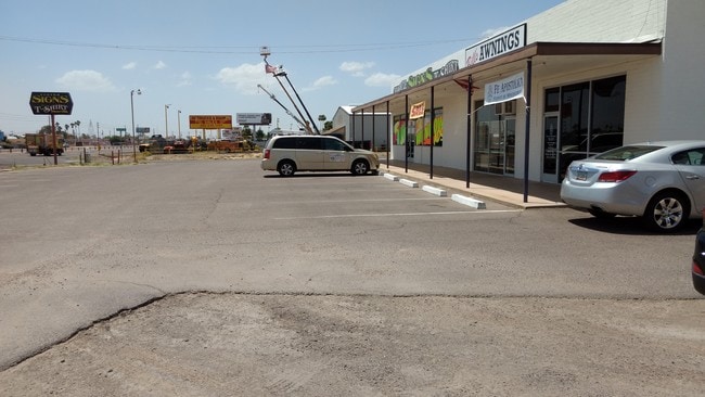
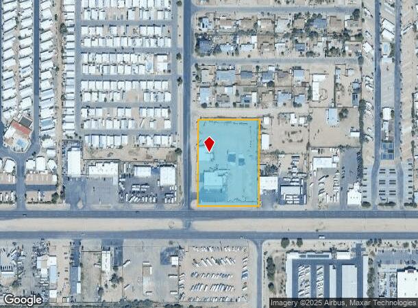
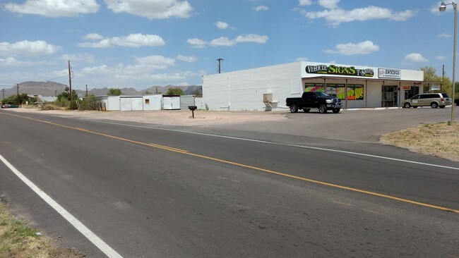
Property Record
10344 E Apache Trl, Apache Junction, AZ 85120
NEARBY LISTINGS FOR SALE OR LEASE
Property Detail
10344 E Apache Trl
220-44-004A
S 560F OF E2 E2 E2 NW4 EX S 150F RD & EX W 40F RD P/F 20-0828714
Storebuilding
Maricopa
X
Arizona
04021C0015F
2.74 AC
2025
Red Mountain/Mesa
2025
Phoenix
420116
Phoenix-Mesa-Chandler, AZ
8,824 SF
DEMOGRAPHICS near 10344 E Apache Trl
1 Mile
3 Mile
5 Mile
2024 Total Population
15,731
94,301
197,162
2029 Population
17,416
105,772
221,439
Pop Growth 2024-2029
+ 10.71%
+ 12.16%
+ 12.31%
Average Age
40
44
45
2024 Total Households
5,825
37,903
80,391
HH Growth 2024-2029
+ 11.02%
+ 12.68%
+ 12.76%
Median Household Inc
$62,666
$60,466
$65,353
Avg Household Size
2.60
2.40
2.40
2024 Avg HH Vehicles
2.00
2.00
2.00
Median Home Value
$253,716
$253,658
$302,625
Median Year Built
1993
1994
1994
Nearby Places
Map Layers
Map Styles
 Street
 Aerial
- Restaurants
- Banks
- Shops
- Fitness
- Groceries
PUBLIC TRANSPORTATION
AIRPORT
Phoenix-Mesa Gateway
DRIVE
WALK
Distance
Phoenix-Mesa Gateway
19 min
12.6 mi
Phoenix Sky Harbor International
DRIVE
WALK
Distance
Phoenix Sky Harbor International
35 min
27.1 mi
Freight Ports
Port of San Diego
DRIVE
WALK
Distance
Port of San Diego
424 min
385.1 mi
SALE & LEASE HISTORY
LISTING DATE
SALE/LEASE

Sep 07, 2018
For Sale
May 18, 2017
For Sale
Nearby Properties
Address
Land Use
TOTAL SIZE
Lot Size
Zoning
Address
Land Use
TOTAL SIZE
Lot Size
Zoning
493,357 SF
46.94 AC
C-N
Address
Land Use
TOTAL SIZE
Lot Size
Zoning
128,905 SF
7.14 AC
UNDESIGNAT
Address
Land Use
TOTAL SIZE
Lot Size
Zoning
209,737 SF
21.98 AC
UNDESIGNAT
Address
Land Use
TOTAL SIZE
Lot Size
Zoning
330,352 SF
28.30 AC
PF
Address
Land Use
TOTAL SIZE
Lot Size
Zoning
52,961 SF
7.94 AC
Address
Land Use
TOTAL SIZE
Lot Size
Zoning
422,427 SF
18.21 AC
C-C
Address
Land Use
TOTAL SIZE
Lot Size
Zoning
173,840 SF
6 AC
UNDESIGNAT
Address
Land Use
TOTAL SIZE
Lot Size
Zoning
6,335 SF
8.30 AC
Address
Land Use
TOTAL SIZE
Lot Size
Zoning
38,353 SF
5 AC
Address
Land Use
TOTAL SIZE
Lot Size
Zoning
23,180 SF
3.90 AC
UNDESIGNAT
Address
Land Use
TOTAL SIZE
Lot Size
Zoning
4.77 AC
LC
Address
Land Use
TOTAL SIZE
Lot Size
Zoning
345,968 SF
14.65 AC
RM4
Address
Land Use
TOTAL SIZE
Lot Size
Zoning
162,184 SF
4.60 AC
UNDESIGNAT
Address
Land Use
TOTAL SIZE
Lot Size
Zoning
27,121 SF
4.05 AC
Address
Land Use
TOTAL SIZE
Lot Size
Zoning
43,958 SF
4.54 AC
UNDESIGNAT
Address
Land Use
TOTAL SIZE
Lot Size
Zoning
196,400 SF
15.67 AC
Address
Land Use
TOTAL SIZE
Lot Size
Zoning
24,158 SF
5.19 AC
Address
Land Use
TOTAL SIZE
Lot Size
Zoning
13.52 AC
Address
Land Use
TOTAL SIZE
Lot Size
Zoning
62,758 SF
5 AC
UNDESIGNAT
Address
Land Use
TOTAL SIZE
Lot Size
Zoning
57,258 SF
5.18 AC
UNDESIGNAT
Address
Land Use
TOTAL SIZE
Lot Size
Zoning
244,351 SF
18.46 AC
RS43
Address
Land Use
TOTAL SIZE
Lot Size
Zoning
30,477 SF
3.91 AC
UNDESIGNAT
Address
Land Use
TOTAL SIZE
Lot Size
Zoning
8,710 SF
14.93 AC
Address
Land Use
TOTAL SIZE
Lot Size
Zoning
162,260 SF
7.62 AC
Address
Land Use
TOTAL SIZE
Lot Size
Zoning
172,756 SF
8.52 AC
LC
Address
Land Use
TOTAL SIZE
Lot Size
Zoning
Address
Land Use
TOTAL SIZE
Lot Size
Zoning
54,784 SF
5.36 AC
Address
Land Use
TOTAL SIZE
Lot Size
Zoning
316 SF
40 AC
MHP
Address
Land Use
TOTAL SIZE
Lot Size
Zoning
19,754 SF
11.67 AC
UNDESIGNAT
Address
Land Use
TOTAL SIZE
Lot Size
Zoning
10,132 SF
14.08 AC
CI2
The World's #1 Commercial Real Estate Marketplace
Connect with us
© 2026 CoStar Group
The information above has been obtained from sources believed reliable. While we do not doubt its accuracy we have not verified it and make no guarantee, warranty or representation about it. It is your responsibility to independently confirm its accuracy and completeness. Any projections, opinions, assumptions, or estimates used are for example only and do not represent the current or future performance of the property. The value of this transaction to you depends on tax and other factors which should be evaluated by your tax, financial, and legal advisors. You and your advisors should conduct a careful, independent investigation of the property to determine to your satisfaction the suitability of the property for your needs.