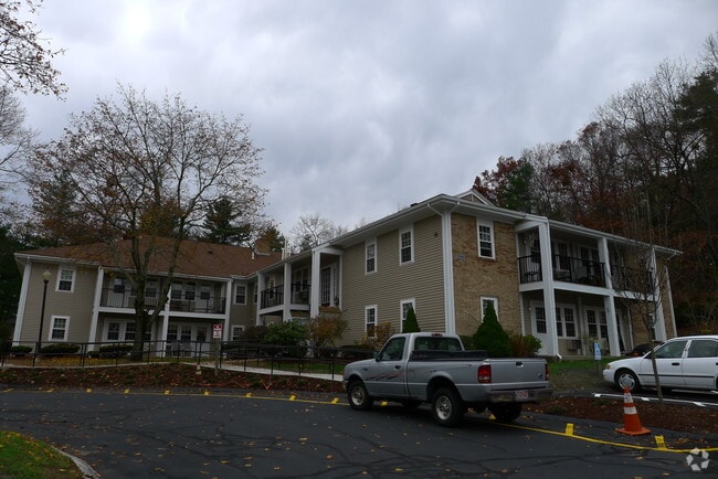
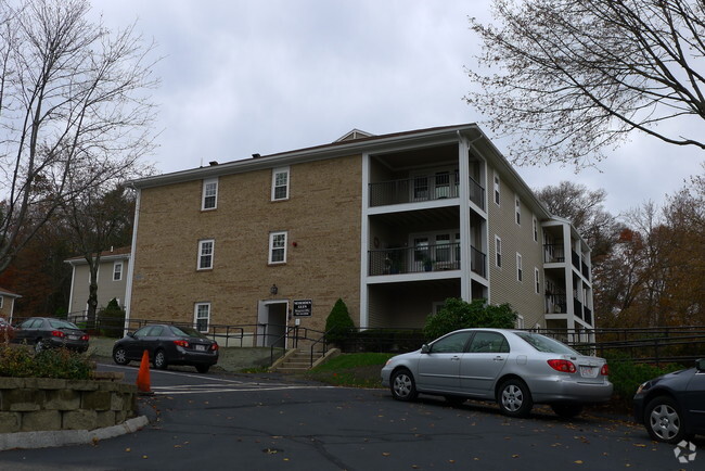
Property Record
1035 Central Ave, Needham, MA 02492

Property Detail
1035 Central Ave
Apartment
Norfolk
A1
Massachusetts
B and X Area of moderate flood hazard, usually the area between the limits of the 100-year and 500-year floods.
4.33 AC
2025
Metro West
2025
Boston
403400
Boston-Cambridge-Newton, MA-NH
50,130 SF
NEED-000120-000013
NEARBY LISTINGS FOR SALE OR LEASE
-
-
View all Needham listings for sale on LoopNet.com
DEMOGRAPHICS near 1035 Central Ave
1 mile
3 mile
5 mile
2025 Total Population
9,215
69,187
175,935
2030 Population
9,540
71,471
181,791
Pop Growth 2025-2030
+ 3.53%
+ 3.30%
+ 3.33%
Average Age
42
41
42
2025 Total Households
3,385
23,296
62,944
HH Growth 2025-2030
+ 3.78%
+ 3.63%
+ 3.53%
Median Household Inc
$200,295
$219,768
$196,856
Avg Household Size
2.60
2.70
2.60
2025 Avg HH Vehicles
2.00
2.00
2.00
Median Home Value
$1,099,008
$1,098,849
$1,063,948
Median Year Built
1968
1958
1955
Nearby Places
Map Layers
Map Styles
 Street
 Aerial
Transit
 Traffic
 Biking
Places
Listings with unknown addresses are not visible on the map
- Restaurants
- Banks
- Shops
- Fitness
- Groceries
PUBLIC TRANSPORTATION
COMMUTER RAIL
Needham Center (Needham Line - Massachusetts Bay Transportation Authority Commuter Rail (Purple Line))
Drive
Walk
Distance
Needham Center (Needham Line - Massachusetts Bay Transportation Authority Commuter Rail (Purple Line))
2 min
20 min
1.0 mi
Needham Heights (Needham Line - Massachusetts Bay Transportation Authority Commuter Rail (Purple Line))
Drive
Walk
Distance
Needham Heights (Needham Line - Massachusetts Bay Transportation Authority Commuter Rail (Purple Line))
3 min
1.4 mi
AIRPORT
General Edward Lawrence Logan International
Drive
Walk
Distance
General Edward Lawrence Logan International
31 min
18.4 mi
Freight Ports
Port of Boston
Drive
Walk
Distance
Port of Boston
30 min
16.7 mi
Nearby Properties
Address
Land Use
TOTAL SIZE
Lot Size
Zoning
Address
Land Use
TOTAL SIZE
Lot Size
Zoning
387,550 SF
7.99 AC
MU1
Address
Land Use
TOTAL SIZE
Lot Size
Zoning
412,208 SF
7.93 AC
I
Address
Land Use
TOTAL SIZE
Lot Size
Zoning
522,600 SF
59.54 AC
A2
Address
Land Use
TOTAL SIZE
Lot Size
Zoning
10.87 AC
SRD 10
Address
Land Use
TOTAL SIZE
Lot Size
Zoning
4.74 AC
NEBC
Address
Land Use
TOTAL SIZE
Lot Size
Zoning
76,800 SF
22.65 AC
MU1
Address
Land Use
TOTAL SIZE
Lot Size
Zoning
15,974 SF
2.45 AC
ED
Address
Land Use
TOTAL SIZE
Lot Size
Zoning
220,500 SF
1.96 AC
NEBC
Address
Land Use
TOTAL SIZE
Lot Size
Zoning
208,500 SF
13.98 AC
I
Address
Land Use
TOTAL SIZE
Lot Size
Zoning
59.94 AC
PUB
Address
Land Use
TOTAL SIZE
Lot Size
Zoning
6.33 AC
SR10
Address
Land Use
TOTAL SIZE
Lot Size
Zoning
Address
Land Use
TOTAL SIZE
Lot Size
Zoning
Address
Land Use
TOTAL SIZE
Lot Size
Zoning
264,014 SF
10.64 AC
NEBC
Address
Land Use
TOTAL SIZE
Lot Size
Zoning
15.08 AC
SR10
Address
Land Use
TOTAL SIZE
Lot Size
Zoning
408,199 SF
23.35 AC
NEBC
Address
Land Use
TOTAL SIZE
Lot Size
Zoning
4,216 SF
6.02 AC
SRA
Address
Land Use
TOTAL SIZE
Lot Size
Zoning
260,552 SF
12.80 AC
LMD
Address
Land Use
TOTAL SIZE
Lot Size
Zoning
1,683 SF
46.10 AC
SR15
Address
Land Use
TOTAL SIZE
Lot Size
Zoning
211,500 SF
12.09 AC
I
Address
Land Use
TOTAL SIZE
Lot Size
Zoning
Address
Land Use
TOTAL SIZE
Lot Size
Zoning
15 AC
Address
Land Use
TOTAL SIZE
Lot Size
Zoning
121,141 SF
19.58 AC
SR1
Address
Land Use
TOTAL SIZE
Lot Size
Zoning
224,517 SF
14 AC
B
Address
Land Use
TOTAL SIZE
Lot Size
Zoning
3.80 AC
Address
Land Use
TOTAL SIZE
Lot Size
Zoning
25.70 AC
SR10
Address
Land Use
TOTAL SIZE
Lot Size
Zoning
13,244 SF
12.72 AC
SR10
Address
Land Use
TOTAL SIZE
Lot Size
Zoning
140,920 SF
4.44 AC
CS
Address
Land Use
TOTAL SIZE
Lot Size
Zoning
3.24 AC
BD
Address
Land Use
TOTAL SIZE
Lot Size
Zoning
7.15 AC
The World's #1 Commercial Real Estate Marketplace
Connect with us
© 2026 CoStar Group
The information above has been obtained from sources believed reliable. While we do not doubt its accuracy we have not verified it and make no guarantee, warranty or representation about it. It is your responsibility to independently confirm its accuracy and completeness. Any projections, opinions, assumptions, or estimates used are for example only and do not represent the current or future performance of the property. The value of this transaction to you depends on tax and other factors which should be evaluated by your tax, financial, and legal advisors. You and your advisors should conduct a careful, independent investigation of the property to determine to your satisfaction the suitability of the property for your needs.