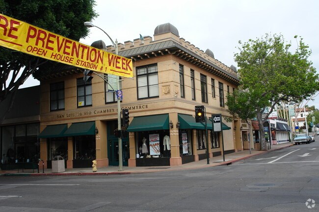
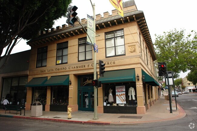
Property Record
1035 Chorro St, San Luis Obispo, CA 93401


NEARBY LISTINGS FOR SALE OR LEASE
Property Detail
1035 Chorro St
002-423-045
Parcel Map Sl-86-166
Storebuilding
CY SLO PM 41-72 PAR 1
AO
San Luis Obispo
06079C1068G
California
2024
0.15 AC
2025
Downtown SLO
011101
San Luis Obispo/Paso Robles
10,607 SF
San Luis Obispo-Paso Robles-Arroyo Grande, CA
DEMOGRAPHICS near 1035 Chorro St
1 Mile
3 Mile
5 Mile
2024 Total Population
15,089
56,398
61,359
2029 Population
15,111
56,732
61,655
Pop Growth 2024-2029
+ 0.15%
+ 0.59%
+ 0.48%
Average Age
35
35
35
2024 Total Households
6,943
21,082
21,948
HH Growth 2024-2029
(0.01%)
+ 0.53%
+ 0.43%
Median Household Inc
$62,342
$67,327
$69,397
Avg Household Size
2.10
2.30
2.30
2024 Avg HH Vehicles
2.00
2.00
2.00
Median Home Value
$838,829
$789,638
$807,184
Median Year Built
1967
1978
1978
Nearby Places
Map Layers
Map Styles
 Street
 Aerial
- Restaurants
- Banks
- Shops
- Fitness
- Groceries
PUBLIC TRANSPORTATION
COMMUTER RAIL
DRIVE
WALK
Distance
2 min
14 min
0.7 mi
AIRPORT
San Luis County Regional
DRIVE
WALK
Distance
San Luis County Regional
11 min
4.8 mi
SALE & LEASE HISTORY
LISTING DATE
SALE/LEASE

Feb 06, 2018
For Lease
Aug 21, 2018
For Lease
Apr 04, 2018
For Lease
Nearby Properties
Address
Land Use
TOTAL SIZE
Lot Size
Zoning
Address
Land Use
TOTAL SIZE
Lot Size
Zoning
99,866 SF
14.05 AC
O
Address
Land Use
TOTAL SIZE
Lot Size
Zoning
92,330 SF
3.69 AC
R4
Address
Land Use
TOTAL SIZE
Lot Size
Zoning
156,079 SF
8.79 AC
O
Address
Land Use
TOTAL SIZE
Lot Size
Zoning
191,653 SF
6.70 AC
CR
Address
Land Use
TOTAL SIZE
Lot Size
Zoning
69,146 SF
0.93 AC
CR
Address
Land Use
TOTAL SIZE
Lot Size
Zoning
139,675 SF
14.88 AC
CR
Address
Land Use
TOTAL SIZE
Lot Size
Zoning
110,984 SF
1.19 AC
CD
Address
Land Use
TOTAL SIZE
Lot Size
Zoning
134,591 SF
1.36 AC
CC
Address
Land Use
TOTAL SIZE
Lot Size
Zoning
137,893 SF
10.08 AC
CS
Address
Land Use
TOTAL SIZE
Lot Size
Zoning
136,725 SF
7.51 AC
Address
Land Use
TOTAL SIZE
Lot Size
Zoning
83,000 SF
4.90 AC
CT
Address
Land Use
TOTAL SIZE
Lot Size
Zoning
3.65 AC
CN
Address
Land Use
TOTAL SIZE
Lot Size
Zoning
172,407 SF
6.80 AC
R4
Address
Land Use
TOTAL SIZE
Lot Size
Zoning
100,759 SF
21.52 AC
CR
Address
Land Use
TOTAL SIZE
Lot Size
Zoning
61,720 SF
0.83 AC
CD
Address
Land Use
TOTAL SIZE
Lot Size
Zoning
116,351 SF
4.59 AC
R3
Address
Land Use
TOTAL SIZE
Lot Size
Zoning
54,577 SF
0.95 AC
CC
Address
Land Use
TOTAL SIZE
Lot Size
Zoning
91,389 SF
4.65 AC
R4
Address
Land Use
TOTAL SIZE
Lot Size
Zoning
201,280 SF
8.66 AC
M
Address
Land Use
TOTAL SIZE
Lot Size
Zoning
118,881 SF
1.90 AC
CT
Address
Land Use
TOTAL SIZE
Lot Size
Zoning
15,193 SF
4.53 AC
R4
Address
Land Use
TOTAL SIZE
Lot Size
Zoning
140,528 SF
4.35 AC
R4
Address
Land Use
TOTAL SIZE
Lot Size
Zoning
92.20 AC
R1
Address
Land Use
TOTAL SIZE
Lot Size
Zoning
72,475 SF
8.12 AC
CR
Address
Land Use
TOTAL SIZE
Lot Size
Zoning
66,348 SF
2.83 AC
CT
Address
Land Use
TOTAL SIZE
Lot Size
Zoning
85,863 SF
7.70 AC
R3
Address
Land Use
TOTAL SIZE
Lot Size
Zoning
66,022 SF
3.26 AC
R4
Address
Land Use
TOTAL SIZE
Lot Size
Zoning
1.48 AC
CD
Address
Land Use
TOTAL SIZE
Lot Size
Zoning
73,223 SF
8.67 AC
CR
Address
Land Use
TOTAL SIZE
Lot Size
Zoning
30,889 SF
3.89 AC
R3
The World's #1 Commercial Real Estate Marketplace
Connect with us
© 2025 CoStar Group
The information above has been obtained from sources believed reliable. While we do not doubt its accuracy we have not verified it and make no guarantee, warranty or representation about it. It is your responsibility to independently confirm its accuracy and completeness. Any projections, opinions, assumptions, or estimates used are for example only and do not represent the current or future performance of the property. The value of this transaction to you depends on tax and other factors which should be evaluated by your tax, financial, and legal advisors. You and your advisors should conduct a careful, independent investigation of the property to determine to your satisfaction the suitability of the property for your needs.