Property Record
1035 Collier Center Way, Naples, FL 34110

NEARBY LISTINGS FOR SALE OR LEASE
Property Detail
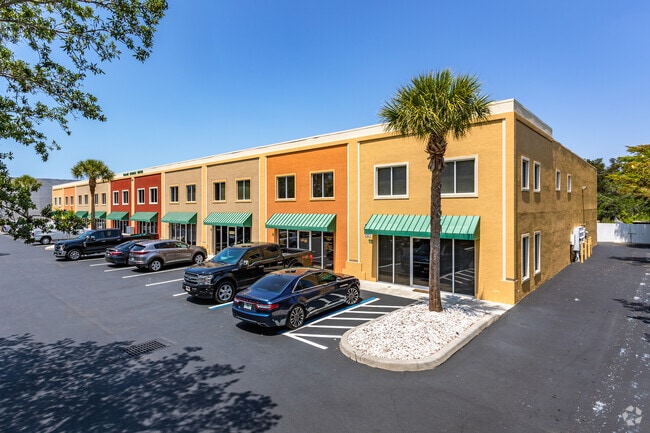
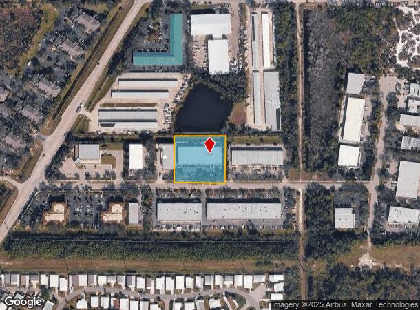
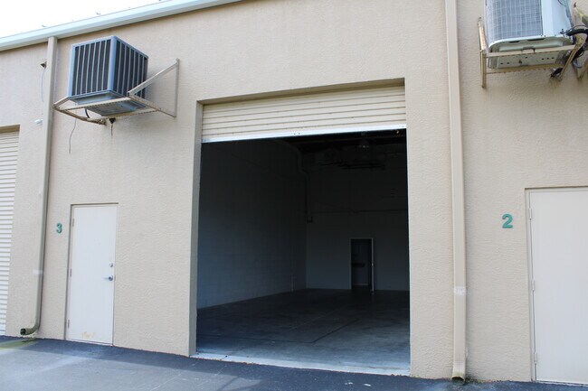
1035 Collier Center Way
Naples-Immokalee-Marco Island, FL
North Collier Industrial Center
64040000200
NORTH COLLIER INDUSTRIAL CENTER E 60FT OF LOT 6 AND LOT 7
Warehouse
Collier
AE
Florida
12021C0191J
6
2024
1.41 AC
2025
North Naples
010102
Southwest Florida
19,360 SF
DEMOGRAPHICS near 1035 Collier Center Way
1 Mile
3 Mile
5 Mile
2024 Total Population
5,054
49,630
118,364
2029 Population
5,746
57,838
138,538
Pop Growth 2024-2029
+ 13.69%
+ 16.54%
+ 17.04%
Average Age
57
52
54
2024 Total Households
2,605
22,694
54,751
HH Growth 2024-2029
+ 13.24%
+ 16.19%
+ 16.76%
Median Household Inc
$63,416
$78,562
$84,367
Avg Household Size
1.90
2.10
2.10
2024 Avg HH Vehicles
1.00
2.00
2.00
Median Home Value
$302,443
$445,245
$462,807
Median Year Built
1994
1994
1995
Nearby Places
Map Layers
Map Styles
 Street
 Aerial
- Restaurants
- Banks
- Shops
- Fitness
- Groceries
PUBLIC TRANSPORTATION
AIRPORT
Southwest Florida International
DRIVE
WALK
Distance
Southwest Florida International
34 min
23.0 mi
Freight Ports
Port Manatee
DRIVE
WALK
Distance
Port Manatee
142 min
122.7 mi
SALE & LEASE HISTORY
LISTING DATE
SALE/LEASE

May 27, 2021
For Lease
Mar 07, 2017
For Lease
Aug 18, 2020
For Sale
Nearby Properties
Address
Land Use
TOTAL SIZE
Lot Size
Zoning
Address
Land Use
TOTAL SIZE
Lot Size
Zoning
993,493 SF
86.10 AC
PUD
Address
Land Use
TOTAL SIZE
Lot Size
Zoning
377,883 SF
20.34 AC
PUD
Address
Land Use
TOTAL SIZE
Lot Size
Zoning
906,730 SF
7.86 AC
Address
Land Use
TOTAL SIZE
Lot Size
Zoning
313,544 SF
60 AC
A
Address
Land Use
TOTAL SIZE
Lot Size
Zoning
325,993 SF
35.92 AC
A
Address
Land Use
TOTAL SIZE
Lot Size
Zoning
311,416 SF
17.06 AC
Address
Land Use
TOTAL SIZE
Lot Size
Zoning
331,056 SF
8 AC
CPD
Address
Land Use
TOTAL SIZE
Lot Size
Zoning
252,506 SF
36.27 AC
PUD
Address
Land Use
TOTAL SIZE
Lot Size
Zoning
87,499 SF
4.36 AC
Address
Land Use
TOTAL SIZE
Lot Size
Zoning
435,724 SF
64.61 AC
PUD
Address
Land Use
TOTAL SIZE
Lot Size
Zoning
10,831 SF
155 AC
RMF-16
Address
Land Use
TOTAL SIZE
Lot Size
Zoning
174,770 SF
3.65 AC
PUD
Address
Land Use
TOTAL SIZE
Lot Size
Zoning
227,264 SF
8.72 AC
A
Address
Land Use
TOTAL SIZE
Lot Size
Zoning
181,774 SF
6.19 AC
PUD
Address
Land Use
TOTAL SIZE
Lot Size
Zoning
155,918 SF
27.31 AC
PUD
Address
Land Use
TOTAL SIZE
Lot Size
Zoning
174,365 SF
18.56 AC
PUD
Address
Land Use
TOTAL SIZE
Lot Size
Zoning
366,884 SF
30.65 AC
RM-2
Address
Land Use
TOTAL SIZE
Lot Size
Zoning
206,687 SF
19.85 AC
PUD
Address
Land Use
TOTAL SIZE
Lot Size
Zoning
128,681 SF
49.55 AC
A
Address
Land Use
TOTAL SIZE
Lot Size
Zoning
253,108 SF
32.47 AC
PUD
Address
Land Use
TOTAL SIZE
Lot Size
Zoning
230,920 SF
7.80 AC
C-4
Address
Land Use
TOTAL SIZE
Lot Size
Zoning
286,416 SF
28.78 AC
CG
Address
Land Use
TOTAL SIZE
Lot Size
Zoning
214,836 SF
24.50 AC
CPD
Address
Land Use
TOTAL SIZE
Lot Size
Zoning
112,623 SF
13.10 AC
PUD
Address
Land Use
TOTAL SIZE
Lot Size
Zoning
464,234 SF
22.53 AC
CPD
Address
Land Use
TOTAL SIZE
Lot Size
Zoning
106,929 SF
23.05 AC
A
Address
Land Use
TOTAL SIZE
Lot Size
Zoning
57,867 SF
60.86 AC
PUD
Address
Land Use
TOTAL SIZE
Lot Size
Zoning
182,802 SF
18.08 AC
CC
Address
Land Use
TOTAL SIZE
Lot Size
Zoning
63,235 SF
22.36 AC
PUD
Address
Land Use
TOTAL SIZE
Lot Size
Zoning
81,505 SF
14.53 AC
PUD
The World's #1 Commercial Real Estate Marketplace
Connect with us
© 2025 CoStar Group
The information above has been obtained from sources believed reliable. While we do not doubt its accuracy we have not verified it and make no guarantee, warranty or representation about it. It is your responsibility to independently confirm its accuracy and completeness. Any projections, opinions, assumptions, or estimates used are for example only and do not represent the current or future performance of the property. The value of this transaction to you depends on tax and other factors which should be evaluated by your tax, financial, and legal advisors. You and your advisors should conduct a careful, independent investigation of the property to determine to your satisfaction the suitability of the property for your needs.