Property Record
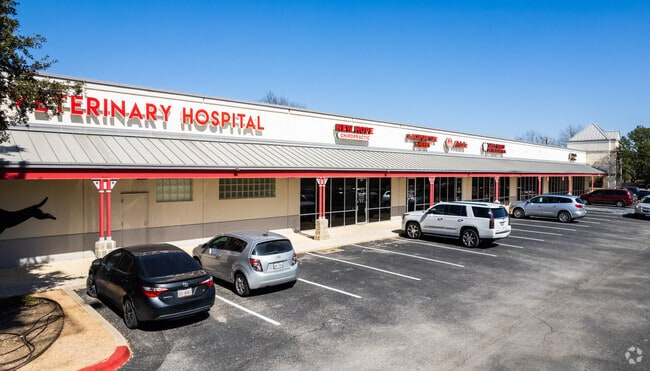
10350 Bandera Rd, San Antonio, TX 78250


NEARBY LISTINGS FOR SALE OR LEASE
Property Detail
10350 Bandera Rd
San Antonio-New Braunfels, TX
Country Sub
18292-001-0500
NCB 18292 BLK 1 LOT 50 TOWN & COUNTRY SUBD
Regionalshoppingcenterormallwithanchorstore
Bexar
X
Texas
48029C0220G
50
2024
5.40 AC
2025
Northwest
181811
San Antonio
50,381 SF
DEMOGRAPHICS near 10350 Bandera Rd
1 Mile
3 Mile
5 Mile
2024 Total Population
13,993
116,073
303,298
2029 Population
14,716
122,162
322,298
Pop Growth 2024-2029
+ 5.17%
+ 5.25%
+ 6.26%
Average Age
38
38
36
2024 Total Households
5,090
42,484
117,073
HH Growth 2024-2029
+ 5.17%
+ 5.41%
+ 6.55%
Median Household Inc
$97,529
$84,514
$72,156
Avg Household Size
2.70
2.70
2.50
2024 Avg HH Vehicles
2.00
2.00
2.00
Median Home Value
$257,628
$236,952
$232,670
Median Year Built
1995
1993
1995
Nearby Places
Map Layers
Map Styles
 Street
 Aerial
- Restaurants
- Banks
- Shops
- Fitness
- Groceries
PUBLIC TRANSPORTATION
AIRPORT
San Antonio International
DRIVE
WALK
Distance
San Antonio International
21 min
14.0 mi
SALE & LEASE HISTORY
LISTING DATE
SALE/LEASE

Sep 25, 2016
For Lease
Nearby Properties
Address
Land Use
TOTAL SIZE
Lot Size
Zoning
Address
Land Use
TOTAL SIZE
Lot Size
Zoning
352,231 SF
19.54 AC
Address
Land Use
TOTAL SIZE
Lot Size
Zoning
520,686 SF
53.63 AC
Address
Land Use
TOTAL SIZE
Lot Size
Zoning
413,362 SF
33.77 AC
Address
Land Use
TOTAL SIZE
Lot Size
Zoning
149,500 SF
9.36 AC
Address
Land Use
TOTAL SIZE
Lot Size
Zoning
305,600 SF
30.64 AC
Address
Land Use
TOTAL SIZE
Lot Size
Zoning
284,890 SF
18.83 AC
Address
Land Use
TOTAL SIZE
Lot Size
Zoning
307,272 SF
24.14 AC
Address
Land Use
TOTAL SIZE
Lot Size
Zoning
451,205 SF
33.82 AC
Address
Land Use
TOTAL SIZE
Lot Size
Zoning
237,499 SF
37.26 AC
Address
Land Use
TOTAL SIZE
Lot Size
Zoning
220,719 SF
25.86 AC
Address
Land Use
TOTAL SIZE
Lot Size
Zoning
308,010 SF
9.93 AC
Address
Land Use
TOTAL SIZE
Lot Size
Zoning
289,158 SF
31.78 AC
Address
Land Use
TOTAL SIZE
Lot Size
Zoning
217,267 SF
17.63 AC
Address
Land Use
TOTAL SIZE
Lot Size
Zoning
226,172 SF
5.80 AC
Address
Land Use
TOTAL SIZE
Lot Size
Zoning
229,430 SF
11.92 AC
Address
Land Use
TOTAL SIZE
Lot Size
Zoning
255,890 SF
14.23 AC
Address
Land Use
TOTAL SIZE
Lot Size
Zoning
230,048 SF
10.70 AC
Address
Land Use
TOTAL SIZE
Lot Size
Zoning
232,610 SF
13.16 AC
Address
Land Use
TOTAL SIZE
Lot Size
Zoning
458,331 SF
4.99 AC
Address
Land Use
TOTAL SIZE
Lot Size
Zoning
185,896 SF
26.12 AC
Address
Land Use
TOTAL SIZE
Lot Size
Zoning
1,080 SF
92.05 AC
Address
Land Use
TOTAL SIZE
Lot Size
Zoning
193,004 SF
16.43 AC
Address
Land Use
TOTAL SIZE
Lot Size
Zoning
228,364 SF
16.14 AC
Address
Land Use
TOTAL SIZE
Lot Size
Zoning
191,361 SF
15.02 AC
Address
Land Use
TOTAL SIZE
Lot Size
Zoning
246,381 SF
10.56 AC
Address
Land Use
TOTAL SIZE
Lot Size
Zoning
215,505 SF
11.21 AC
Address
Land Use
TOTAL SIZE
Lot Size
Zoning
194,289 SF
13.32 AC
Address
Land Use
TOTAL SIZE
Lot Size
Zoning
37,500 SF
3.58 AC
Address
Land Use
TOTAL SIZE
Lot Size
Zoning
248,352 SF
14.72 AC
Address
Land Use
TOTAL SIZE
Lot Size
Zoning
191,244 SF
10.90 AC
The World's #1 Commercial Real Estate Marketplace
Connect with us
© 2026 CoStar Group
The information above has been obtained from sources believed reliable. While we do not doubt its accuracy we have not verified it and make no guarantee, warranty or representation about it. It is your responsibility to independently confirm its accuracy and completeness. Any projections, opinions, assumptions, or estimates used are for example only and do not represent the current or future performance of the property. The value of this transaction to you depends on tax and other factors which should be evaluated by your tax, financial, and legal advisors. You and your advisors should conduct a careful, independent investigation of the property to determine to your satisfaction the suitability of the property for your needs.