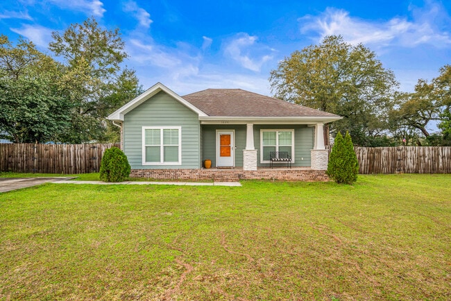
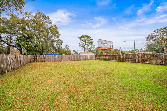
Property Record
10351 Chemstrand Rd, Pensacola, FL 32514

NEARBY LISTINGS FOR SALE OR LEASE
Property Detail
10351 Chemstrand Rd
Pensacola-Ferry Pass-Brent, FL
Escambia
08-1S-30-1003-029-013
Florida
Sfr
0.39 AC
X
Gonzalez/SW Santa Rosa
12033C0295G
Pensacola
1,185 SF
DEMOGRAPHICS near 10351 Chemstrand Rd
1 Mile
3 Mile
5 Mile
2024 Total Population
5,756
41,894
86,002
2029 Population
5,663
42,176
87,215
Pop Growth 2024-2029
(1.62%)
+ 0.67%
+ 1.41%
Average Age
41
40
41
2024 Total Households
2,377
17,336
35,080
HH Growth 2024-2029
(1.64%)
+ 0.67%
+ 1.36%
Median Household Inc
$62,992
$58,636
$56,893
Avg Household Size
2.40
2.30
2.30
2024 Avg HH Vehicles
2.00
2.00
2.00
Median Home Value
$202,770
$205,246
$208,739
Median Year Built
1986
1989
1988
Nearby Places
Map Layers
Map Styles
 Street
 Aerial
- Restaurants
- Banks
- Shops
- Fitness
- Groceries
PUBLIC TRANSPORTATION
AIRPORT
Pensacola International
DRIVE
WALK
Distance
Pensacola International
22 min
10.4 mi
Freight Ports
Port of Mobile
DRIVE
WALK
Distance
Port of Mobile
61 min
51.0 mi
SALE & LEASE HISTORY
LISTING DATE
SALE/LEASE

Mar 11, 2025
For Sale
Nearby Properties
Address
Land Use
TOTAL SIZE
Lot Size
Zoning
Address
Land Use
TOTAL SIZE
Lot Size
Zoning
1 AC
PUB
Address
Land Use
TOTAL SIZE
Lot Size
Zoning
368,851 SF
19.16 AC
HDMU,REC
Address
Land Use
TOTAL SIZE
Lot Size
Zoning
336,376 SF
19.68 AC
HDMU
Address
Land Use
TOTAL SIZE
Lot Size
Zoning
303,273 SF
9.95 AC
HC/LI
Address
Land Use
TOTAL SIZE
Lot Size
Zoning
264,273 SF
15.97 AC
HC/LI
Address
Land Use
TOTAL SIZE
Lot Size
Zoning
266,096 SF
13.46 AC
HDMU
Address
Land Use
TOTAL SIZE
Lot Size
Zoning
269,404 SF
23.85 AC
HDMU
Address
Land Use
TOTAL SIZE
Lot Size
Zoning
274,822 SF
12.67 AC
HC/LI
Address
Land Use
TOTAL SIZE
Lot Size
Zoning
238,060 SF
21.93 AC
HDMU
Address
Land Use
TOTAL SIZE
Lot Size
Zoning
262,823 SF
11.57 AC
HDMU
Address
Land Use
TOTAL SIZE
Lot Size
Zoning
275,458 SF
8.29 AC
HDMU
Address
Land Use
TOTAL SIZE
Lot Size
Zoning
171,283 SF
3.89 AC
HDR
Address
Land Use
TOTAL SIZE
Lot Size
Zoning
175,834 SF
14.17 AC
COM
Address
Land Use
TOTAL SIZE
Lot Size
Zoning
112,265 SF
25.22 AC
COM
Address
Land Use
TOTAL SIZE
Lot Size
Zoning
68,810 SF
182 AC
IND
Address
Land Use
TOTAL SIZE
Lot Size
Zoning
1,736,528 SF
1,780.92 AC
IND
Address
Land Use
TOTAL SIZE
Lot Size
Zoning
109,855 SF
16.70 AC
COM
Address
Land Use
TOTAL SIZE
Lot Size
Zoning
117,603 SF
4.59 AC
HDR
Address
Land Use
TOTAL SIZE
Lot Size
Zoning
317,266 SF
58.88 AC
LDMU,PUB
Address
Land Use
TOTAL SIZE
Lot Size
Zoning
106,507 SF
12.71 AC
HDMU
Address
Land Use
TOTAL SIZE
Lot Size
Zoning
219,541 SF
18.71 AC
HC/LI
Address
Land Use
TOTAL SIZE
Lot Size
Zoning
99,164 SF
9.67 AC
HDMU
Address
Land Use
TOTAL SIZE
Lot Size
Zoning
86,184 SF
4.03 AC
COM
Address
Land Use
TOTAL SIZE
Lot Size
Zoning
160,211 SF
34 AC
HDMU
Address
Land Use
TOTAL SIZE
Lot Size
Zoning
159,935 SF
1 AC
IND
Address
Land Use
TOTAL SIZE
Lot Size
Zoning
73,069 SF
3.34 AC
COM
Address
Land Use
TOTAL SIZE
Lot Size
Zoning
84,372 SF
3.94 AC
HC/LI,HDMU
Address
Land Use
TOTAL SIZE
Lot Size
Zoning
72,248 SF
6.07 AC
COM,HC/LI
Address
Land Use
TOTAL SIZE
Lot Size
Zoning
258,979 SF
100 AC
PUB
Address
Land Use
TOTAL SIZE
Lot Size
Zoning
169,842 SF
8.03 AC
HDMU
The World's #1 Commercial Real Estate Marketplace
Connect with us
© 2025 CoStar Group
The information above has been obtained from sources believed reliable. While we do not doubt its accuracy we have not verified it and make no guarantee, warranty or representation about it. It is your responsibility to independently confirm its accuracy and completeness. Any projections, opinions, assumptions, or estimates used are for example only and do not represent the current or future performance of the property. The value of this transaction to you depends on tax and other factors which should be evaluated by your tax, financial, and legal advisors. You and your advisors should conduct a careful, independent investigation of the property to determine to your satisfaction the suitability of the property for your needs.