Property Record
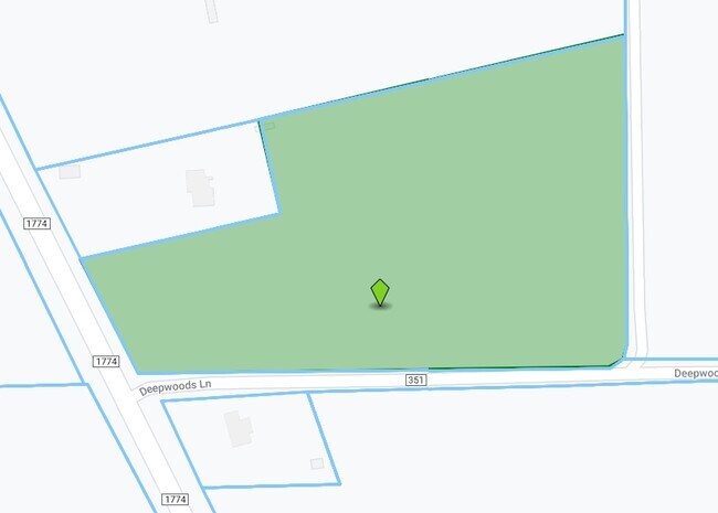
10355 County Road 351, Plantersville, TX 77363

Property Detail
10355 County Road 351
R13449
A0043 WM MONTGOMERY, TRACT 5-1, ACRES 11.663
Ranch
GRIMES
4
Texas
B and X Area of moderate flood hazard, usually the area between the limits of the 100-year and 500-year floods.
1-5
2024
11.66 AC
2025
Central Texas Area
180102
Other Market Areas
1,344 SF
NEARBY LISTINGS FOR SALE OR LEASE
DEMOGRAPHICS near 10355 County Road 351
1 mile
3 mile
5 mile
2024 Total Population
240
2,435
6,983
2029 Population
283
2,920
8,378
Pop Growth 2024-2029
+ 17.92%
+ 19.92%
+ 19.98%
Average Age
42
41
41
2024 Total Households
88
907
2,523
HH Growth 2024-2029
+ 19.32%
+ 20.07%
+ 20.02%
Median Household Inc
$61,000
$60,421
$66,890
Avg Household Size
2.80
2.70
2.70
2024 Avg HH Vehicles
2.00
2.00
2.00
Median Home Value
$182,352
$238,442
$263,725
Median Year Built
1995
2002
2002
Nearby Places
Map Layers
Map Styles
 Street
 Aerial
Transit
 Traffic
 Biking
Places
Listings with unknown addresses are not visible on the map
- Restaurants
- Banks
- Shops
- Fitness
- Groceries
SALE & LEASE HISTORY
LISTING DATE
SALE/LEASE

Aug 23, 2021
For Sale
Nearby Properties
Address
Land Use
TOTAL SIZE
Lot Size
Zoning
Address
Land Use
TOTAL SIZE
Lot Size
Zoning
29,495 SF
170.14 AC
Address
Land Use
TOTAL SIZE
Lot Size
Zoning
Address
Land Use
TOTAL SIZE
Lot Size
Zoning
98.72 AC
4
Address
Land Use
TOTAL SIZE
Lot Size
Zoning
Address
Land Use
TOTAL SIZE
Lot Size
Zoning
41,777 SF
25.49 AC
Address
Land Use
TOTAL SIZE
Lot Size
Zoning
100.76 AC
Address
Land Use
TOTAL SIZE
Lot Size
Zoning
3,352 SF
0.60 AC
Address
Land Use
TOTAL SIZE
Lot Size
Zoning
5,003 SF
28.13 AC
4
Address
Land Use
TOTAL SIZE
Lot Size
Zoning
10,569 SF
10 AC
4
Address
Land Use
TOTAL SIZE
Lot Size
Zoning
2,172 SF
76 AC
4
Address
Land Use
TOTAL SIZE
Lot Size
Zoning
18,574 SF
15 AC
Address
Land Use
TOTAL SIZE
Lot Size
Zoning
960 SF
46.25 AC
4
Address
Land Use
TOTAL SIZE
Lot Size
Zoning
20,440 SF
34.25 AC
4C
Address
Land Use
TOTAL SIZE
Lot Size
Zoning
Address
Land Use
TOTAL SIZE
Lot Size
Zoning
55,220 SF
6.27 AC
2
Address
Land Use
TOTAL SIZE
Lot Size
Zoning
11,834 SF
11.33 AC
Address
Land Use
TOTAL SIZE
Lot Size
Zoning
29.47 AC
Address
Land Use
TOTAL SIZE
Lot Size
Zoning
90.52 AC
Address
Land Use
TOTAL SIZE
Lot Size
Zoning
Address
Land Use
TOTAL SIZE
Lot Size
Zoning
196 SF
10.52 AC
4
Address
Land Use
TOTAL SIZE
Lot Size
Zoning
3,434 SF
5.92 AC
4
Address
Land Use
TOTAL SIZE
Lot Size
Zoning
10,754 SF
1.64 AC
4
Address
Land Use
TOTAL SIZE
Lot Size
Zoning
11,411 SF
29 AC
4
Address
Land Use
TOTAL SIZE
Lot Size
Zoning
12,798 SF
14.38 AC
4
Address
Land Use
TOTAL SIZE
Lot Size
Zoning
8,422 SF
18.27 AC
Address
Land Use
TOTAL SIZE
Lot Size
Zoning
9,379 SF
9 AC
4
Address
Land Use
TOTAL SIZE
Lot Size
Zoning
10,533 SF
205.88 AC
4
Address
Land Use
TOTAL SIZE
Lot Size
Zoning
7,694 SF
24.98 AC
The World's #1 Commercial Real Estate Marketplace
Connect with us
© 2026 CoStar Group
The information above has been obtained from sources believed reliable. While we do not doubt its accuracy we have not verified it and make no guarantee, warranty or representation about it. It is your responsibility to independently confirm its accuracy and completeness. Any projections, opinions, assumptions, or estimates used are for example only and do not represent the current or future performance of the property. The value of this transaction to you depends on tax and other factors which should be evaluated by your tax, financial, and legal advisors. You and your advisors should conduct a careful, independent investigation of the property to determine to your satisfaction the suitability of the property for your needs.