Property Record
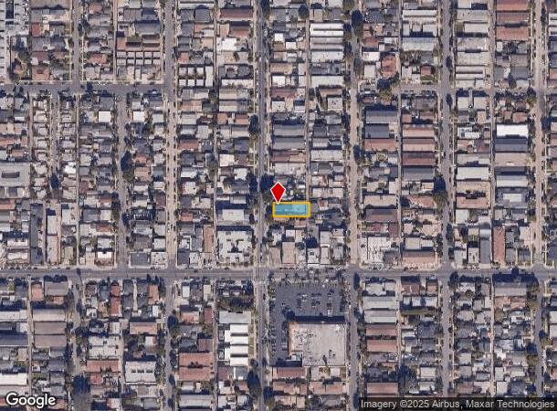
1036 Cherry Ave, Long Beach, CA 90813

This Property Is For Sale
NEARBY LISTINGS FOR SALE OR LEASE
Property Detail
1036 Cherry Ave
Los Angeles-Long Beach-Glendale, CA
Ticknor Tract
7262-008-019
T1CKNOR TRACT LOT 13
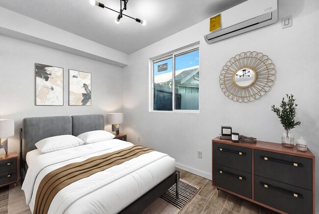
Triplex
Los Angeles
X
California
06037C1968G
13
2024
0.13 AC
2025
Eastside Long Beach
576901
Los Angeles
3,979 SF
DEMOGRAPHICS near 1036 Cherry Ave
1 mile
3 mile
5 mile
2024 Total Population
78,703
258,242
424,189
2029 Population
76,211
250,878
411,308
Pop Growth 2024-2029
(3.17%)
(2.85%)
(3.04%)
Average Age
36
38
40
2024 Total Households
29,517
102,304
163,195
HH Growth 2024-2029
(3.39%)
(2.93%)
(3.09%)
Median Household Inc
$55,851
$67,815
$76,138
Avg Household Size
2.50
2.40
2.50
2024 Avg HH Vehicles
1.00
2.00
2.00
Median Home Value
$659,106
$759,595
$749,963
Median Year Built
1959
1961
1958
Nearby Places
Map Layers
Map Styles
 Street
 Aerial
Transit
 Traffic
 Biking
Places
Listings with unknown addresses are not visible on the map
- Restaurants
- Banks
- Shops
- Fitness
- Groceries
PUBLIC TRANSPORTATION
AIRPORT
Long Beach (Daugherty Field)
Drive
Walk
Distance
Long Beach (Daugherty Field)
8 min
3.3 mi
John Wayne/Orange County
Drive
Walk
Distance
John Wayne/Orange County
28 min
20.2 mi
Los Angeles International
Drive
Walk
Distance
Los Angeles International
32 min
22.3 mi
Freight Ports
Port of Long Beach
Drive
Walk
Distance
Port of Long Beach
5 min
1.7 mi
Nearby Properties
Address
Land Use
TOTAL SIZE
Lot Size
Zoning
Address
Land Use
TOTAL SIZE
Lot Size
Zoning
502,333 SF
21.89 AC
LBI
Address
Land Use
TOTAL SIZE
Lot Size
Zoning
402,342 SF
LBPD30
Address
Land Use
TOTAL SIZE
Lot Size
Zoning
845,760 SF
4.01 AC
LBPD6
Address
Land Use
TOTAL SIZE
Lot Size
Zoning
708,409 SF
3.15 AC
LBPD
Address
Land Use
TOTAL SIZE
Lot Size
Zoning
266,158 SF
1 AC
LBPD30
Address
Land Use
TOTAL SIZE
Lot Size
Zoning
954,581 SF
50.09 AC
LBPD 19
Address
Land Use
TOTAL SIZE
Lot Size
Zoning
617,114 SF
3.53 AC
LBPD
Address
Land Use
TOTAL SIZE
Lot Size
Zoning
918,344 SF
4.14 AC
LBPD30
Address
Land Use
TOTAL SIZE
Lot Size
Zoning
260,804 SF
1.71 AC
LBPD30
Address
Land Use
TOTAL SIZE
Lot Size
Zoning
982,195 SF
1.77 AC
LBPD30
Address
Land Use
TOTAL SIZE
Lot Size
Zoning
182,749 SF
LBPD30
Address
Land Use
TOTAL SIZE
Lot Size
Zoning
393,161 SF
1.11 AC
LBPD30
Address
Land Use
TOTAL SIZE
Lot Size
Zoning
372,367 SF
2.40 AC
LBPD30
Address
Land Use
TOTAL SIZE
Lot Size
Zoning
174,688 SF
0.88 AC
LBI*
Address
Land Use
TOTAL SIZE
Lot Size
Zoning
140,236 SF
9.21 AC
LBR4N
Address
Land Use
TOTAL SIZE
Lot Size
Zoning
199,137 SF
6.39 AC
LBR4R
Address
Land Use
TOTAL SIZE
Lot Size
Zoning
311,796 SF
1.90 AC
LBPD30
Address
Land Use
TOTAL SIZE
Lot Size
Zoning
133,668 SF
0.76 AC
LBCH
Address
Land Use
TOTAL SIZE
Lot Size
Zoning
113,919 SF
0.72 AC
LBPD30
Address
Land Use
TOTAL SIZE
Lot Size
Zoning
9,629 SF
2.37 AC
LBPD30
Address
Land Use
TOTAL SIZE
Lot Size
Zoning
279,022 SF
1.80 AC
LBCB
Address
Land Use
TOTAL SIZE
Lot Size
Zoning
120,843 SF
9 AC
LBCCA
Address
Land Use
TOTAL SIZE
Lot Size
Zoning
603,213 SF
4.70 AC
LBI
Address
Land Use
TOTAL SIZE
Lot Size
Zoning
454,860 SF
0.64 AC
LBIM
Address
Land Use
TOTAL SIZE
Lot Size
Zoning
152,584 SF
0.86 AC
LBPD30
Address
Land Use
TOTAL SIZE
Lot Size
Zoning
117,457 SF
0.75 AC
LBPD30
Address
Land Use
TOTAL SIZE
Lot Size
Zoning
84,054 SF
0.34 AC
LBPD
Address
Land Use
TOTAL SIZE
Lot Size
Zoning
74,452 SF
1.05 AC
LBPD30
Address
Land Use
TOTAL SIZE
Lot Size
Zoning
237,124 SF
5.50 AC
LBCHW
The World's #1 Commercial Real Estate Marketplace
Connect with us
© 2026 CoStar Group
The information above has been obtained from sources believed reliable. While we do not doubt its accuracy we have not verified it and make no guarantee, warranty or representation about it. It is your responsibility to independently confirm its accuracy and completeness. Any projections, opinions, assumptions, or estimates used are for example only and do not represent the current or future performance of the property. The value of this transaction to you depends on tax and other factors which should be evaluated by your tax, financial, and legal advisors. You and your advisors should conduct a careful, independent investigation of the property to determine to your satisfaction the suitability of the property for your needs.