Property Record
1037 Olive St, Ramona, CA 92065
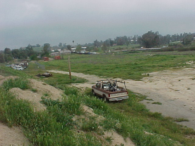


Property Detail
1037 Olive St
281-065-19
BLK 275 (EX SLY 125 FT OF ELY 100 FT) TR 000644
Shipyard
San Diego
M52
California
B and X Area of moderate flood hazard, usually the area between the limits of the 100-year and 500-year floods.
4.49 AC
2024
Outlying SD County N
2025
San Diego
020806
San Diego-Chula Vista-Carlsbad, CA
74,828 SF
NEARBY LISTINGS FOR SALE OR LEASE
DEMOGRAPHICS near 1037 Olive St
1 mile
3 mile
5 mile
2025 Total Population
7,912
18,484
29,032
2030 Population
7,881
18,404
28,870
Pop Growth 2025-2030
(0.39%)
(0.43%)
(0.56%)
Average Age
37
40
41
2025 Total Households
2,607
6,088
9,761
HH Growth 2025-2030
(0.54%)
(0.56%)
(0.71%)
Median Household Inc
$85,656
$104,193
$118,586
Avg Household Size
3.00
2.90
2.90
2025 Avg HH Vehicles
2.00
3.00
3.00
Median Home Value
$734,140
$728,043
$760,127
Median Year Built
1977
1979
1983
Nearby Places
Map Layers
Map Styles
 Street
 Aerial
Layers
 Traffic
 Biking
Places
Listings with unknown addresses are not visible on the map
- Restaurants
- Banks
- Shops
- Fitness
- Groceries
PUBLIC TRANSPORTATION
AIRPORT
San Diego International
Drive
Walk
Distance
San Diego International
52 min
36.8 mi
Freight Ports
Port of San Diego
Drive
Walk
Distance
Port of San Diego
55 min
39.0 mi
Nearby Properties
Address
Land Use
TOTAL SIZE
Lot Size
Zoning
Address
Land Use
TOTAL SIZE
Lot Size
Zoning
9.63 AC
RMV4
Address
Land Use
TOTAL SIZE
Lot Size
Zoning
4.79 AC
RMV4
Address
Land Use
TOTAL SIZE
Lot Size
Zoning
24.83 AC
RMH6
Address
Land Use
TOTAL SIZE
Lot Size
Zoning
69,060 SF
2.79 AC
RMV4
Address
Land Use
TOTAL SIZE
Lot Size
Zoning
65,361 SF
4.78 AC
RV
Address
Land Use
TOTAL SIZE
Lot Size
Zoning
56,184 SF
2.40 AC
RMV4
Address
Land Use
TOTAL SIZE
Lot Size
Zoning
51,250 SF
3.15 AC
RMV4
Address
Land Use
TOTAL SIZE
Lot Size
Zoning
9.91 AC
RMV5
Address
Land Use
TOTAL SIZE
Lot Size
Zoning
35,248 SF
1.41 AC
RMV4
Address
Land Use
TOTAL SIZE
Lot Size
Zoning
35,878 SF
1.85 AC
RMV5
Address
Land Use
TOTAL SIZE
Lot Size
Zoning
10.63 AC
M54
Address
Land Use
TOTAL SIZE
Lot Size
Zoning
32,160 SF
3.19 AC
RMV5
Address
Land Use
TOTAL SIZE
Lot Size
Zoning
Address
Land Use
TOTAL SIZE
Lot Size
Zoning
46,996 SF
3.66 AC
RMV5
Address
Land Use
TOTAL SIZE
Lot Size
Zoning
36,248 SF
5.28 AC
RMV2
Address
Land Use
TOTAL SIZE
Lot Size
Zoning
46,450 SF
2.87 AC
RMV5
Address
Land Use
TOTAL SIZE
Lot Size
Zoning
35,103 SF
3.41 AC
RU
Address
Land Use
TOTAL SIZE
Lot Size
Zoning
380 AC
S88
Address
Land Use
TOTAL SIZE
Lot Size
Zoning
22,224 SF
2.30 AC
RMV5
Address
Land Use
TOTAL SIZE
Lot Size
Zoning
18,800 SF
3.32 AC
RMV5
Address
Land Use
TOTAL SIZE
Lot Size
Zoning
4.54 AC
RMV5
Address
Land Use
TOTAL SIZE
Lot Size
Zoning
56,070 SF
3.60 AC
M54
Address
Land Use
TOTAL SIZE
Lot Size
Zoning
36,226 SF
1.51 AC
RMV5
Address
Land Use
TOTAL SIZE
Lot Size
Zoning
1.69 AC
RMV5
Address
Land Use
TOTAL SIZE
Lot Size
Zoning
19,857 SF
2.50 AC
RMV5
Address
Land Use
TOTAL SIZE
Lot Size
Zoning
81,935 SF
2.93 AC
RMV4
Address
Land Use
TOTAL SIZE
Lot Size
Zoning
0.87 AC
RMV5
Address
Land Use
TOTAL SIZE
Lot Size
Zoning
22,880 SF
0.97 AC
RMV4
Address
Land Use
TOTAL SIZE
Lot Size
Zoning
16,767 SF
8.25 AC
A70
The World's #1 Commercial Real Estate Marketplace
Connect with us
© 2026 CoStar Group
The information above has been obtained from sources believed reliable. While we do not doubt its accuracy we have not verified it and make no guarantee, warranty or representation about it. It is your responsibility to independently confirm its accuracy and completeness. Any projections, opinions, assumptions, or estimates used are for example only and do not represent the current or future performance of the property. The value of this transaction to you depends on tax and other factors which should be evaluated by your tax, financial, and legal advisors. You and your advisors should conduct a careful, independent investigation of the property to determine to your satisfaction the suitability of the property for your needs.