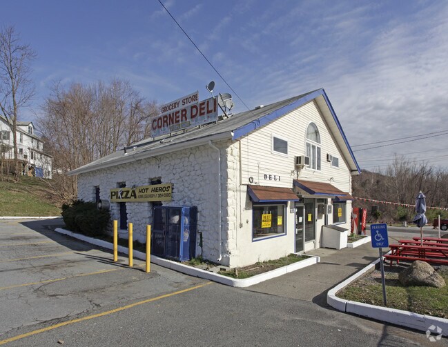
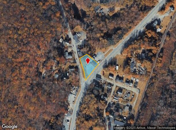
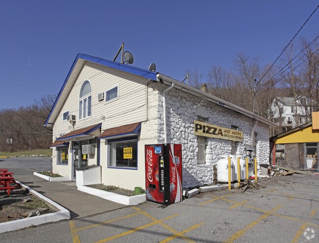
Property Record
1037 Route 17, Southfields, NY 10975
NEARBY LISTINGS FOR SALE OR LEASE
-
-
View all Southfields listings for lease on LoopNet.com
Property Detail
1037 Route 17
335089-005-000-0001-019.000-0000
Orange
Commercialnec
New York
X
19.00
36071C0606E
0.57 AC
2024
Monroe
2024
Northern New Jersey
014900
New York-Jersey City-White Plains, NY-NJ
DEMOGRAPHICS near 1037 Route 17
1 Mile
3 Mile
5 Mile
2024 Total Population
406
1,886
17,706
2029 Population
411
1,932
18,059
Pop Growth 2024-2029
+ 1.23%
+ 2.44%
+ 1.99%
Average Age
43
43
41
2024 Total Households
139
668
6,115
HH Growth 2024-2029
+ 0.72%
+ 2.54%
+ 2.14%
Median Household Inc
$99,999
$123,456
$127,858
Avg Household Size
2.60
2.60
2.80
2024 Avg HH Vehicles
2.00
2.00
2.00
Median Home Value
$402,778
$464,285
$411,243
Median Year Built
1960
1959
1978
Nearby Places
- Restaurants
- Banks
- Shops
- Fitness
- Groceries
PUBLIC TRANSPORTATION
COMMUTER RAIL
Tuxedo (Bergen County/Port Jervis Line - NJ Transit Commuter Rail (NJ Transit), Main/Port Jervis Line - NJ Transit Commuter Rail (NJ Transit))
DRIVE
WALK
Distance
Tuxedo (Bergen County/Port Jervis Line - NJ Transit Commuter Rail (NJ Transit), Main/Port Jervis Line - NJ Transit Commuter Rail (NJ Transit))
7 min
3.8 mi
Harriman (Bergen County/Port Jervis Line - NJ Transit Commuter Rail (NJ Transit), Main/Port Jervis Line - NJ Transit Commuter Rail (NJ Transit))
DRIVE
WALK
Distance
Harriman (Bergen County/Port Jervis Line - NJ Transit Commuter Rail (NJ Transit), Main/Port Jervis Line - NJ Transit Commuter Rail (NJ Transit))
7 min
4.2 mi
AIRPORT
New York Stewart International
DRIVE
WALK
Distance
New York Stewart International
39 min
26.8 mi
Westchester County
DRIVE
WALK
Distance
Westchester County
60 min
40.8 mi
Freight Ports
Port Newark Container Terminal
DRIVE
WALK
Distance
Port Newark Container Terminal
70 min
46.2 mi
SALE & LEASE HISTORY
LISTING DATE
SALE/LEASE

Sep 25, 2016
For Lease
Nearby Properties
Address
Land Use
TOTAL SIZE
Lot Size
Zoning
Address
Land Use
TOTAL SIZE
Lot Size
Zoning
3,734.70 AC
Address
Land Use
TOTAL SIZE
Lot Size
Zoning
2,210.70 AC
Address
Land Use
TOTAL SIZE
Lot Size
Zoning
1,490.50 AC
Address
Land Use
TOTAL SIZE
Lot Size
Zoning
1,248.30 AC
Address
Land Use
TOTAL SIZE
Lot Size
Zoning
3.80 AC
Address
Land Use
TOTAL SIZE
Lot Size
Zoning
Address
Land Use
TOTAL SIZE
Lot Size
Zoning
10,067 SF
609.30 AC
Address
Land Use
TOTAL SIZE
Lot Size
Zoning
1,869 SF
268.90 AC
205
Address
Land Use
TOTAL SIZE
Lot Size
Zoning
12.60 AC
Address
Land Use
TOTAL SIZE
Lot Size
Zoning
389.03 AC
Address
Land Use
TOTAL SIZE
Lot Size
Zoning
3.23 AC
911
Address
Land Use
TOTAL SIZE
Lot Size
Zoning
299.78 AC
Address
Land Use
TOTAL SIZE
Lot Size
Zoning
50.50 AC
Address
Land Use
TOTAL SIZE
Lot Size
Zoning
2,655 SF
12.10 AC
R3A
Address
Land Use
TOTAL SIZE
Lot Size
Zoning
247.26 AC
Address
Land Use
TOTAL SIZE
Lot Size
Zoning
960 SF
74.80 AC
R3A
Address
Land Use
TOTAL SIZE
Lot Size
Zoning
6.20 AC
Address
Land Use
TOTAL SIZE
Lot Size
Zoning
30,200 SF
62.44 AC
RR-3AC
Address
Land Use
TOTAL SIZE
Lot Size
Zoning
6.20 AC
911
Address
Land Use
TOTAL SIZE
Lot Size
Zoning
390.15 AC
RR-1.0AC
Address
Land Use
TOTAL SIZE
Lot Size
Zoning
41.20 AC
Address
Land Use
TOTAL SIZE
Lot Size
Zoning
2,056 SF
0.01 AC
Address
Land Use
TOTAL SIZE
Lot Size
Zoning
4.40 AC
911
Address
Land Use
TOTAL SIZE
Lot Size
Zoning
41.30 AC
Address
Land Use
TOTAL SIZE
Lot Size
Zoning
Address
Land Use
TOTAL SIZE
Lot Size
Zoning
7,663 SF
27 AC
Address
Land Use
TOTAL SIZE
Lot Size
Zoning
1.80 AC
Address
Land Use
TOTAL SIZE
Lot Size
Zoning
1,341 SF
3.50 AC
205
Address
Land Use
TOTAL SIZE
Lot Size
Zoning
42.90 AC
Address
Land Use
TOTAL SIZE
Lot Size
Zoning
40.20 AC
The World's #1 Commercial Real Estate Marketplace
Connect with us
© 2025 CoStar Group
The information above has been obtained from sources believed reliable. While we do not doubt its accuracy we have not verified it and make no guarantee, warranty or representation about it. It is your responsibility to independently confirm its accuracy and completeness. Any projections, opinions, assumptions, or estimates used are for example only and do not represent the current or future performance of the property. The value of this transaction to you depends on tax and other factors which should be evaluated by your tax, financial, and legal advisors. You and your advisors should conduct a careful, independent investigation of the property to determine to your satisfaction the suitability of the property for your needs.