Property Record
1037 N State St, Pottstown, PA 19464

Current Lease Availabilities
NEARBY LISTINGS FOR SALE OR LEASE
Property Detail
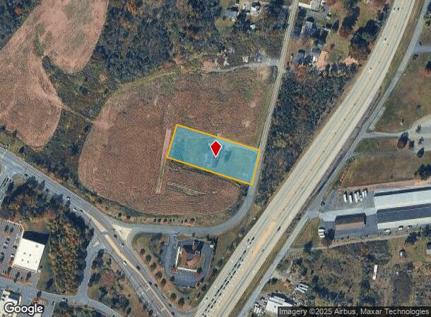
1037 N State St
Philadelphia-Camden-Wilmington, PA-NJ-DE-MD
Lands/Helen Gresko
60-00-02920-602
Montgomery
Sfr
Pennsylvania
X
1.14 AC
42091C0069G
West Montgomery County
1,712 SF
Philadelphia
DEMOGRAPHICS near 1037 N State St
1 Mile
3 Mile
5 Mile
2024 Total Population
7,089
47,563
96,693
2029 Population
7,201
48,356
98,255
Pop Growth 2024-2029
+ 1.58%
+ 1.67%
+ 1.62%
Average Age
41
40
41
2024 Total Households
2,872
18,853
37,141
HH Growth 2024-2029
+ 1.53%
+ 1.69%
+ 1.63%
Median Household Inc
$64,007
$67,050
$80,246
Avg Household Size
2.40
2.40
2.50
2024 Avg HH Vehicles
2.00
2.00
2.00
Median Home Value
$162,663
$191,766
$252,092
Median Year Built
1959
1958
1971
Nearby Places
Map Layers
Map Styles
 Street
 Aerial
- Restaurants
- Banks
- Shops
- Fitness
- Groceries
PUBLIC TRANSPORTATION
AIRPORT
Lehigh Valley International
DRIVE
WALK
Distance
Lehigh Valley International
58 min
32.9 mi
Freight Ports
Port of Philadelphia
DRIVE
WALK
Distance
Port of Philadelphia
71 min
48.7 mi
Nearby Properties
Address
Land Use
TOTAL SIZE
Lot Size
Zoning
Address
Land Use
TOTAL SIZE
Lot Size
Zoning
707,965 SF
80.33 AC
RMHD
Address
Land Use
TOTAL SIZE
Lot Size
Zoning
406,166 SF
65.54 AC
C
Address
Land Use
TOTAL SIZE
Lot Size
Zoning
327,827 SF
21 AC
RMD
Address
Land Use
TOTAL SIZE
Lot Size
Zoning
309,443 SF
20.56 AC
GE
Address
Land Use
TOTAL SIZE
Lot Size
Zoning
172,766 SF
43.12 AC
R3
Address
Land Use
TOTAL SIZE
Lot Size
Zoning
181,947 SF
8.19 AC
RMD
Address
Land Use
TOTAL SIZE
Lot Size
Zoning
191,272 SF
48.22 AC
R2
Address
Land Use
TOTAL SIZE
Lot Size
Zoning
123,946 SF
39.60 AC
R2
Address
Land Use
TOTAL SIZE
Lot Size
Zoning
135,368 SF
5.31 AC
DG
Address
Land Use
TOTAL SIZE
Lot Size
Zoning
150,711 SF
21.72 AC
HB
Address
Land Use
TOTAL SIZE
Lot Size
Zoning
216,693 SF
38 AC
I1
Address
Land Use
TOTAL SIZE
Lot Size
Zoning
176,741 SF
17.40 AC
HB
Address
Land Use
TOTAL SIZE
Lot Size
Zoning
589,859 SF
53.31 AC
C2
Address
Land Use
TOTAL SIZE
Lot Size
Zoning
138,563 SF
12.98 AC
C
Address
Land Use
TOTAL SIZE
Lot Size
Zoning
245,651 SF
20.79 AC
R2
Address
Land Use
TOTAL SIZE
Lot Size
Zoning
165,168 SF
11.10 AC
C2
Address
Land Use
TOTAL SIZE
Lot Size
Zoning
175,151 SF
14.74 AC
RMHD
Address
Land Use
TOTAL SIZE
Lot Size
Zoning
166,912 SF
11.10 AC
R4
Address
Land Use
TOTAL SIZE
Lot Size
Zoning
104,075 SF
14 AC
SC
Address
Land Use
TOTAL SIZE
Lot Size
Zoning
70,319 SF
7.31 AC
CO
Address
Land Use
TOTAL SIZE
Lot Size
Zoning
77,944 SF
0.47 AC
D
Address
Land Use
TOTAL SIZE
Lot Size
Zoning
61,031 SF
14.54 AC
R3
Address
Land Use
TOTAL SIZE
Lot Size
Zoning
45,138 SF
9.13 AC
C
Address
Land Use
TOTAL SIZE
Lot Size
Zoning
114,240 SF
18.57 AC
IN
Address
Land Use
TOTAL SIZE
Lot Size
Zoning
56,774 SF
1.58 AC
C
Address
Land Use
TOTAL SIZE
Lot Size
Zoning
227,008 SF
0.79 AC
TTN
Address
Land Use
TOTAL SIZE
Lot Size
Zoning
78,770 SF
2.20 AC
RHD
Address
Land Use
TOTAL SIZE
Lot Size
Zoning
65,910 SF
4.55 AC
RHD
Address
Land Use
TOTAL SIZE
Lot Size
Zoning
522,093 SF
23.50 AC
HM
Address
Land Use
TOTAL SIZE
Lot Size
Zoning
51,586 SF
5.77 AC
RLD
The World's #1 Commercial Real Estate Marketplace
Connect with us
© 2026 CoStar Group
The information above has been obtained from sources believed reliable. While we do not doubt its accuracy we have not verified it and make no guarantee, warranty or representation about it. It is your responsibility to independently confirm its accuracy and completeness. Any projections, opinions, assumptions, or estimates used are for example only and do not represent the current or future performance of the property. The value of this transaction to you depends on tax and other factors which should be evaluated by your tax, financial, and legal advisors. You and your advisors should conduct a careful, independent investigation of the property to determine to your satisfaction the suitability of the property for your needs.