Property Record
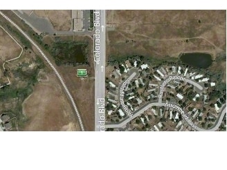
10375 Colorado Blvd, Denver, CO 80229

Property Detail
10375 Colorado Blvd
Denver-Aurora-Centennial, CO
SUBDIVISION THORNTON CROSSROADS AT 104TH STATION: LOT 1
1719-13-1-13-012
ADAMS
Stateproperty
Colorado
C and X Area of minimal flood hazard, usually depicted on FIRMs as above the 500-year flood level.
1
0
4.01 AC
2025
North Denver
009101
Denver
282,144 SF
NEARBY LISTINGS FOR SALE OR LEASE
DEMOGRAPHICS near 10375 Colorado Blvd
1 mile
3 mile
5 mile
2025 Total Population
20,174
113,655
282,011
2030 Population
20,929
117,342
291,432
Pop Growth 2025-2030
+ 3.74%
+ 3.24%
+ 3.34%
Average Age
36
37
37
2025 Total Households
6,966
39,850
98,833
HH Growth 2025-2030
+ 4.12%
+ 3.55%
+ 3.64%
Median Household Inc
$92,896
$93,041
$93,209
Avg Household Size
2.80
2.80
2.80
2025 Avg HH Vehicles
2.00
2.00
2.00
Median Home Value
$447,764
$455,214
$465,601
Median Year Built
1995
1986
1989
Nearby Places
Map Layers
Map Styles
 Street
 Aerial
Layers
 Traffic
 Biking
Places
Listings with unknown addresses are not visible on the map
- Restaurants
- Banks
- Shops
- Fitness
- Groceries
PUBLIC TRANSPORTATION
COMMUTER RAIL
Thornton Crossroads - 104Th Station Track 1 (Union Station to Eastlake & 124th Station - Regional Transportation District)
Drive
Walk
Distance
Thornton Crossroads - 104Th Station Track 1 (Union Station to Eastlake & 124th Station - Regional Transportation District)
0 min
3 min
0.1 mi
Northglenn - 112Th Station Track 1 (Union Station to Eastlake & 124th Station - Regional Transportation District)
Drive
Walk
Distance
Northglenn - 112Th Station Track 1 (Union Station to Eastlake & 124th Station - Regional Transportation District)
5 min
2.5 mi
AIRPORT
Denver International
Drive
Walk
Distance
Denver International
30 min
19.3 mi
Freight Ports
Tulsa Port Of Catoosa
Drive
Walk
Distance
Tulsa Port Of Catoosa
735 min
713.2 mi
Nearby Properties
Address
Land Use
TOTAL SIZE
Lot Size
Zoning
Address
Land Use
TOTAL SIZE
Lot Size
Zoning
332,908 SF
10.49 AC
Address
Land Use
TOTAL SIZE
Lot Size
Zoning
295,558 SF
13.41 AC
Address
Land Use
TOTAL SIZE
Lot Size
Zoning
106,680 SF
17.39 AC
Address
Land Use
TOTAL SIZE
Lot Size
Zoning
154,914 SF
11.39 AC
Address
Land Use
TOTAL SIZE
Lot Size
Zoning
261,540 SF
19.23 AC
Address
Land Use
TOTAL SIZE
Lot Size
Zoning
170,210 SF
9 AC
Address
Land Use
TOTAL SIZE
Lot Size
Zoning
8,556 SF
382.73 AC
A3
Address
Land Use
TOTAL SIZE
Lot Size
Zoning
549,866 SF
33.82 AC
Address
Land Use
TOTAL SIZE
Lot Size
Zoning
91,326 SF
5.09 AC
Address
Land Use
TOTAL SIZE
Lot Size
Zoning
85,738 SF
4.43 AC
Address
Land Use
TOTAL SIZE
Lot Size
Zoning
309,126 SF
5.75 AC
Address
Land Use
TOTAL SIZE
Lot Size
Zoning
512,780 SF
25.11 AC
Address
Land Use
TOTAL SIZE
Lot Size
Zoning
141,124 SF
22.35 AC
Address
Land Use
TOTAL SIZE
Lot Size
Zoning
13,224 SF
9.72 AC
Address
Land Use
TOTAL SIZE
Lot Size
Zoning
10,883 SF
4.54 AC
Address
Land Use
TOTAL SIZE
Lot Size
Zoning
616,346 SF
30.04 AC
Address
Land Use
TOTAL SIZE
Lot Size
Zoning
317,619 SF
32.28 AC
Address
Land Use
TOTAL SIZE
Lot Size
Zoning
428,341 SF
22.35 AC
Address
Land Use
TOTAL SIZE
Lot Size
Zoning
153,301 SF
26.75 AC
Address
Land Use
TOTAL SIZE
Lot Size
Zoning
547,908 SF
12.24 AC
Address
Land Use
TOTAL SIZE
Lot Size
Zoning
11,200 SF
36.45 AC
A1
Address
Land Use
TOTAL SIZE
Lot Size
Zoning
445,016 SF
23.77 AC
Address
Land Use
TOTAL SIZE
Lot Size
Zoning
250,523 SF
70.73 AC
I1
Address
Land Use
TOTAL SIZE
Lot Size
Zoning
411,708 SF
22.39 AC
Address
Land Use
TOTAL SIZE
Lot Size
Zoning
172,816 SF
59.89 AC
Address
Land Use
TOTAL SIZE
Lot Size
Zoning
459,283 SF
16.88 AC
Address
Land Use
TOTAL SIZE
Lot Size
Zoning
258,279 SF
70.11 AC
I2
Address
Land Use
TOTAL SIZE
Lot Size
Zoning
273,415 SF
35.24 AC
Address
Land Use
TOTAL SIZE
Lot Size
Zoning
311,274 SF
18.75 AC
The World's #1 Commercial Real Estate Marketplace
Connect with us
© 2026 CoStar Group
The information above has been obtained from sources believed reliable. While we do not doubt its accuracy we have not verified it and make no guarantee, warranty or representation about it. It is your responsibility to independently confirm its accuracy and completeness. Any projections, opinions, assumptions, or estimates used are for example only and do not represent the current or future performance of the property. The value of this transaction to you depends on tax and other factors which should be evaluated by your tax, financial, and legal advisors. You and your advisors should conduct a careful, independent investigation of the property to determine to your satisfaction the suitability of the property for your needs.