Property Record
1039 Basse Rd, San Antonio, TX 78212

Property Detail
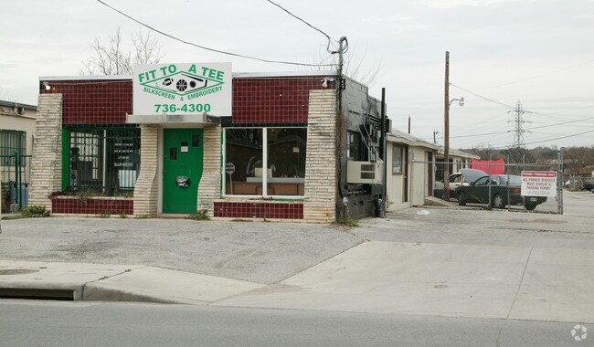
1039 Basse Rd
San Antonio-New Braunfels, TX
NCB 10115 BLK LOT 41 BASSE BUSINESS PK SUBD
10115-000-0410
BEXAR
Autorepair
Texas
B and X Area of moderate flood hazard, usually the area between the limits of the 100-year and 500-year floods.
41
2025
2.82 AC
2025
North Central
191004
San Antonio
32,939 SF
NEARBY LISTINGS FOR SALE OR LEASE
DEMOGRAPHICS near 1039 Basse Rd
1 mile
3 mile
5 mile
2025 Total Population
14,836
130,989
347,055
2030 Population
15,484
137,644
365,835
Pop Growth 2025-2030
+ 4.37%
+ 5.08%
+ 5.41%
Average Age
40
40
39
2025 Total Households
5,552
53,048
141,682
HH Growth 2025-2030
+ 4.54%
+ 5.40%
+ 5.74%
Median Household Inc
$48,344
$60,771
$55,596
Avg Household Size
2.60
2.30
2.30
2025 Avg HH Vehicles
2.00
2.00
2.00
Median Home Value
$192,614
$288,113
$278,771
Median Year Built
1957
1959
1968
Nearby Places
Map Layers
Map Styles
 Street
 Aerial
Layers
 Traffic
 Biking
Places
Listings with unknown addresses are not visible on the map
- Restaurants
- Banks
- Shops
- Fitness
- Groceries
PUBLIC TRANSPORTATION
COMMUTER RAIL
San Antonio Amtrak Station (Sunset Limited - Amtrak, Texas Eagle - Amtrak)
Drive
Walk
Distance
San Antonio Amtrak Station (Sunset Limited - Amtrak, Texas Eagle - Amtrak)
10 min
6.7 mi
AIRPORT
San Antonio International
Drive
Walk
Distance
San Antonio International
8 min
4.1 mi
Freight Ports
Calhoun Port
Drive
Walk
Distance
Calhoun Port
188 min
153.2 mi
Nearby Properties
Address
Land Use
TOTAL SIZE
Lot Size
Zoning
Address
Land Use
TOTAL SIZE
Lot Size
Zoning
557,078 SF
10.73 AC
Address
Land Use
TOTAL SIZE
Lot Size
Zoning
632,091 SF
27.82 AC
Address
Land Use
TOTAL SIZE
Lot Size
Zoning
173,422 SF
5.85 AC
Address
Land Use
TOTAL SIZE
Lot Size
Zoning
324,360 SF
15.05 AC
Address
Land Use
TOTAL SIZE
Lot Size
Zoning
246,000 SF
22.54 AC
Address
Land Use
TOTAL SIZE
Lot Size
Zoning
38.73 AC
Address
Land Use
TOTAL SIZE
Lot Size
Zoning
50.69 AC
Address
Land Use
TOTAL SIZE
Lot Size
Zoning
46,451 SF
7.03 AC
Address
Land Use
TOTAL SIZE
Lot Size
Zoning
Address
Land Use
TOTAL SIZE
Lot Size
Zoning
317,537 SF
25.06 AC
Address
Land Use
TOTAL SIZE
Lot Size
Zoning
56,042 SF
14.60 AC
Address
Land Use
TOTAL SIZE
Lot Size
Zoning
262,515 SF
6.38 AC
Address
Land Use
TOTAL SIZE
Lot Size
Zoning
10,342 SF
1.41 AC
Address
Land Use
TOTAL SIZE
Lot Size
Zoning
506,058 SF
25.23 AC
Address
Land Use
TOTAL SIZE
Lot Size
Zoning
250,990 SF
4.89 AC
Address
Land Use
TOTAL SIZE
Lot Size
Zoning
23,738 SF
4.84 AC
Address
Land Use
TOTAL SIZE
Lot Size
Zoning
314,264 SF
4.27 AC
Address
Land Use
TOTAL SIZE
Lot Size
Zoning
32,315 SF
21.03 AC
Address
Land Use
TOTAL SIZE
Lot Size
Zoning
219,400 SF
6.16 AC
Address
Land Use
TOTAL SIZE
Lot Size
Zoning
307,193 SF
7.18 AC
Address
Land Use
TOTAL SIZE
Lot Size
Zoning
128,396 SF
6.77 AC
Address
Land Use
TOTAL SIZE
Lot Size
Zoning
8,671 SF
2.71 AC
Address
Land Use
TOTAL SIZE
Lot Size
Zoning
23.26 AC
Address
Land Use
TOTAL SIZE
Lot Size
Zoning
245,160 SF
15.10 AC
Address
Land Use
TOTAL SIZE
Lot Size
Zoning
392,678 SF
21.04 AC
Address
Land Use
TOTAL SIZE
Lot Size
Zoning
248,547 SF
3.30 AC
Address
Land Use
TOTAL SIZE
Lot Size
Zoning
74,510 SF
6.58 AC
Address
Land Use
TOTAL SIZE
Lot Size
Zoning
Address
Land Use
TOTAL SIZE
Lot Size
Zoning
122,292 SF
12.83 AC
Address
Land Use
TOTAL SIZE
Lot Size
Zoning
192,175 SF
5.08 AC
The World's #1 Commercial Real Estate Marketplace
Connect with us
© 2026 CoStar Group
The information above has been obtained from sources believed reliable. While we do not doubt its accuracy we have not verified it and make no guarantee, warranty or representation about it. It is your responsibility to independently confirm its accuracy and completeness. Any projections, opinions, assumptions, or estimates used are for example only and do not represent the current or future performance of the property. The value of this transaction to you depends on tax and other factors which should be evaluated by your tax, financial, and legal advisors. You and your advisors should conduct a careful, independent investigation of the property to determine to your satisfaction the suitability of the property for your needs.