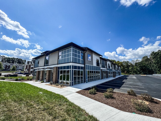
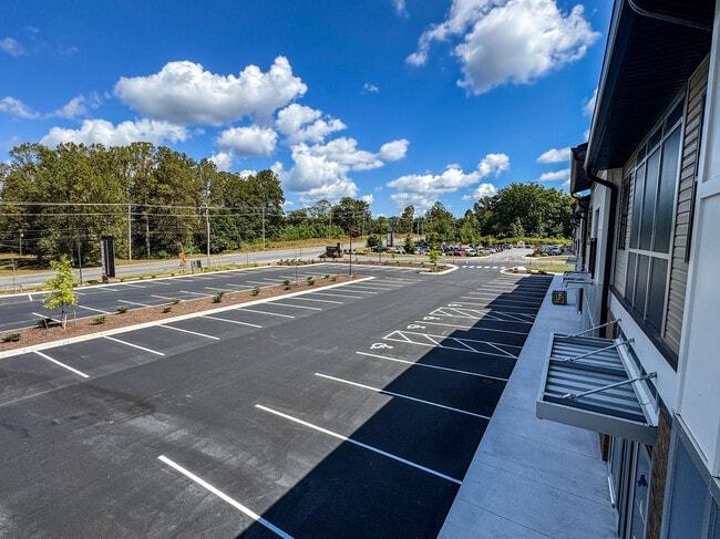
Property Record
1039 Gables Dr, Forest, VA 24551

Current Lease Availabilities
NEARBY LISTINGS FOR SALE OR LEASE
Property Detail
1039 Gables Dr
Lynchburg, VA
The Carter Properties
117-A-145
LOT 1 PB 50/359
Commercialacreage
Bedford
X
Virginia
51019C0360D
1
2025
1.51 AC
2025
Lynchburg
030104
Other Market Areas
DEMOGRAPHICS near 1039 Gables Dr
1 Mile
3 Mile
5 Mile
2024 Total Population
3,406
33,288
72,210
2029 Population
3,467
33,888
72,872
Pop Growth 2024-2029
+ 1.79%
+ 1.80%
+ 0.92%
Average Age
41
40
39
2024 Total Households
1,411
13,976
29,882
HH Growth 2024-2029
+ 1.56%
+ 1.73%
+ 0.80%
Median Household Inc
$68,599
$69,956
$67,171
Avg Household Size
2.40
2.30
2.40
2024 Avg HH Vehicles
2.00
2.00
2.00
Median Home Value
$286,450
$241,657
$233,661
Median Year Built
1992
1992
1986
Nearby Places
Map Layers
Map Styles
 Street
 Aerial
- Restaurants
- Banks
- Shops
- Fitness
- Groceries
PUBLIC TRANSPORTATION
COMMUTER RAIL
Lynchburg (Crescent - Amtrak, Northeast Regional - Amtrak)
DRIVE
WALK
Distance
Lynchburg (Crescent - Amtrak, Northeast Regional - Amtrak)
14 min
7.6 mi
AIRPORT
Lynchburg Regional/Preston Glenn Field
DRIVE
WALK
Distance
Lynchburg Regional/Preston Glenn Field
14 min
6.0 mi
Freight Ports
Virginia Port Authority - Richmond
DRIVE
WALK
Distance
Virginia Port Authority - Richmond
161 min
117.9 mi
Nearby Properties
Address
Land Use
TOTAL SIZE
Lot Size
Zoning
Address
Land Use
TOTAL SIZE
Lot Size
Zoning
3.33 AC
1909
Address
Land Use
TOTAL SIZE
Lot Size
Zoning
Address
Land Use
TOTAL SIZE
Lot Size
Zoning
22.70 AC
Address
Land Use
TOTAL SIZE
Lot Size
Zoning
912 SF
52.88 AC
BGC
Address
Land Use
TOTAL SIZE
Lot Size
Zoning
Address
Land Use
TOTAL SIZE
Lot Size
Zoning
1,282 SF
12.75 AC
Address
Land Use
TOTAL SIZE
Lot Size
Zoning
199,056 SF
16.21 AC
R1
Address
Land Use
TOTAL SIZE
Lot Size
Zoning
Address
Land Use
TOTAL SIZE
Lot Size
Zoning
36,168 SF
7.96 AC
BGC
Address
Land Use
TOTAL SIZE
Lot Size
Zoning
415,272 SF
117.43 AC
I3RC
Address
Land Use
TOTAL SIZE
Lot Size
Zoning
155,125 SF
38.67 AC
250129
Address
Land Use
TOTAL SIZE
Lot Size
Zoning
161,688 SF
16.57 AC
R3RC
Address
Land Use
TOTAL SIZE
Lot Size
Zoning
222,427 SF
23.56 AC
I2RC
Address
Land Use
TOTAL SIZE
Lot Size
Zoning
1,120 SF
16.81 AC
RMF
Address
Land Use
TOTAL SIZE
Lot Size
Zoning
Address
Land Use
TOTAL SIZE
Lot Size
Zoning
Address
Land Use
TOTAL SIZE
Lot Size
Zoning
3,478 SF
13.10 AC
RMFC
Address
Land Use
TOTAL SIZE
Lot Size
Zoning
537,608 SF
47.65 AC
152919
Address
Land Use
TOTAL SIZE
Lot Size
Zoning
336,338 SF
50.60 AC
Address
Land Use
TOTAL SIZE
Lot Size
Zoning
161,333 SF
10.60 AC
2119
Address
Land Use
TOTAL SIZE
Lot Size
Zoning
192,704 SF
8.35 AC
252905
Address
Land Use
TOTAL SIZE
Lot Size
Zoning
Address
Land Use
TOTAL SIZE
Lot Size
Zoning
76,421 SF
25.07 AC
R2RC
Address
Land Use
TOTAL SIZE
Lot Size
Zoning
172,074 SF
9.93 AC
Address
Land Use
TOTAL SIZE
Lot Size
Zoning
95,792 SF
3.28 AC
Address
Land Use
TOTAL SIZE
Lot Size
Zoning
180,800 SF
13.76 AC
I2
Address
Land Use
TOTAL SIZE
Lot Size
Zoning
96,428 SF
4.38 AC
Address
Land Use
TOTAL SIZE
Lot Size
Zoning
105,534 SF
1.89 AC
B1
Address
Land Use
TOTAL SIZE
Lot Size
Zoning
235,213 SF
24.61 AC
I2
Address
Land Use
TOTAL SIZE
Lot Size
Zoning
91,588 SF
10.96 AC
B3R4
The World's #1 Commercial Real Estate Marketplace
Connect with us
© 2025 CoStar Group
The information above has been obtained from sources believed reliable. While we do not doubt its accuracy we have not verified it and make no guarantee, warranty or representation about it. It is your responsibility to independently confirm its accuracy and completeness. Any projections, opinions, assumptions, or estimates used are for example only and do not represent the current or future performance of the property. The value of this transaction to you depends on tax and other factors which should be evaluated by your tax, financial, and legal advisors. You and your advisors should conduct a careful, independent investigation of the property to determine to your satisfaction the suitability of the property for your needs.