Property Record
10391 Ophir Rd, Newcastle, CA 95658

Save to a Folder
{{folder.Name}}
{{folder.ListingIds.length}} Properties
{{folder.ListingIds.length}} Property
Create a New Folder
Property Detail
10391 Ophir Rd
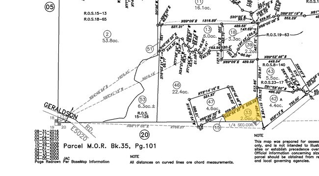
040-200-039
2 A FR SEC 17 12 8
Industrialacreage
PLACER
C3UPDC
California
B and X Area of moderate flood hazard, usually the area between the limits of the 100-year and 500-year floods.
9.20 AC
2025
Auburn/Lincoln
2026
Sacramento
020501
Sacramento-Roseville-Folsom, CA
NEARBY LISTINGS FOR SALE OR LEASE
DEMOGRAPHICS near 10391 Ophir Rd
1 mile
3 mile
5 mile
2025 Total Population
965
19,322
42,939
2030 Population
1,010
20,228
44,850
Pop Growth 2025-2030
+ 4.66%
+ 4.69%
+ 4.45%
Average Age
46
46
46
2025 Total Households
368
8,189
17,400
HH Growth 2025-2030
+ 4.62%
+ 4.73%
+ 4.49%
Median Household Inc
$130,278
$88,249
$91,112
Avg Household Size
2.60
2.30
2.40
2025 Avg HH Vehicles
2.00
2.00
2.00
Median Home Value
$754,411
$725,955
$708,160
Median Year Built
1979
1978
1979
Nearby Places
Map Layers
Map Styles
 Street
 Aerial
Layers
 Traffic
 Biking
Places
Listings with unknown addresses are not visible on the map
- Restaurants
- Banks
- Shops
- Fitness
- Groceries
PUBLIC TRANSPORTATION
COMMUTER RAIL
Auburn-Conheim (Capitol Corridor - Capitol Corridor Joint Powers Authority)
Drive
Walk
Distance
Auburn-Conheim (Capitol Corridor - Capitol Corridor Joint Powers Authority)
5 min
3.1 mi
Auburn Amtrak (Capitol Corridor - Amtrak)
Drive
Walk
Distance
Auburn Amtrak (Capitol Corridor - Amtrak)
6 min
3.2 mi
AIRPORT
Sacramento International
Drive
Walk
Distance
Sacramento International
48 min
37.9 mi
Freight Ports
Port of Stockton
Drive
Walk
Distance
Port of Stockton
91 min
78.1 mi
SALE & LEASE HISTORY
LISTING DATE
SALE/LEASE

Nov 18, 2020
For Sale
Nov 06, 2020
For Sale
Nearby Properties
Address
Land Use
TOTAL SIZE
Lot Size
Zoning
Address
Land Use
TOTAL SIZE
Lot Size
Zoning
43,785 SF
3.80 AC
Address
Land Use
TOTAL SIZE
Lot Size
Zoning
161,432 SF
7.90 AC
Address
Land Use
TOTAL SIZE
Lot Size
Zoning
124,714 SF
7.90 AC
Address
Land Use
TOTAL SIZE
Lot Size
Zoning
52,100 SF
2.30 AC
Address
Land Use
TOTAL SIZE
Lot Size
Zoning
55,721 SF
3.10 AC
Address
Land Use
TOTAL SIZE
Lot Size
Zoning
35,418 SF
2.70 AC
Address
Land Use
TOTAL SIZE
Lot Size
Zoning
39,328 SF
5.07 AC
Address
Land Use
TOTAL SIZE
Lot Size
Zoning
49,023 SF
0.89 AC
Address
Land Use
TOTAL SIZE
Lot Size
Zoning
49,000 SF
2 AC
Address
Land Use
TOTAL SIZE
Lot Size
Zoning
50,450 SF
2.60 AC
Address
Land Use
TOTAL SIZE
Lot Size
Zoning
65,550 SF
5.70 AC
Address
Land Use
TOTAL SIZE
Lot Size
Zoning
878 SF
0.28 AC
C2DC
Address
Land Use
TOTAL SIZE
Lot Size
Zoning
44,800 SF
4.10 AC
Address
Land Use
TOTAL SIZE
Lot Size
Zoning
38,448 SF
2.40 AC
Address
Land Use
TOTAL SIZE
Lot Size
Zoning
23,426 SF
2.40 AC
Address
Land Use
TOTAL SIZE
Lot Size
Zoning
26,064 SF
1.60 AC
Address
Land Use
TOTAL SIZE
Lot Size
Zoning
63,378 SF
30.30 AC
Address
Land Use
TOTAL SIZE
Lot Size
Zoning
32,396 SF
5.83 AC
Address
Land Use
TOTAL SIZE
Lot Size
Zoning
28,256 SF
2.80 AC
Address
Land Use
TOTAL SIZE
Lot Size
Zoning
20,710 SF
1.50 AC
Address
Land Use
TOTAL SIZE
Lot Size
Zoning
30,419 SF
3 AC
Address
Land Use
TOTAL SIZE
Lot Size
Zoning
19,726 SF
1.21 AC
Address
Land Use
TOTAL SIZE
Lot Size
Zoning
18,980 SF
0.37 AC
Address
Land Use
TOTAL SIZE
Lot Size
Zoning
34,536 SF
3 AC
Address
Land Use
TOTAL SIZE
Lot Size
Zoning
37,038 SF
2.80 AC
Address
Land Use
TOTAL SIZE
Lot Size
Zoning
186.30 AC
FBX
Address
Land Use
TOTAL SIZE
Lot Size
Zoning
18,932 SF
0.37 AC
Address
Land Use
TOTAL SIZE
Lot Size
Zoning
8,856 SF
0.52 AC
Address
Land Use
TOTAL SIZE
Lot Size
Zoning
23,914 SF
1.80 AC
Address
Land Use
TOTAL SIZE
Lot Size
Zoning
165.10 AC
FBX
The World's #1 Commercial Real Estate Marketplace
Connect with us
© 2026 CoStar Group
The information above has been obtained from sources believed reliable. While we do not doubt its accuracy we have not verified it and make no guarantee, warranty or representation about it. It is your responsibility to independently confirm its accuracy and completeness. Any projections, opinions, assumptions, or estimates used are for example only and do not represent the current or future performance of the property. The value of this transaction to you depends on tax and other factors which should be evaluated by your tax, financial, and legal advisors. You and your advisors should conduct a careful, independent investigation of the property to determine to your satisfaction the suitability of the property for your needs.