Property Record
104 Depot St, Archbold, OH 43502


NEARBY LISTINGS FOR SALE OR LEASE
-
-
View all Archbold listings for sale on LoopNet.com
Property Detail
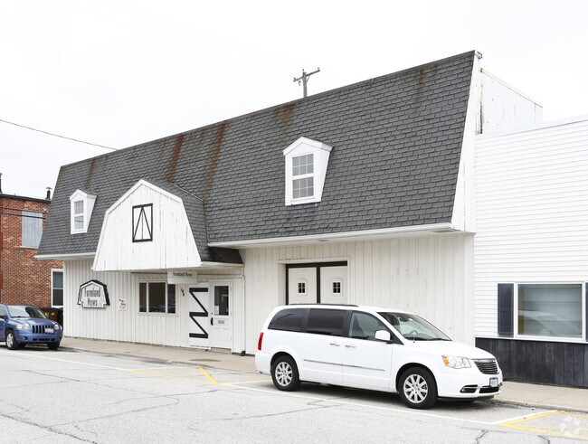
104 Depot St
Toledo, OH
Haywoods Division
17-029404-00.000
HAYWOODS DIVISION LOT 30 EX E66'
Officebuilding
Fulton
X
Ohio
39051C0168D
30
2024
0.10 AC
2024
Fulton County
040900
Toledo
4,356 SF
DEMOGRAPHICS near 104 Depot St
1 mile
3 mile
5 mile
2024 Total Population
4,002
5,452
7,412
2029 Population
3,969
5,388
7,254
Pop Growth 2024-2029
(0.82%)
(1.17%)
(2.13%)
Average Age
43
43
42
2024 Total Households
1,687
2,234
2,952
HH Growth 2024-2029
(0.89%)
(1.21%)
(2.10%)
Median Household Inc
$62,366
$66,303
$68,465
Avg Household Size
2.30
2.30
2.40
2024 Avg HH Vehicles
2.00
2.00
2.00
Median Home Value
$162,946
$168,006
$171,509
Median Year Built
1968
1968
1966
Nearby Places
Map Layers
Map Styles
 Street
 Aerial
Transit
 Traffic
 Biking
Places
Listings with unknown addresses are not visible on the map
- Restaurants
- Banks
- Shops
- Fitness
- Groceries
PUBLIC TRANSPORTATION
AIRPORT
Eugene F Kranz Toledo Express
Drive
Walk
Distance
Eugene F Kranz Toledo Express
45 min
37.8 mi
Freight Ports
Port of Baltimore
Drive
Walk
Distance
Port of Baltimore
1 min
434.4 mi
SALE & LEASE HISTORY
LISTING DATE
SALE/LEASE

Mar 09, 2018
For Sale
Nearby Properties
Address
Land Use
TOTAL SIZE
Lot Size
Zoning
Address
Land Use
TOTAL SIZE
Lot Size
Zoning
751,940 SF
37.84 AC
M2
Address
Land Use
TOTAL SIZE
Lot Size
Zoning
103,304 SF
39.67 AC
S
Address
Land Use
TOTAL SIZE
Lot Size
Zoning
10.21 AC
S
Address
Land Use
TOTAL SIZE
Lot Size
Zoning
32.55 AC
Address
Land Use
TOTAL SIZE
Lot Size
Zoning
2,962 SF
21.46 AC
S
Address
Land Use
TOTAL SIZE
Lot Size
Zoning
10,804 SF
19.74 AC
M2
Address
Land Use
TOTAL SIZE
Lot Size
Zoning
2,793 SF
12.57 AC
S
Address
Land Use
TOTAL SIZE
Lot Size
Zoning
712,800 SF
10 AC
M2
Address
Land Use
TOTAL SIZE
Lot Size
Zoning
16,831 SF
10.18 AC
Address
Land Use
TOTAL SIZE
Lot Size
Zoning
29,338 SF
2.35 AC
Address
Land Use
TOTAL SIZE
Lot Size
Zoning
66,680 SF
17.17 AC
S
Address
Land Use
TOTAL SIZE
Lot Size
Zoning
18,900 SF
27.11 AC
M2
Address
Land Use
TOTAL SIZE
Lot Size
Zoning
39,044 SF
23.36 AC
Address
Land Use
TOTAL SIZE
Lot Size
Zoning
52,861 SF
9.20 AC
M2
Address
Land Use
TOTAL SIZE
Lot Size
Zoning
99,156 SF
1.04 AC
S
Address
Land Use
TOTAL SIZE
Lot Size
Zoning
502,500 SF
35.95 AC
M2
Address
Land Use
TOTAL SIZE
Lot Size
Zoning
150,946 SF
4.09 AC
M2
Address
Land Use
TOTAL SIZE
Lot Size
Zoning
66,000 SF
4.45 AC
M1
Address
Land Use
TOTAL SIZE
Lot Size
Zoning
243,100 SF
5.99 AC
M2
Address
Land Use
TOTAL SIZE
Lot Size
Zoning
21,838 SF
3.75 AC
Address
Land Use
TOTAL SIZE
Lot Size
Zoning
76.22 AC
S
Address
Land Use
TOTAL SIZE
Lot Size
Zoning
298,080 SF
31.20 AC
M2
Address
Land Use
TOTAL SIZE
Lot Size
Zoning
26,144 SF
7.29 AC
S
Address
Land Use
TOTAL SIZE
Lot Size
Zoning
72,000 SF
10.63 AC
M2
Address
Land Use
TOTAL SIZE
Lot Size
Zoning
1,600 SF
15 AC
M2
Address
Land Use
TOTAL SIZE
Lot Size
Zoning
27,211 SF
2.35 AC
R2
Address
Land Use
TOTAL SIZE
Lot Size
Zoning
10,392 SF
11.88 AC
S
Address
Land Use
TOTAL SIZE
Lot Size
Zoning
28,361 SF
5.65 AC
B2
Address
Land Use
TOTAL SIZE
Lot Size
Zoning
232,335 SF
11.30 AC
M2
Address
Land Use
TOTAL SIZE
Lot Size
Zoning
1,860 SF
53.60 AC
S
The World's #1 Commercial Real Estate Marketplace
Connect with us
© 2026 CoStar Group
The information above has been obtained from sources believed reliable. While we do not doubt its accuracy we have not verified it and make no guarantee, warranty or representation about it. It is your responsibility to independently confirm its accuracy and completeness. Any projections, opinions, assumptions, or estimates used are for example only and do not represent the current or future performance of the property. The value of this transaction to you depends on tax and other factors which should be evaluated by your tax, financial, and legal advisors. You and your advisors should conduct a careful, independent investigation of the property to determine to your satisfaction the suitability of the property for your needs.