Property Record
104 E Esterbrook Dr, North Webster, IN 46555
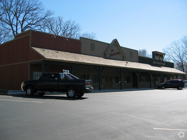

Property Detail
104 E Esterbrook Dr
43-08-15-100-020.000-024
24-57-89.A LOTS 4, 5, 6, & W 1/2 LOT 7 GRIFFITH GARDEN ADD AMENDED
Storebuilding
KOSCIUSKO
COMME
Indiana
B and X Area of moderate flood hazard, usually the area between the limits of the 100-year and 500-year floods.
4-6,7
2025
1.33 AC
2025
Indiana North Area
961400
Other Market Areas
6,160 SF
Warsaw, IN
NEARBY LISTINGS FOR SALE OR LEASE
-
-
View all North Webster listings for sale on LoopNet.com
DEMOGRAPHICS near 104 E Esterbrook Dr
1 mile
3 mile
5 mile
2025 Total Population
1,283
5,402
14,372
2030 Population
1,275
5,601
15,161
Pop Growth 2025-2030
(0.62%)
+ 3.68%
+ 5.49%
Average Age
43
45
45
2025 Total Households
560
2,359
6,218
HH Growth 2025-2030
(0.89%)
+ 3.60%
+ 5.50%
Median Household Inc
$57,380
$67,406
$68,305
Avg Household Size
2.30
2.20
2.30
2025 Avg HH Vehicles
2.00
2.00
2.00
Median Home Value
$202,830
$256,223
$281,726
Median Year Built
1965
1973
1976
Nearby Places
Map Layers
Map Styles
 Street
 Aerial
Transit
 Traffic
 Biking
Places
Listings with unknown addresses are not visible on the map
- Restaurants
- Banks
- Shops
- Fitness
- Groceries
Nearby Properties
Address
Land Use
TOTAL SIZE
Lot Size
Zoning
Address
Land Use
TOTAL SIZE
Lot Size
Zoning
1,768 SF
104.66 AC
AG
Address
Land Use
TOTAL SIZE
Lot Size
Zoning
31.94 AC
AG
Address
Land Use
TOTAL SIZE
Lot Size
Zoning
7,200 SF
22.50 AC
AG
Address
Land Use
TOTAL SIZE
Lot Size
Zoning
55,804 SF
9.55 AC
COMME
Address
Land Use
TOTAL SIZE
Lot Size
Zoning
44,896 SF
4.69 AC
PUBLI
Address
Land Use
TOTAL SIZE
Lot Size
Zoning
630 SF
29.87 AC
RESID
Address
Land Use
TOTAL SIZE
Lot Size
Zoning
2,360 SF
35.67 AC
AG
Address
Land Use
TOTAL SIZE
Lot Size
Zoning
20,043 SF
10.53 AC
COMME
Address
Land Use
TOTAL SIZE
Lot Size
Zoning
6,395 SF
4.44 AC
COMME
Address
Land Use
TOTAL SIZE
Lot Size
Zoning
42,145 SF
5.80 AC
COMME
Address
Land Use
TOTAL SIZE
Lot Size
Zoning
7,560 SF
1.45 AC
COMME
Address
Land Use
TOTAL SIZE
Lot Size
Zoning
15,000 SF
7.80 AC
COMME
Address
Land Use
TOTAL SIZE
Lot Size
Zoning
72,978 SF
4.51 AC
IND-2
Address
Land Use
TOTAL SIZE
Lot Size
Zoning
4,680 SF
21.88 AC
COMME
Address
Land Use
TOTAL SIZE
Lot Size
Zoning
1,920 SF
1.07 AC
RESID
Address
Land Use
TOTAL SIZE
Lot Size
Zoning
4,000 SF
2.99 AC
COMME
Address
Land Use
TOTAL SIZE
Lot Size
Zoning
988 SF
15.37 AC
RESID
Address
Land Use
TOTAL SIZE
Lot Size
Zoning
55,160 SF
4.79 AC
PUBLI
Address
Land Use
TOTAL SIZE
Lot Size
Zoning
26,772 SF
10 AC
RESID
Address
Land Use
TOTAL SIZE
Lot Size
Zoning
6,144 SF
12.62 AC
AG
Address
Land Use
TOTAL SIZE
Lot Size
Zoning
0.93 AC
RESID
Address
Land Use
TOTAL SIZE
Lot Size
Zoning
11,912 SF
6.77 AC
COMME
Address
Land Use
TOTAL SIZE
Lot Size
Zoning
13,728 SF
9.29 AC
COMME
Address
Land Use
TOTAL SIZE
Lot Size
Zoning
10,125 SF
1.72 AC
COMME
Address
Land Use
TOTAL SIZE
Lot Size
Zoning
9,280 SF
1.70 AC
COMME
Address
Land Use
TOTAL SIZE
Lot Size
Zoning
9,100 SF
1.63 AC
COMME
Address
Land Use
TOTAL SIZE
Lot Size
Zoning
4,716 SF
6.98 AC
PUBLI
Address
Land Use
TOTAL SIZE
Lot Size
Zoning
4,640 SF
2.13 AC
COMME
Address
Land Use
TOTAL SIZE
Lot Size
Zoning
26,310 SF
11.05 AC
IND-2
Address
Land Use
TOTAL SIZE
Lot Size
Zoning
4,544 SF
20.22 AC
PUBLI
The World's #1 Commercial Real Estate Marketplace
Connect with us
© 2026 CoStar Group
The information above has been obtained from sources believed reliable. While we do not doubt its accuracy we have not verified it and make no guarantee, warranty or representation about it. It is your responsibility to independently confirm its accuracy and completeness. Any projections, opinions, assumptions, or estimates used are for example only and do not represent the current or future performance of the property. The value of this transaction to you depends on tax and other factors which should be evaluated by your tax, financial, and legal advisors. You and your advisors should conduct a careful, independent investigation of the property to determine to your satisfaction the suitability of the property for your needs.