Property Record
104 Max Stark Dam St, Marble Falls, TX 78654
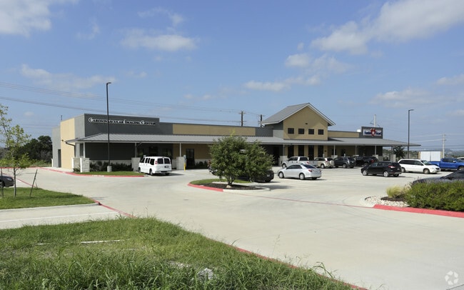

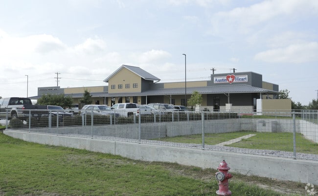
Property Detail
104 Max Stark Dam St
106891
S6162 MEDICAL BUSINESS DISTRICT SUB LOT 1 BLK 1 2.0
Commercialnec
BURNET
B and X Area of moderate flood hazard, usually the area between the limits of the 100-year and 500-year floods.
Texas
2024
1
2025
2 AC
960701
Marble Falls
21,100 SF
Other Market Areas
NEARBY LISTINGS FOR SALE OR LEASE
DEMOGRAPHICS near 104 Max Stark Dam St
1 mile
3 mile
5 mile
2025 Total Population
1,622
10,313
14,069
2030 Population
1,785
11,307
15,435
Pop Growth 2025-2030
+ 10.05%
+ 9.64%
+ 9.71%
Average Age
44
43
43
2025 Total Households
701
4,277
5,799
HH Growth 2025-2030
+ 10.13%
+ 9.59%
+ 9.69%
Median Household Inc
$71,475
$65,801
$69,994
Avg Household Size
2.30
2.40
2.40
2025 Avg HH Vehicles
2.00
2.00
2.00
Median Home Value
$355,479
$350,764
$357,799
Median Year Built
1999
2000
2000
Nearby Places
Map Layers
Map Styles
 Street
 Aerial
Layers
 Traffic
 Biking
Places
Listings with unknown addresses are not visible on the map
- Restaurants
- Banks
- Shops
- Fitness
- Groceries
Nearby Properties
Address
Land Use
TOTAL SIZE
Lot Size
Zoning
Address
Land Use
TOTAL SIZE
Lot Size
Zoning
248,481 SF
20.32 AC
Address
Land Use
TOTAL SIZE
Lot Size
Zoning
118,251 SF
11.34 AC
Address
Land Use
TOTAL SIZE
Lot Size
Zoning
152,379 SF
7.57 AC
Address
Land Use
TOTAL SIZE
Lot Size
Zoning
114,375 SF
9.86 AC
Address
Land Use
TOTAL SIZE
Lot Size
Zoning
140,976 SF
8.34 AC
Address
Land Use
TOTAL SIZE
Lot Size
Zoning
112,599 SF
11.74 AC
Address
Land Use
TOTAL SIZE
Lot Size
Zoning
73,344 SF
13.72 AC
Address
Land Use
TOTAL SIZE
Lot Size
Zoning
73,721 SF
9.30 AC
Address
Land Use
TOTAL SIZE
Lot Size
Zoning
28,107 SF
8.34 AC
Address
Land Use
TOTAL SIZE
Lot Size
Zoning
48,288 SF
7.89 AC
Address
Land Use
TOTAL SIZE
Lot Size
Zoning
66,194 SF
3.85 AC
Address
Land Use
TOTAL SIZE
Lot Size
Zoning
65,350 SF
35 AC
Address
Land Use
TOTAL SIZE
Lot Size
Zoning
55,484 SF
3.01 AC
Address
Land Use
TOTAL SIZE
Lot Size
Zoning
47,104 SF
2.08 AC
Address
Land Use
TOTAL SIZE
Lot Size
Zoning
11,679 SF
Address
Land Use
TOTAL SIZE
Lot Size
Zoning
60,103 SF
6.55 AC
Address
Land Use
TOTAL SIZE
Lot Size
Zoning
76,951 SF
8.26 AC
Address
Land Use
TOTAL SIZE
Lot Size
Zoning
44,856 SF
2.90 AC
Address
Land Use
TOTAL SIZE
Lot Size
Zoning
37,440 SF
1.97 AC
Address
Land Use
TOTAL SIZE
Lot Size
Zoning
32,224 SF
10.20 AC
Address
Land Use
TOTAL SIZE
Lot Size
Zoning
6.95 AC
Address
Land Use
TOTAL SIZE
Lot Size
Zoning
30,824 SF
3.31 AC
Address
Land Use
TOTAL SIZE
Lot Size
Zoning
2,855 SF
5.54 AC
Address
Land Use
TOTAL SIZE
Lot Size
Zoning
54,787 SF
17.07 AC
Address
Land Use
TOTAL SIZE
Lot Size
Zoning
27,960 SF
2.01 AC
Address
Land Use
TOTAL SIZE
Lot Size
Zoning
34,848 SF
5.31 AC
Address
Land Use
TOTAL SIZE
Lot Size
Zoning
45,644 SF
6.43 AC
Address
Land Use
TOTAL SIZE
Lot Size
Zoning
40,392 SF
5.47 AC
Address
Land Use
TOTAL SIZE
Lot Size
Zoning
15,846 SF
4.93 AC
The World's #1 Commercial Real Estate Marketplace
Connect with us
© 2026 CoStar Group
The information above has been obtained from sources believed reliable. While we do not doubt its accuracy we have not verified it and make no guarantee, warranty or representation about it. It is your responsibility to independently confirm its accuracy and completeness. Any projections, opinions, assumptions, or estimates used are for example only and do not represent the current or future performance of the property. The value of this transaction to you depends on tax and other factors which should be evaluated by your tax, financial, and legal advisors. You and your advisors should conduct a careful, independent investigation of the property to determine to your satisfaction the suitability of the property for your needs.