Property Record
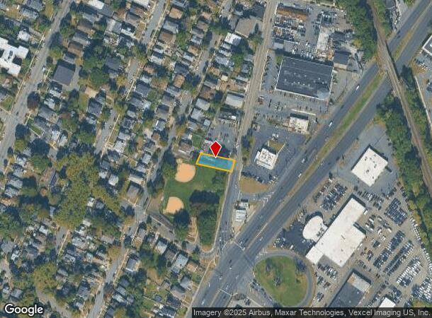
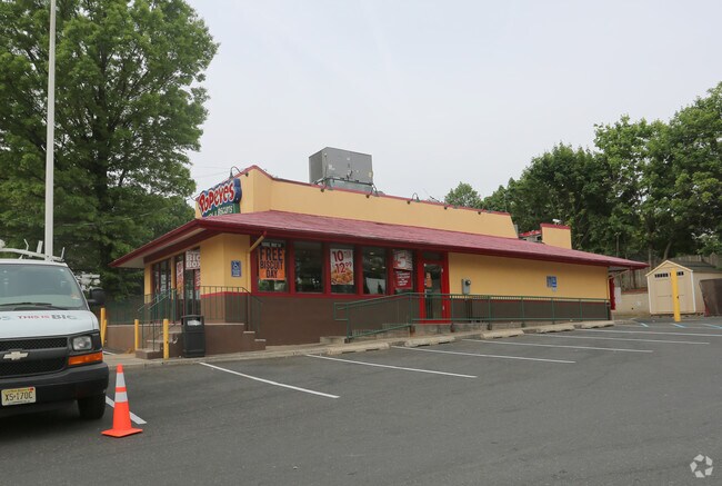
104 Meadow Rd, Rutherford, NJ 07070

NEARBY LISTINGS FOR SALE OR LEASE
Property Detail
104 Meadow Rd
56-00168-0000-00019
50X154
Commercialnec
Bergen
X
New Jersey
34031C0278G
19
2024
0.18 AC
2025
Meadowlands
051400
Northern New Jersey
1,800 SF
New York-Jersey City-White Plains, NY-NJ
DEMOGRAPHICS near 104 Meadow Rd
1 Mile
3 Mile
5 Mile
2024 Total Population
17,384
159,605
543,169
2029 Population
17,084
155,861
525,220
Pop Growth 2024-2029
(1.73%)
(2.35%)
(3.30%)
Average Age
40
40
40
2024 Total Households
6,730
59,831
196,453
HH Growth 2024-2029
(1.95%)
(2.48%)
(3.48%)
Median Household Inc
$111,878
$91,148
$76,397
Avg Household Size
2.50
2.60
2.70
2024 Avg HH Vehicles
2.00
2.00
2.00
Median Home Value
$567,993
$464,193
$422,629
Median Year Built
1948
1954
1954
Nearby Places
Map Layers
Map Styles
 Street
 Aerial
- Restaurants
- Banks
- Shops
- Fitness
- Groceries
PUBLIC TRANSPORTATION
COMMUTER RAIL
Rutherford (Bergen County/Port Jervis Line - NJ Transit Commuter Rail (NJ Transit))
DRIVE
WALK
Distance
Rutherford (Bergen County/Port Jervis Line - NJ Transit Commuter Rail (NJ Transit))
1 min
10 min
0.5 mi
Kingsland (Main/Port Jervis Line - NJ Transit Commuter Rail (NJ Transit))
DRIVE
WALK
Distance
Kingsland (Main/Port Jervis Line - NJ Transit Commuter Rail (NJ Transit))
3 min
1.8 mi
AIRPORT
Newark Liberty International
DRIVE
WALK
Distance
Newark Liberty International
15 min
11.9 mi
LaGuardia
DRIVE
WALK
Distance
LaGuardia
34 min
21.9 mi
John F Kennedy International
DRIVE
WALK
Distance
John F Kennedy International
46 min
26.5 mi
Freight Ports
Maher Terminal
DRIVE
WALK
Distance
Maher Terminal
25 min
14.1 mi
Nearby Properties
Address
Land Use
TOTAL SIZE
Lot Size
Zoning
Address
Land Use
TOTAL SIZE
Lot Size
Zoning
Address
Land Use
TOTAL SIZE
Lot Size
Zoning
Address
Land Use
TOTAL SIZE
Lot Size
Zoning
4,014 SF
21 AC
Address
Land Use
TOTAL SIZE
Lot Size
Zoning
612 AC
SEA
Address
Land Use
TOTAL SIZE
Lot Size
Zoning
335.71 AC
AF
Address
Land Use
TOTAL SIZE
Lot Size
Zoning
Address
Land Use
TOTAL SIZE
Lot Size
Zoning
Address
Land Use
TOTAL SIZE
Lot Size
Zoning
Address
Land Use
TOTAL SIZE
Lot Size
Zoning
Address
Land Use
TOTAL SIZE
Lot Size
Zoning
Address
Land Use
TOTAL SIZE
Lot Size
Zoning
9.57 AC
I2
Address
Land Use
TOTAL SIZE
Lot Size
Zoning
3,956 SF
250 AC
C2
Address
Land Use
TOTAL SIZE
Lot Size
Zoning
68.93 AC
Address
Land Use
TOTAL SIZE
Lot Size
Zoning
Address
Land Use
TOTAL SIZE
Lot Size
Zoning
602,220 SF
25.91 AC
Address
Land Use
TOTAL SIZE
Lot Size
Zoning
5.80 AC
CGI
Address
Land Use
TOTAL SIZE
Lot Size
Zoning
416,340 SF
10.49 AC
Address
Land Use
TOTAL SIZE
Lot Size
Zoning
30.46 AC
I
Address
Land Use
TOTAL SIZE
Lot Size
Zoning
8.88 AC
ORD
Address
Land Use
TOTAL SIZE
Lot Size
Zoning
1,218 SF
41.30 AC
RB
Address
Land Use
TOTAL SIZE
Lot Size
Zoning
100,014 SF
8.80 AC
M2
Address
Land Use
TOTAL SIZE
Lot Size
Zoning
8.79 AC
Address
Land Use
TOTAL SIZE
Lot Size
Zoning
4.80 AC
Address
Land Use
TOTAL SIZE
Lot Size
Zoning
275,260 SF
11.88 AC
Address
Land Use
TOTAL SIZE
Lot Size
Zoning
18.30 AC
Address
Land Use
TOTAL SIZE
Lot Size
Zoning
11.59 AC
Address
Land Use
TOTAL SIZE
Lot Size
Zoning
144,024 SF
1 AC
LM
Address
Land Use
TOTAL SIZE
Lot Size
Zoning
24.29 AC
Address
Land Use
TOTAL SIZE
Lot Size
Zoning
82.74 AC
Address
Land Use
TOTAL SIZE
Lot Size
Zoning
71,634 SF
12.31 AC
M1
The World's #1 Commercial Real Estate Marketplace
Connect with us
© 2026 CoStar Group
The information above has been obtained from sources believed reliable. While we do not doubt its accuracy we have not verified it and make no guarantee, warranty or representation about it. It is your responsibility to independently confirm its accuracy and completeness. Any projections, opinions, assumptions, or estimates used are for example only and do not represent the current or future performance of the property. The value of this transaction to you depends on tax and other factors which should be evaluated by your tax, financial, and legal advisors. You and your advisors should conduct a careful, independent investigation of the property to determine to your satisfaction the suitability of the property for your needs.