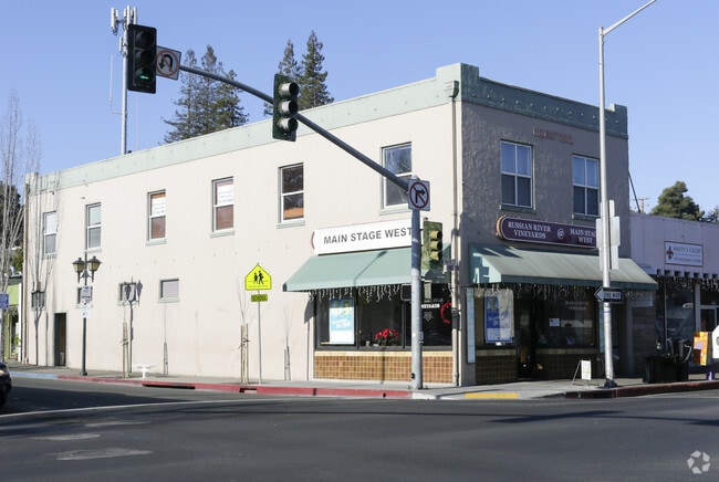
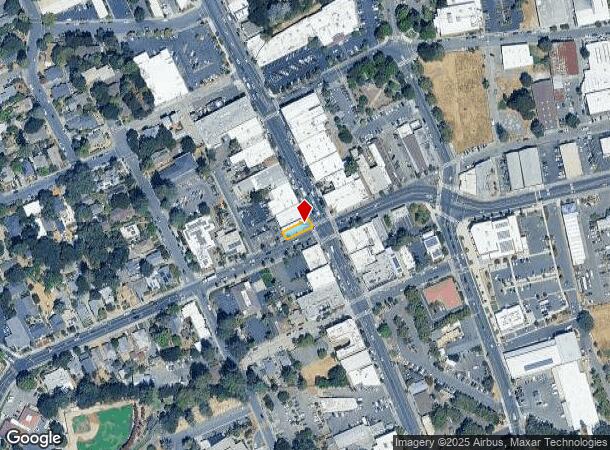
Property Record
104 N Main St, Sebastopol, CA 95472
NEARBY LISTINGS FOR SALE OR LEASE
Property Detail
104 N Main St
Santa Rosa, CA
Sebastopol
004-243-021
1968 FORM/PT OF 4-243-06
Storemultistory
Sonoma
X
California
06097C0715E
5
2024
0.02 AC
2025
Sebastopol/Bodega
153406
North Bay/Santa Rosa
4,342 SF
DEMOGRAPHICS near 104 N Main St
1 Mile
3 Mile
5 Mile
2024 Total Population
7,543
16,545
56,194
2029 Population
7,371
15,880
54,367
Pop Growth 2024-2029
(2.28%)
(4.02%)
(3.25%)
Average Age
47
48
44
2024 Total Households
3,328
6,820
20,487
HH Growth 2024-2029
(2.37%)
(3.99%)
(3.43%)
Median Household Inc
$104,318
$110,564
$103,873
Avg Household Size
2.20
2.40
2.60
2024 Avg HH Vehicles
2.00
2.00
2.00
Median Home Value
$840,695
$889,842
$783,166
Median Year Built
1970
1971
1977
Nearby Places
Map Layers
Map Styles
 Street
 Aerial
- Restaurants
- Banks
- Shops
- Fitness
- Groceries
PUBLIC TRANSPORTATION
COMMUTER RAIL
Santa Rosa Downtown Smart (Main Line - Sonoma Marin Area Rail Transit)
DRIVE
WALK
Distance
Santa Rosa Downtown Smart (Main Line - Sonoma Marin Area Rail Transit)
10 min
6.6 mi
Santa Rosa North Smart (Main Line - Sonoma Marin Area Rail Transit)
DRIVE
WALK
Distance
Santa Rosa North Smart (Main Line - Sonoma Marin Area Rail Transit)
12 min
7.9 mi
AIRPORT
Charles M Schulz - Sonoma County
DRIVE
WALK
Distance
Charles M Schulz - Sonoma County
20 min
11.3 mi
Freight Ports
Port of Richmond
DRIVE
WALK
Distance
Port of Richmond
65 min
49.0 mi
Nearby Properties
Address
Land Use
TOTAL SIZE
Lot Size
Zoning
Address
Land Use
TOTAL SIZE
Lot Size
Zoning
89,970 SF
7.32 AC
Address
Land Use
TOTAL SIZE
Lot Size
Zoning
26,734 SF
9.55 AC
Address
Land Use
TOTAL SIZE
Lot Size
Zoning
53,766 SF
20 AC
Address
Land Use
TOTAL SIZE
Lot Size
Zoning
1,040 SF
2.32 AC
CITYSE
Address
Land Use
TOTAL SIZE
Lot Size
Zoning
276,623 SF
76.04 AC
Address
Land Use
TOTAL SIZE
Lot Size
Zoning
17,064 SF
21.15 AC
Address
Land Use
TOTAL SIZE
Lot Size
Zoning
41,874 SF
2.46 AC
Address
Land Use
TOTAL SIZE
Lot Size
Zoning
5,988 SF
20.11 AC
Address
Land Use
TOTAL SIZE
Lot Size
Zoning
46,649 SF
9.09 AC
AR5
Address
Land Use
TOTAL SIZE
Lot Size
Zoning
29,861 SF
4 AC
Address
Land Use
TOTAL SIZE
Lot Size
Zoning
48,349 SF
0.40 AC
C3
Address
Land Use
TOTAL SIZE
Lot Size
Zoning
18,403 SF
0.68 AC
Address
Land Use
TOTAL SIZE
Lot Size
Zoning
41,643 SF
1.77 AC
Address
Land Use
TOTAL SIZE
Lot Size
Zoning
20,473 SF
1.02 AC
CITYSE
Address
Land Use
TOTAL SIZE
Lot Size
Zoning
18.05 AC
DA40
Address
Land Use
TOTAL SIZE
Lot Size
Zoning
23,572 SF
1.74 AC
CITYSE
Address
Land Use
TOTAL SIZE
Lot Size
Zoning
21,096 SF
1.74 AC
CD
Address
Land Use
TOTAL SIZE
Lot Size
Zoning
7,720 SF
56.30 AC
DA20
Address
Land Use
TOTAL SIZE
Lot Size
Zoning
57,564 SF
3.33 AC
M3
Address
Land Use
TOTAL SIZE
Lot Size
Zoning
33,150 SF
1 AC
MLPD
Address
Land Use
TOTAL SIZE
Lot Size
Zoning
43,968 SF
9.67 AC
Address
Land Use
TOTAL SIZE
Lot Size
Zoning
43,858 SF
2.35 AC
Address
Land Use
TOTAL SIZE
Lot Size
Zoning
22,582 SF
71.18 AC
LEA100
Address
Land Use
TOTAL SIZE
Lot Size
Zoning
4,100 SF
65.01 AC
LEA60
Address
Land Use
TOTAL SIZE
Lot Size
Zoning
47.64 AC
DA20
Address
Land Use
TOTAL SIZE
Lot Size
Zoning
46,285 SF
125.47 AC
Address
Land Use
TOTAL SIZE
Lot Size
Zoning
50,726 SF
32.32 AC
P2P
Address
Land Use
TOTAL SIZE
Lot Size
Zoning
47,724 SF
3.33 AC
CITYSE
Address
Land Use
TOTAL SIZE
Lot Size
Zoning
2,048 SF
39 AC
DA20
Address
Land Use
TOTAL SIZE
Lot Size
Zoning
9,601 SF
9.77 AC
DA10
The World's #1 Commercial Real Estate Marketplace
Connect with us
© 2026 CoStar Group
The information above has been obtained from sources believed reliable. While we do not doubt its accuracy we have not verified it and make no guarantee, warranty or representation about it. It is your responsibility to independently confirm its accuracy and completeness. Any projections, opinions, assumptions, or estimates used are for example only and do not represent the current or future performance of the property. The value of this transaction to you depends on tax and other factors which should be evaluated by your tax, financial, and legal advisors. You and your advisors should conduct a careful, independent investigation of the property to determine to your satisfaction the suitability of the property for your needs.