Property Record
104 Regency Dr, Columbia, SC 29212
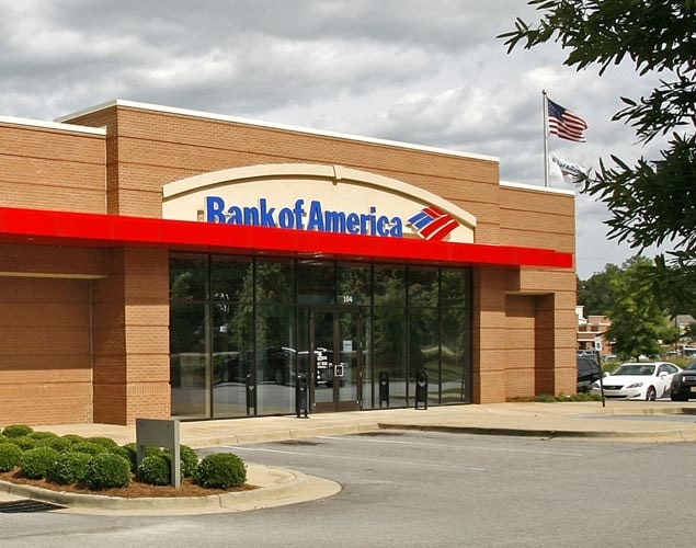

Property Detail
104 Regency Dr
001800-01-048
MURRAY LANDING PH I OUTPARCEL 1
Financialbuilding
Lexington
C2
South Carolina
B and X Area of moderate flood hazard, usually the area between the limits of the 100-year and 500-year floods.
1.99 AC
2025
Dutch Fork/Irmo
2024
Columbia
021113
Columbia, SC
4,958 SF
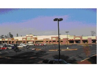
NEARBY LISTINGS FOR SALE OR LEASE
DEMOGRAPHICS near 104 Regency Dr
1 mile
3 mile
5 mile
2025 Total Population
5,560
30,475
73,899
2030 Population
5,764
31,484
76,091
Pop Growth 2025-2030
+ 3.67%
+ 3.31%
+ 2.97%
Average Age
42
42
41
2025 Total Households
2,192
12,280
29,354
HH Growth 2025-2030
+ 3.83%
+ 3.49%
+ 3.11%
Median Household Inc
$98,151
$91,470
$91,343
Avg Household Size
2.50
2.50
2.50
2025 Avg HH Vehicles
2.00
2.00
2.00
Median Home Value
$325,000
$271,430
$279,019
Median Year Built
1992
1988
1992
Nearby Places
Map Layers
Map Styles
 Street
 Aerial
Layers
 Traffic
 Biking
Places
Listings with unknown addresses are not visible on the map
- Restaurants
- Banks
- Shops
- Fitness
- Groceries
PUBLIC TRANSPORTATION
AIRPORT
Columbia Metro
Drive
Walk
Distance
Columbia Metro
23 min
18.3 mi
Freight Ports
Georgia Ports - Savannah
Drive
Walk
Distance
Georgia Ports - Savannah
1 min
136.4 mi
Nearby Properties
Address
Land Use
TOTAL SIZE
Lot Size
Zoning
Address
Land Use
TOTAL SIZE
Lot Size
Zoning
3,957 SF
20.32 AC
GC
Address
Land Use
TOTAL SIZE
Lot Size
Zoning
333,986 SF
11.33 AC
GC
Address
Land Use
TOTAL SIZE
Lot Size
Zoning
191,009 SF
28.02 AC
CG
Address
Land Use
TOTAL SIZE
Lot Size
Zoning
81,197 SF
10.34 AC
C-3
Address
Land Use
TOTAL SIZE
Lot Size
Zoning
153,210 SF
31.78 AC
LM
Address
Land Use
TOTAL SIZE
Lot Size
Zoning
75,358 SF
13.84 AC
M-1
Address
Land Use
TOTAL SIZE
Lot Size
Zoning
8,358 SF
9.12 AC
CG
Address
Land Use
TOTAL SIZE
Lot Size
Zoning
76,204 SF
2.26 AC
CN
Address
Land Use
TOTAL SIZE
Lot Size
Zoning
21,580 SF
16.15 AC
GC
Address
Land Use
TOTAL SIZE
Lot Size
Zoning
85,201 SF
48.22 AC
CG
Address
Land Use
TOTAL SIZE
Lot Size
Zoning
13.81 AC
M-1
Address
Land Use
TOTAL SIZE
Lot Size
Zoning
49,840 SF
2.25 AC
CG
Address
Land Use
TOTAL SIZE
Lot Size
Zoning
56,958 SF
6.21 AC
CG
Address
Land Use
TOTAL SIZE
Lot Size
Zoning
9.83 AC
CG
Address
Land Use
TOTAL SIZE
Lot Size
Zoning
56,588 SF
6.46 AC
GC
Address
Land Use
TOTAL SIZE
Lot Size
Zoning
15,205 SF
2.05 AC
C-3
Address
Land Use
TOTAL SIZE
Lot Size
Zoning
31,032 SF
7.36 AC
GC
Address
Land Use
TOTAL SIZE
Lot Size
Zoning
8.57 AC
CG
Address
Land Use
TOTAL SIZE
Lot Size
Zoning
11,917 SF
5.72 AC
RU
Address
Land Use
TOTAL SIZE
Lot Size
Zoning
14,370 SF
6.84 AC
RU
Address
Land Use
TOTAL SIZE
Lot Size
Zoning
14,400 SF
2.31 AC
CN
Address
Land Use
TOTAL SIZE
Lot Size
Zoning
24,049 SF
5.13 AC
CG
Address
Land Use
TOTAL SIZE
Lot Size
Zoning
24,049 SF
4.30 AC
CG
Address
Land Use
TOTAL SIZE
Lot Size
Zoning
23,439 SF
7.68 AC
RU
Address
Land Use
TOTAL SIZE
Lot Size
Zoning
15,252 SF
5.70 AC
RS-LD
Address
Land Use
TOTAL SIZE
Lot Size
Zoning
44,330 SF
2.30 AC
LM
Address
Land Use
TOTAL SIZE
Lot Size
Zoning
17,805 SF
23.60 AC
RS
Address
Land Use
TOTAL SIZE
Lot Size
Zoning
11,265 SF
2.47 AC
CG
Address
Land Use
TOTAL SIZE
Lot Size
Zoning
12,050 SF
1.13 AC
PD
Address
Land Use
TOTAL SIZE
Lot Size
Zoning
10,953 SF
1.20 AC
GC
The World's #1 Commercial Real Estate Marketplace
Connect with us
© 2026 CoStar Group
The information above has been obtained from sources believed reliable. While we do not doubt its accuracy we have not verified it and make no guarantee, warranty or representation about it. It is your responsibility to independently confirm its accuracy and completeness. Any projections, opinions, assumptions, or estimates used are for example only and do not represent the current or future performance of the property. The value of this transaction to you depends on tax and other factors which should be evaluated by your tax, financial, and legal advisors. You and your advisors should conduct a careful, independent investigation of the property to determine to your satisfaction the suitability of the property for your needs.