Property Record
1040 E Cheyenne Dr, Gilroy, CA 95020


NEARBY LISTINGS FOR SALE OR LEASE
Property Detail
1040 E Cheyenne Dr
Yakima, WA
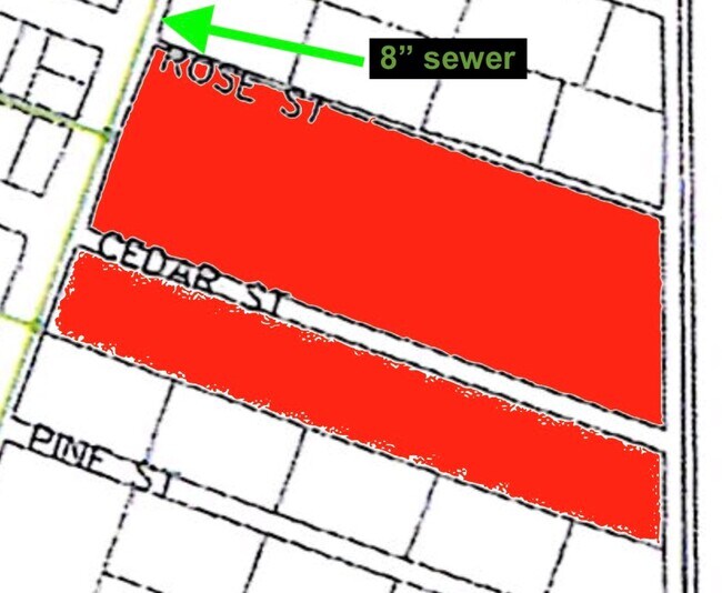
Mab Twnsite Cos 2Nd Add & Mab Garden Trt
220801-41413
SECTION 01 TOWNSHIP 08 RANGE 22 QUARTER SE PLAT MAB TWNSITE CO'S 2ND ADD & MAB GARDEN TRTS (A-101 & RE-RECORD J-45) BLOCK 48 LOT 2 EXCEPT THE NORTHEASTERLY 10 FEET DEED TO CITY OF MABTON AF#7835982
Recreationalacreage
Yakima
X
Washington
53077C2280D
2
2025
1.45 AC
2025
Outlying Yakima County
002701
Yakima
DEMOGRAPHICS near 1040 E Cheyenne Dr
1 Mile
3 Mile
5 Mile
2024 Total Population
1,851
2,405
10,232
2029 Population
1,763
2,305
10,168
Pop Growth 2024-2029
(4.75%)
(4.16%)
(0.63%)
Average Age
33
34
34
2024 Total Households
493
659
2,953
HH Growth 2024-2029
(4.87%)
(4.25%)
(0.71%)
Median Household Inc
$65,543
$67,790
$64,239
Avg Household Size
3.80
3.60
3.40
2024 Avg HH Vehicles
3.00
3.00
3.00
Median Home Value
$158,854
$173,333
$204,491
Median Year Built
1983
1982
1977
Nearby Places
Map Layers
Map Styles
 Street
 Aerial
- Restaurants
- Banks
- Shops
- Fitness
- Groceries
PUBLIC TRANSPORTATION
COMMUTER RAIL
Gilroy (Caltrain - Caltrain (Caltrain))
DRIVE
WALK
Distance
Gilroy (Caltrain - Caltrain (Caltrain))
8 min
3.8 mi
Gilroy Caltrain Station Southbound (South Santa Clara County Connector - Caltrain (Caltrain))
DRIVE
WALK
Distance
Gilroy Caltrain Station Southbound (South Santa Clara County Connector - Caltrain (Caltrain))
8 min
3.9 mi
AIRPORT
Norman Y Mineta San Jose International
DRIVE
WALK
Distance
Norman Y Mineta San Jose International
46 min
34.6 mi
Freight Ports
Port of Redwood City
DRIVE
WALK
Distance
Port of Redwood City
67 min
52.7 mi
SALE & LEASE HISTORY
LISTING DATE
SALE/LEASE

Jan 16, 2020
For Sale
Nearby Properties
Address
Land Use
TOTAL SIZE
Lot Size
Zoning
Address
Land Use
TOTAL SIZE
Lot Size
Zoning
270,205 SF
6.65 AC
M2
Address
Land Use
TOTAL SIZE
Lot Size
Zoning
171,339 SF
16.43 AC
C3
Address
Land Use
TOTAL SIZE
Lot Size
Zoning
133,498 SF
12.16 AC
C3
Address
Land Use
TOTAL SIZE
Lot Size
Zoning
156,290 SF
5.87 AC
APD
Address
Land Use
TOTAL SIZE
Lot Size
Zoning
113,883 SF
9.63 AC
C1
Address
Land Use
TOTAL SIZE
Lot Size
Zoning
103,974 SF
3.90 AC
R4
Address
Land Use
TOTAL SIZE
Lot Size
Zoning
172,348 SF
9.58 AC
A140
Address
Land Use
TOTAL SIZE
Lot Size
Zoning
94,345 SF
10.68 AC
C1
Address
Land Use
TOTAL SIZE
Lot Size
Zoning
102,915 SF
3.81 AC
R3
Address
Land Use
TOTAL SIZE
Lot Size
Zoning
43,973 SF
3.38 AC
R3
Address
Land Use
TOTAL SIZE
Lot Size
Zoning
56.33 AC
M2
Address
Land Use
TOTAL SIZE
Lot Size
Zoning
142,684 SF
4.94 AC
CD
Address
Land Use
TOTAL SIZE
Lot Size
Zoning
123,268 SF
7.62 AC
R3
Address
Land Use
TOTAL SIZE
Lot Size
Zoning
64,893 SF
4.32 AC
R3
Address
Land Use
TOTAL SIZE
Lot Size
Zoning
72,159 SF
4.16 AC
R3
Address
Land Use
TOTAL SIZE
Lot Size
Zoning
148,663 SF
14.79 AC
PUD
Address
Land Use
TOTAL SIZE
Lot Size
Zoning
32,727 SF
1.82 AC
M2
Address
Land Use
TOTAL SIZE
Lot Size
Zoning
129,000 SF
6.84 AC
MULIT
Address
Land Use
TOTAL SIZE
Lot Size
Zoning
2.94 AC
A140
Address
Land Use
TOTAL SIZE
Lot Size
Zoning
3.43 AC
APD
Address
Land Use
TOTAL SIZE
Lot Size
Zoning
126,503 SF
4.61 AC
MI
Address
Land Use
TOTAL SIZE
Lot Size
Zoning
70,209 SF
5.40 AC
COM
Address
Land Use
TOTAL SIZE
Lot Size
Zoning
96,524 SF
5 AC
R3
Address
Land Use
TOTAL SIZE
Lot Size
Zoning
59,676 SF
3.53 AC
R-1
Address
Land Use
TOTAL SIZE
Lot Size
Zoning
84,728 SF
6.54 AC
HC
Address
Land Use
TOTAL SIZE
Lot Size
Zoning
130,384 SF
9 AC
A-40A
Address
Land Use
TOTAL SIZE
Lot Size
Zoning
146,682 SF
11.83 AC
A1-25
Address
Land Use
TOTAL SIZE
Lot Size
Zoning
116,035 SF
4.59 AC
M1
Address
Land Use
TOTAL SIZE
Lot Size
Zoning
100,058 SF
9.48 AC
C3
Address
Land Use
TOTAL SIZE
Lot Size
Zoning
92,950 SF
3.65 AC
PUD
The World's #1 Commercial Real Estate Marketplace
Connect with us
© 2025 CoStar Group
The information above has been obtained from sources believed reliable. While we do not doubt its accuracy we have not verified it and make no guarantee, warranty or representation about it. It is your responsibility to independently confirm its accuracy and completeness. Any projections, opinions, assumptions, or estimates used are for example only and do not represent the current or future performance of the property. The value of this transaction to you depends on tax and other factors which should be evaluated by your tax, financial, and legal advisors. You and your advisors should conduct a careful, independent investigation of the property to determine to your satisfaction the suitability of the property for your needs.