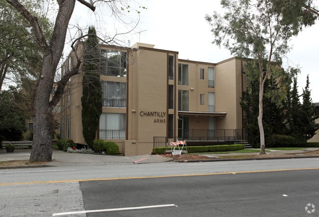
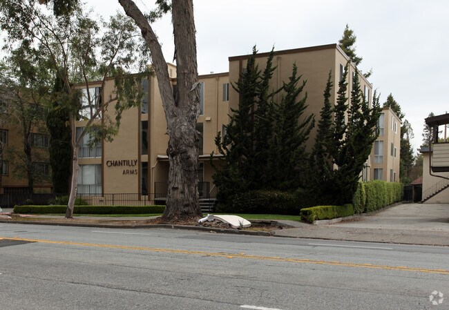
Property Record
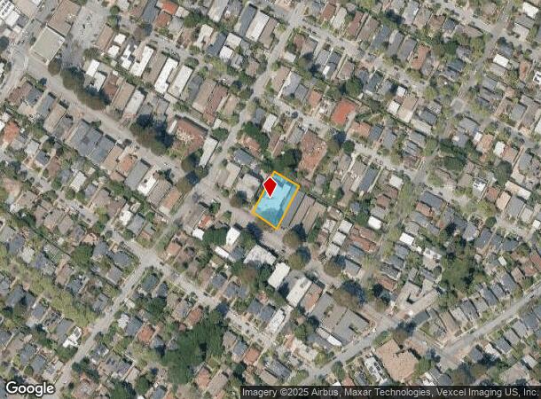
1040 El Camino Real, Burlingame, CA 94010
NEARBY LISTINGS FOR SALE OR LEASE
Property Detail
1040 El Camino Real
San Francisco-Redwood City-South San Francisco, CA
Easton Add Burlingame
026-214-300
LOTS 26 & 27 BLK 6 EASTON ADD BURLINGAME RSM D/51
Multifamilydwelling
San Mateo
X
California
06081C0153F
26,27
2024
0.38 AC
2025
Burlingame Terrace
605300
San Francisco
29,377 SF
DEMOGRAPHICS near 1040 El Camino Real
1 Mile
3 Mile
5 Mile
2024 Total Population
19,731
97,168
186,122
2029 Population
18,953
92,965
177,666
Pop Growth 2024-2029
(3.94%)
(4.33%)
(4.54%)
Average Age
41
42
42
2024 Total Households
7,992
36,631
69,703
HH Growth 2024-2029
(4.13%)
(4.53%)
(4.76%)
Median Household Inc
$144,914
$140,100
$138,556
Avg Household Size
2.40
2.60
2.60
2024 Avg HH Vehicles
2.00
2.00
2.00
Median Home Value
$1,139,687
$1,123,561
$1,115,518
Median Year Built
1957
1960
1962
Nearby Places
Map Layers
Map Styles
 Street
 Aerial
- Restaurants
- Banks
- Shops
- Fitness
- Groceries
PUBLIC TRANSPORTATION
TRANSIT/SUBWAY
Broadway (Caltrain - Caltrain (Caltrain))
DRIVE
WALK
Distance
Broadway (Caltrain - Caltrain (Caltrain))
2 min
8 min
0.4 mi
COMMUTER RAIL
Broadway (Caltrain - Caltrain (Caltrain))
DRIVE
WALK
Distance
Broadway (Caltrain - Caltrain (Caltrain))
2 min
8 min
0.4 mi
DRIVE
WALK
Distance
3 min
1.3 mi
AIRPORT
San Francisco International
DRIVE
WALK
Distance
San Francisco International
8 min
4.0 mi
Metro Oakland International
DRIVE
WALK
Distance
Metro Oakland International
38 min
29.2 mi
Norman Y Mineta San Jose International
DRIVE
WALK
Distance
Norman Y Mineta San Jose International
38 min
30.6 mi
Nearby Properties
Address
Land Use
TOTAL SIZE
Lot Size
Zoning
Address
Land Use
TOTAL SIZE
Lot Size
Zoning
8.65 AC
Address
Land Use
TOTAL SIZE
Lot Size
Zoning
5.73 AC
Address
Land Use
TOTAL SIZE
Lot Size
Zoning
10,000 SF
0.48 AC
ML00M1
Address
Land Use
TOTAL SIZE
Lot Size
Zoning
277,784 SF
10.85 AC
Address
Land Use
TOTAL SIZE
Lot Size
Zoning
634,000 SF
8.62 AC
M10000
Address
Land Use
TOTAL SIZE
Lot Size
Zoning
5.02 AC
Address
Land Use
TOTAL SIZE
Lot Size
Zoning
19,657 SF
0.69 AC
Address
Land Use
TOTAL SIZE
Lot Size
Zoning
2.83 AC
Address
Land Use
TOTAL SIZE
Lot Size
Zoning
547,306 SF
3.93 AC
Address
Land Use
TOTAL SIZE
Lot Size
Zoning
55,000 SF
1.64 AC
ML00M1
Address
Land Use
TOTAL SIZE
Lot Size
Zoning
85,500 SF
2.20 AC
Address
Land Use
TOTAL SIZE
Lot Size
Zoning
2.57 AC
Address
Land Use
TOTAL SIZE
Lot Size
Zoning
0.93 AC
CL00C2
Address
Land Use
TOTAL SIZE
Lot Size
Zoning
589,128 SF
11.23 AC
Address
Land Use
TOTAL SIZE
Lot Size
Zoning
5.47 AC
CBD000
Address
Land Use
TOTAL SIZE
Lot Size
Zoning
1.27 AC
Address
Land Use
TOTAL SIZE
Lot Size
Zoning
426,540 SF
9.36 AC
C40000
Address
Land Use
TOTAL SIZE
Lot Size
Zoning
294,000 SF
6.34 AC
PD0000
Address
Land Use
TOTAL SIZE
Lot Size
Zoning
Address
Land Use
TOTAL SIZE
Lot Size
Zoning
20.86 AC
Address
Land Use
TOTAL SIZE
Lot Size
Zoning
32,625 SF
1.70 AC
CL00C1
Address
Land Use
TOTAL SIZE
Lot Size
Zoning
1.08 AC
RM00R4
Address
Land Use
TOTAL SIZE
Lot Size
Zoning
139,073 SF
0.73 AC
CL00C1
Address
Land Use
TOTAL SIZE
Lot Size
Zoning
220,008 SF
4.64 AC
C40000
Address
Land Use
TOTAL SIZE
Lot Size
Zoning
182,870 SF
2.09 AC
Address
Land Use
TOTAL SIZE
Lot Size
Zoning
255,185 SF
13.63 AC
ML0000
Address
Land Use
TOTAL SIZE
Lot Size
Zoning
86,115 SF
0.62 AC
Address
Land Use
TOTAL SIZE
Lot Size
Zoning
65,625 SF
0.51 AC
Address
Land Use
TOTAL SIZE
Lot Size
Zoning
1.48 AC
Address
Land Use
TOTAL SIZE
Lot Size
Zoning
200,068 SF
3.08 AC
The World's #1 Commercial Real Estate Marketplace
Connect with us
© 2025 CoStar Group
The information above has been obtained from sources believed reliable. While we do not doubt its accuracy we have not verified it and make no guarantee, warranty or representation about it. It is your responsibility to independently confirm its accuracy and completeness. Any projections, opinions, assumptions, or estimates used are for example only and do not represent the current or future performance of the property. The value of this transaction to you depends on tax and other factors which should be evaluated by your tax, financial, and legal advisors. You and your advisors should conduct a careful, independent investigation of the property to determine to your satisfaction the suitability of the property for your needs.