Property Record
1040 Magazine St, New Orleans, LA 70130


NEARBY LISTINGS FOR SALE OR LEASE
Property Detail
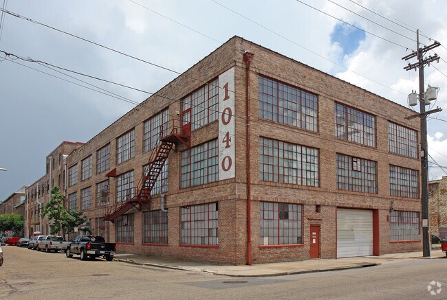
1040 Magazine St
1-02-1-034-01
SQ 137 LOTS P A OR 15 1 & 2 68 11 X 117 10 SQ FT = 8120 3-STORY BUILDING 2/95 PERMIT #B-25688
Warehouse
Orleans
X
Louisiana
22051C0225F
p
2024
0.19 AC
2025
Warehouse/Arts District
007700
New Orleans/Metairie/Kenner
23,802 SF
New Orleans-Metairie, LA
DEMOGRAPHICS near 1040 Magazine St
1 Mile
3 Mile
5 Mile
2024 Total Population
19,647
172,701
349,871
2029 Population
19,576
168,103
338,093
Pop Growth 2024-2029
(0.36%)
(2.66%)
(3.37%)
Average Age
42
41
41
2024 Total Households
11,809
82,475
154,616
HH Growth 2024-2029
(0.06%)
(2.59%)
(3.38%)
Median Household Inc
$56,616
$49,073
$48,903
Avg Household Size
1.60
2.00
2.10
2024 Avg HH Vehicles
1.00
1.00
1.00
Median Home Value
$452,010
$360,483
$276,173
Median Year Built
1952
1948
1955
Nearby Places
Map Layers
Map Styles
 Street
 Aerial
- Restaurants
- Banks
- Shops
- Fitness
- Groceries
PUBLIC TRANSPORTATION
TRANSIT/SUBWAY
St Charles At Lee Circle (St. Charles Streetcar - New Orleans Regional Transit Authority Streetcars (New Orleans Streetcars))
DRIVE
WALK
Distance
St Charles At Lee Circle (St. Charles Streetcar - New Orleans Regional Transit Authority Streetcars (New Orleans Streetcars))
0 min
5 min
0.3 mi
Howard And Carondelet (St. Charles Streetcar - NORTA)
DRIVE
WALK
Distance
Howard And Carondelet (St. Charles Streetcar - NORTA)
1 min
6 min
0.3 mi
St Charles And Erato (St. Charles Streetcar - New Orleans Regional Transit Authority Streetcars (New Orleans Streetcars))
DRIVE
WALK
Distance
St Charles And Erato (St. Charles Streetcar - New Orleans Regional Transit Authority Streetcars (New Orleans Streetcars))
1 min
7 min
0.4 mi
St Charles And Mlk Blvd/Melpomene (St. Charles Streetcar - New Orleans Regional Transit Authority Streetcars (New Orleans Streetcars))
DRIVE
WALK
Distance
St Charles And Mlk Blvd/Melpomene (St. Charles Streetcar - New Orleans Regional Transit Authority Streetcars (New Orleans Streetcars))
1 min
9 min
0.5 mi
St Charles And Girod (St. Charles Streetcar - New Orleans Regional Transit Authority Streetcars (New Orleans Streetcars))
DRIVE
WALK
Distance
St Charles And Girod (St. Charles Streetcar - New Orleans Regional Transit Authority Streetcars (New Orleans Streetcars))
2 min
9 min
0.5 mi
COMMUTER RAIL
New Orleans Union Passenger Terminal (City of New Orleans - Amtrak, Crescent - Amtrak, Sunset Limited - Amtrak)
DRIVE
WALK
Distance
New Orleans Union Passenger Terminal (City of New Orleans - Amtrak, Crescent - Amtrak, Sunset Limited - Amtrak)
2 min
13 min
0.7 mi
AIRPORT
Louis Armstrong New Orleans International
DRIVE
WALK
Distance
Louis Armstrong New Orleans International
21 min
15.2 mi
Freight Ports
Port of New Orleans
DRIVE
WALK
Distance
Port of New Orleans
7 min
2.0 mi
SALE & LEASE HISTORY
LISTING DATE
SALE/LEASE

Mar 19, 2020
For Sale
Nearby Properties
Address
Land Use
TOTAL SIZE
Lot Size
Zoning
Address
Land Use
TOTAL SIZE
Lot Size
Zoning
300 SF
2.19 AC
LS
Address
Land Use
TOTAL SIZE
Lot Size
Zoning
85,052 SF
2.19 AC
LS
Address
Land Use
TOTAL SIZE
Lot Size
Zoning
80.92 AC
EC
Address
Land Use
TOTAL SIZE
Lot Size
Zoning
44.43 AC
CBD-4
Address
Land Use
TOTAL SIZE
Lot Size
Zoning
66.23 AC
CBD-4
Address
Land Use
TOTAL SIZE
Lot Size
Zoning
3.66 AC
MC
Address
Land Use
TOTAL SIZE
Lot Size
Zoning
834,043 SF
1.40 AC
CBD-2
Address
Land Use
TOTAL SIZE
Lot Size
Zoning
18.31 AC
CBD-4
Address
Land Use
TOTAL SIZE
Lot Size
Zoning
1.87 AC
CBD-2
Address
Land Use
TOTAL SIZE
Lot Size
Zoning
6.64 AC
Address
Land Use
TOTAL SIZE
Lot Size
Zoning
844,362 SF
5.85 AC
CBD-4
Address
Land Use
TOTAL SIZE
Lot Size
Zoning
0.12 AC
Address
Land Use
TOTAL SIZE
Lot Size
Zoning
30.63 AC
Address
Land Use
TOTAL SIZE
Lot Size
Zoning
444,121 SF
1.46 AC
CBD-1
Address
Land Use
TOTAL SIZE
Lot Size
Zoning
0.88 AC
CBD-2
Address
Land Use
TOTAL SIZE
Lot Size
Zoning
22.17 AC
Address
Land Use
TOTAL SIZE
Lot Size
Zoning
1.91 AC
CBD-1
Address
Land Use
TOTAL SIZE
Lot Size
Zoning
576,962 SF
3.31 AC
CBD-4
Address
Land Use
TOTAL SIZE
Lot Size
Zoning
1.79 AC
Address
Land Use
TOTAL SIZE
Lot Size
Zoning
512,729 SF
6.60 AC
Address
Land Use
TOTAL SIZE
Lot Size
Zoning
1.24 AC
CBD-1
Address
Land Use
TOTAL SIZE
Lot Size
Zoning
190,708 SF
1.09 AC
CBD-2
Address
Land Use
TOTAL SIZE
Lot Size
Zoning
499,287 SF
1.44 AC
VCE
Address
Land Use
TOTAL SIZE
Lot Size
Zoning
0.67 AC
CBD-3
Address
Land Use
TOTAL SIZE
Lot Size
Zoning
202,291 SF
4.04 AC
HU-RD2
Address
Land Use
TOTAL SIZE
Lot Size
Zoning
162,382 SF
1.25 AC
CBD-2
Address
Land Use
TOTAL SIZE
Lot Size
Zoning
258,024 SF
0.63 AC
CBD-2
Address
Land Use
TOTAL SIZE
Lot Size
Zoning
2.94 AC
CBD-1
Address
Land Use
TOTAL SIZE
Lot Size
Zoning
4.12 AC
Address
Land Use
TOTAL SIZE
Lot Size
Zoning
462,672 SF
1.11 AC
CBD-1
The World's #1 Commercial Real Estate Marketplace
Connect with us
© 2026 CoStar Group
The information above has been obtained from sources believed reliable. While we do not doubt its accuracy we have not verified it and make no guarantee, warranty or representation about it. It is your responsibility to independently confirm its accuracy and completeness. Any projections, opinions, assumptions, or estimates used are for example only and do not represent the current or future performance of the property. The value of this transaction to you depends on tax and other factors which should be evaluated by your tax, financial, and legal advisors. You and your advisors should conduct a careful, independent investigation of the property to determine to your satisfaction the suitability of the property for your needs.