Property Record
1040 W Main St, Middleton, ID 83644
NEARBY LISTINGS FOR SALE OR LEASE
Property Detail
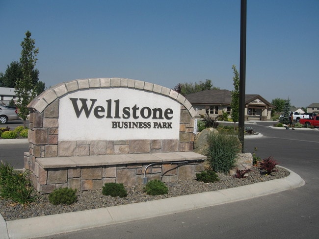
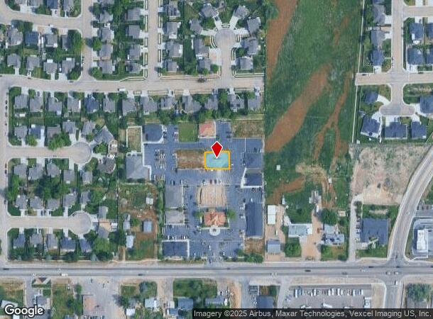
1040 W Main St
Boise City, ID
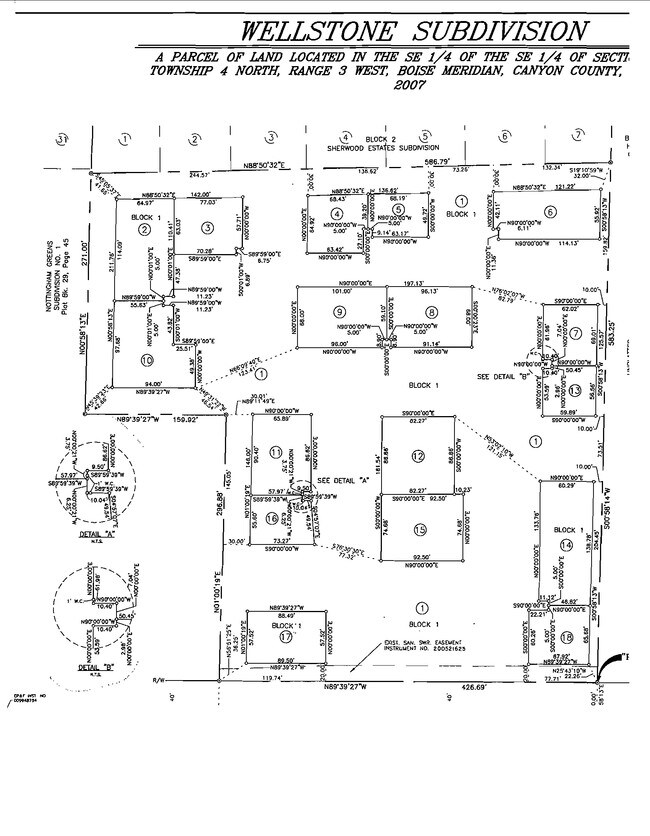
Wellstone Sub
1789510700
01-4N-3W SE WELLSTONE SUB LT 8 BLK 1
Commercialacreage
Canyon
X
Idaho
16027C0234G
8
2024
0.15 AC
2025
Middleton
021907
Boise City/Nampa
DEMOGRAPHICS near 1040 W Main St
1 mile
3 mile
5 mile
2024 Total Population
5,869
25,095
61,681
2029 Population
7,166
30,838
75,537
Pop Growth 2024-2029
+ 22.10%
+ 22.89%
+ 22.46%
Average Age
37
37
36
2024 Total Households
1,945
8,120
20,248
HH Growth 2024-2029
+ 22.47%
+ 23.17%
+ 22.75%
Median Household Inc
$70,760
$71,278
$63,532
Avg Household Size
3.00
3.10
3.00
2024 Avg HH Vehicles
3.00
3.00
2.00
Median Home Value
$363,834
$366,006
$348,607
Median Year Built
2005
2002
1997
Nearby Places
Map Layers
Map Styles
 Street
 Aerial
Transit
 Traffic
 Biking
Places
Listings with unknown addresses are not visible on the map
- Restaurants
- Banks
- Shops
- Fitness
- Groceries
PUBLIC TRANSPORTATION
AIRPORT
Boise Air Trml/Gowen Field
Drive
Walk
Distance
Boise Air Trml/Gowen Field
45 min
33.3 mi
Nearby Properties
Address
Land Use
TOTAL SIZE
Lot Size
Zoning
Address
Land Use
TOTAL SIZE
Lot Size
Zoning
15.55 AC
Address
Land Use
TOTAL SIZE
Lot Size
Zoning
16.40 AC
Address
Land Use
TOTAL SIZE
Lot Size
Zoning
1,566 SF
36.60 AC
Address
Land Use
TOTAL SIZE
Lot Size
Zoning
Address
Land Use
TOTAL SIZE
Lot Size
Zoning
25.87 AC
Address
Land Use
TOTAL SIZE
Lot Size
Zoning
4.63 AC
Address
Land Use
TOTAL SIZE
Lot Size
Zoning
55,920 SF
7.47 AC
M1
Address
Land Use
TOTAL SIZE
Lot Size
Zoning
9.55 AC
Address
Land Use
TOTAL SIZE
Lot Size
Zoning
5,020 SF
21.89 AC
C2
Address
Land Use
TOTAL SIZE
Lot Size
Zoning
20.18 AC
Address
Land Use
TOTAL SIZE
Lot Size
Zoning
7.56 AC
Address
Land Use
TOTAL SIZE
Lot Size
Zoning
4.93 AC
Address
Land Use
TOTAL SIZE
Lot Size
Zoning
4.47 AC
Address
Land Use
TOTAL SIZE
Lot Size
Zoning
2.04 AC
Address
Land Use
TOTAL SIZE
Lot Size
Zoning
68.92 AC
Address
Land Use
TOTAL SIZE
Lot Size
Zoning
15.69 AC
M1
Address
Land Use
TOTAL SIZE
Lot Size
Zoning
4.89 AC
M1
Address
Land Use
TOTAL SIZE
Lot Size
Zoning
4.50 AC
CR-C2
Address
Land Use
TOTAL SIZE
Lot Size
Zoning
13.44 AC
Address
Land Use
TOTAL SIZE
Lot Size
Zoning
1.08 AC
M1
Address
Land Use
TOTAL SIZE
Lot Size
Zoning
2.53 AC
Address
Land Use
TOTAL SIZE
Lot Size
Zoning
1,368 SF
4.73 AC
Address
Land Use
TOTAL SIZE
Lot Size
Zoning
14.45 AC
Address
Land Use
TOTAL SIZE
Lot Size
Zoning
2.36 AC
M1
Address
Land Use
TOTAL SIZE
Lot Size
Zoning
62,950 SF
8.40 AC
M1
Address
Land Use
TOTAL SIZE
Lot Size
Zoning
3.76 AC
Address
Land Use
TOTAL SIZE
Lot Size
Zoning
23.41 AC
C1
Address
Land Use
TOTAL SIZE
Lot Size
Zoning
49.81 AC
R1
Address
Land Use
TOTAL SIZE
Lot Size
Zoning
Address
Land Use
TOTAL SIZE
Lot Size
Zoning
6.03 AC
CR-C2
The World's #1 Commercial Real Estate Marketplace
Connect with us
© 2026 CoStar Group
The information above has been obtained from sources believed reliable. While we do not doubt its accuracy we have not verified it and make no guarantee, warranty or representation about it. It is your responsibility to independently confirm its accuracy and completeness. Any projections, opinions, assumptions, or estimates used are for example only and do not represent the current or future performance of the property. The value of this transaction to you depends on tax and other factors which should be evaluated by your tax, financial, and legal advisors. You and your advisors should conduct a careful, independent investigation of the property to determine to your satisfaction the suitability of the property for your needs.