Property Record
10400 Harry J Parrish Blvd, Manassas, VA 20110
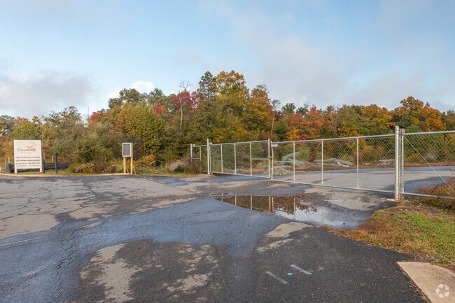


Property Detail
10400 Harry J Parrish Blvd
Washington-Arlington-Alexandria, DC-VA-MD-WV
PCL 2
7695-50-2997
PRINCE WILLIAM
Vacantlandnec
Virginia
M2
2691
2024
30.22 AC
2025
Manassas
901304
Washington, DC
NEARBY LISTINGS FOR SALE OR LEASE
DEMOGRAPHICS near 10400 Harry J Parrish Blvd
1 mile
3 mile
5 mile
2025 Total Population
2,177
56,754
170,492
2030 Population
2,260
58,226
174,277
Pop Growth 2025-2030
+ 3.81%
+ 2.59%
+ 2.22%
Average Age
37
36
36
2025 Total Households
703
18,226
53,513
HH Growth 2025-2030
+ 4.13%
+ 2.61%
+ 2.22%
Median Household Inc
$197,868
$126,037
$119,809
Avg Household Size
3.00
3.00
3.10
2025 Avg HH Vehicles
2.00
2.00
2.00
Median Home Value
$608,724
$517,972
$494,838
Median Year Built
1997
1992
1991
Nearby Places
Map Layers
Map Styles
 Street
 Aerial
Layers
 Traffic
 Biking
Places
Listings with unknown addresses are not visible on the map
- Restaurants
- Banks
- Shops
- Fitness
- Groceries
PUBLIC TRANSPORTATION
COMMUTER RAIL
Lead (Manassas Line - Virginia Railway Express)
Drive
Walk
Distance
Lead (Manassas Line - Virginia Railway Express)
7 min
3.0 mi
Manassas Amtrak Station (Cardinal - Amtrak, Crescent - Amtrak, Manassas Line - Amtrak, Northeast Regional - Amtrak)
Drive
Walk
Distance
Manassas Amtrak Station (Cardinal - Amtrak, Crescent - Amtrak, Manassas Line - Amtrak, Northeast Regional - Amtrak)
9 min
3.7 mi
AIRPORT
Washington Dulles International
Drive
Walk
Distance
Washington Dulles International
40 min
25.7 mi
Ronald Reagan Washington Ntl
Drive
Walk
Distance
Ronald Reagan Washington Ntl
54 min
40.3 mi
Freight Ports
Port of Baltimore
Drive
Walk
Distance
Port of Baltimore
99 min
76.1 mi
Nearby Properties
Address
Land Use
TOTAL SIZE
Lot Size
Zoning
Address
Land Use
TOTAL SIZE
Lot Size
Zoning
795,191 SF
82.58 AC
M1
Address
Land Use
TOTAL SIZE
Lot Size
Zoning
347,876 SF
23.23 AC
PBD
Address
Land Use
TOTAL SIZE
Lot Size
Zoning
394,593 SF
27.60 AC
MT
Address
Land Use
TOTAL SIZE
Lot Size
Zoning
233,757 SF
15.54 AC
PBD
Address
Land Use
TOTAL SIZE
Lot Size
Zoning
223,757 SF
15.92 AC
PBD
Address
Land Use
TOTAL SIZE
Lot Size
Zoning
216,067 SF
15.85 AC
PBD
Address
Land Use
TOTAL SIZE
Lot Size
Zoning
213,320 SF
31.06 AC
PBD
Address
Land Use
TOTAL SIZE
Lot Size
Zoning
305,510 SF
22.72 AC
M2
Address
Land Use
TOTAL SIZE
Lot Size
Zoning
269,091 SF
32.31 AC
M2
Address
Land Use
TOTAL SIZE
Lot Size
Zoning
224,652 SF
12.05 AC
PBD
Address
Land Use
TOTAL SIZE
Lot Size
Zoning
241,249 SF
12.58 AC
PBD
Address
Land Use
TOTAL SIZE
Lot Size
Zoning
281,000 SF
10.08 AC
PBD
Address
Land Use
TOTAL SIZE
Lot Size
Zoning
259,200 SF
14.22 AC
PBD
Address
Land Use
TOTAL SIZE
Lot Size
Zoning
656,797 SF
Address
Land Use
TOTAL SIZE
Lot Size
Zoning
824,085 SF
120.07 AC
MIXED
Address
Land Use
TOTAL SIZE
Lot Size
Zoning
139,000 SF
9.78 AC
PBD
Address
Land Use
TOTAL SIZE
Lot Size
Zoning
247,608 SF
19.50 AC
PBD
Address
Land Use
TOTAL SIZE
Lot Size
Zoning
127,000 SF
12.40 AC
M2
Address
Land Use
TOTAL SIZE
Lot Size
Zoning
440,331 SF
61.47 AC
M1
Address
Land Use
TOTAL SIZE
Lot Size
Zoning
409,252 SF
18.75 AC
M2
Address
Land Use
TOTAL SIZE
Lot Size
Zoning
136,228 SF
9.19 AC
M2
Address
Land Use
TOTAL SIZE
Lot Size
Zoning
270,540 SF
13.65 AC
PBD
Address
Land Use
TOTAL SIZE
Lot Size
Zoning
352,030 SF
21.14 AC
PBD
Address
Land Use
TOTAL SIZE
Lot Size
Zoning
352,401 SF
91.60 AC
M2
Address
Land Use
TOTAL SIZE
Lot Size
Zoning
395,617 SF
19.08 AC
PMD
Address
Land Use
TOTAL SIZE
Lot Size
Zoning
187,752 SF
20.77 AC
HEAVY INDU
Address
Land Use
TOTAL SIZE
Lot Size
Zoning
51.84 AC
MIXED
Address
Land Use
TOTAL SIZE
Lot Size
Zoning
2,357 SF
216.41 AC
AIRPORT
Address
Land Use
TOTAL SIZE
Lot Size
Zoning
402,295 SF
8.50 AC
A1
Address
Land Use
TOTAL SIZE
Lot Size
Zoning
203,544 SF
20.90 AC
GENERAL CO
The World's #1 Commercial Real Estate Marketplace
Connect with us
© 2026 CoStar Group
The information above has been obtained from sources believed reliable. While we do not doubt its accuracy we have not verified it and make no guarantee, warranty or representation about it. It is your responsibility to independently confirm its accuracy and completeness. Any projections, opinions, assumptions, or estimates used are for example only and do not represent the current or future performance of the property. The value of this transaction to you depends on tax and other factors which should be evaluated by your tax, financial, and legal advisors. You and your advisors should conduct a careful, independent investigation of the property to determine to your satisfaction the suitability of the property for your needs.