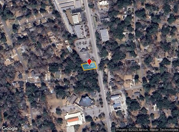
Property Record
1041 Folly Rd, Charleston, SC 29412

NEARBY LISTINGS FOR SALE OR LEASE
Property Detail
1041 Folly Rd
Charleston-North Charleston, SC
Centerville
337-04-00-126
SUBDIVISION NAME -CENTERVILLE DESCRIPTION -LOT 32A SECTION C UNIT #5363 SITE NAME -DOMINO'S PIZZA
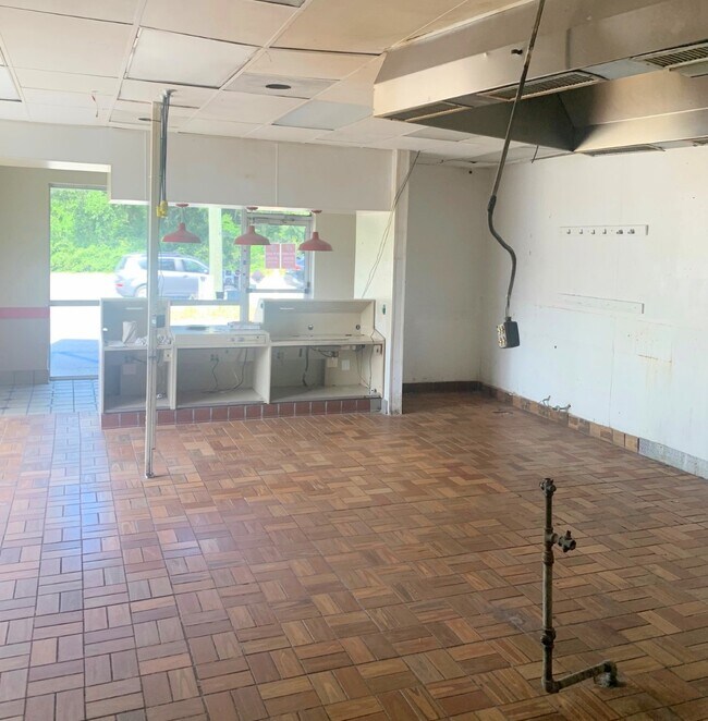
Restaurantbuilding
Charleston
AE
South Carolina
45019C0677K
32a
2025
0.20 AC
2024
James Island/Folly Beach
002008
Charleston/N Charleston
1,335 SF
DEMOGRAPHICS near 1041 Folly Rd
1 Mile
3 Mile
5 Mile
2024 Total Population
8,497
35,708
83,684
2029 Population
8,989
38,007
89,938
Pop Growth 2024-2029
+ 5.79%
+ 6.44%
+ 7.47%
Average Age
43
41
40
2024 Total Households
4,070
15,848
37,802
HH Growth 2024-2029
+ 5.65%
+ 6.36%
+ 7.43%
Median Household Inc
$75,434
$86,672
$82,055
Avg Household Size
2.00
2.20
2.10
2024 Avg HH Vehicles
2.00
2.00
2.00
Median Home Value
$314,856
$383,405
$446,113
Median Year Built
1985
1987
1980
Nearby Places
Map Layers
Map Styles
 Street
 Aerial
- Restaurants
- Banks
- Shops
- Fitness
- Groceries
PUBLIC TRANSPORTATION
AIRPORT
Charleston AFB/International
DRIVE
WALK
Distance
Charleston AFB/International
31 min
17.2 mi
Freight Ports
Columbus Street Terminal
DRIVE
WALK
Distance
Columbus Street Terminal
12 min
6.3 mi
SALE & LEASE HISTORY
LISTING DATE
SALE/LEASE

Jun 21, 2021
For Lease
Nearby Properties
Address
Land Use
TOTAL SIZE
Lot Size
Zoning
Address
Land Use
TOTAL SIZE
Lot Size
Zoning
3,780 SF
14.35 AC
Address
Land Use
TOTAL SIZE
Lot Size
Zoning
14,474 SF
23.53 AC
Address
Land Use
TOTAL SIZE
Lot Size
Zoning
257,500 SF
4.72 AC
Address
Land Use
TOTAL SIZE
Lot Size
Zoning
12,766 SF
1.72 AC
Address
Land Use
TOTAL SIZE
Lot Size
Zoning
Address
Land Use
TOTAL SIZE
Lot Size
Zoning
119.64 AC
Address
Land Use
TOTAL SIZE
Lot Size
Zoning
16,775 SF
5.93 AC
Address
Land Use
TOTAL SIZE
Lot Size
Zoning
Address
Land Use
TOTAL SIZE
Lot Size
Zoning
7,722 SF
20.48 AC
Address
Land Use
TOTAL SIZE
Lot Size
Zoning
3.11 AC
Address
Land Use
TOTAL SIZE
Lot Size
Zoning
Address
Land Use
TOTAL SIZE
Lot Size
Zoning
1.11 AC
Address
Land Use
TOTAL SIZE
Lot Size
Zoning
2,896 SF
18.13 AC
Address
Land Use
TOTAL SIZE
Lot Size
Zoning
65,397 SF
2.46 AC
Address
Land Use
TOTAL SIZE
Lot Size
Zoning
11.80 AC
Address
Land Use
TOTAL SIZE
Lot Size
Zoning
5,988 SF
10 AC
Address
Land Use
TOTAL SIZE
Lot Size
Zoning
7.46 AC
Address
Land Use
TOTAL SIZE
Lot Size
Zoning
1.13 AC
C-C
Address
Land Use
TOTAL SIZE
Lot Size
Zoning
3.94 AC
Address
Land Use
TOTAL SIZE
Lot Size
Zoning
8,172 SF
8.89 AC
Address
Land Use
TOTAL SIZE
Lot Size
Zoning
39,428 SF
17.98 AC
Address
Land Use
TOTAL SIZE
Lot Size
Zoning
1,348 SF
6.87 AC
Address
Land Use
TOTAL SIZE
Lot Size
Zoning
27,900 SF
158.54 AC
Address
Land Use
TOTAL SIZE
Lot Size
Zoning
122,930 SF
22.78 AC
Address
Land Use
TOTAL SIZE
Lot Size
Zoning
61,072 SF
6.38 AC
Address
Land Use
TOTAL SIZE
Lot Size
Zoning
11,270 SF
1.16 AC
Address
Land Use
TOTAL SIZE
Lot Size
Zoning
37,889 SF
11.06 AC
Address
Land Use
TOTAL SIZE
Lot Size
Zoning
119,883 SF
14.95 AC
Address
Land Use
TOTAL SIZE
Lot Size
Zoning
Address
Land Use
TOTAL SIZE
Lot Size
Zoning
2,459 SF
0.39 AC
The World's #1 Commercial Real Estate Marketplace
Connect with us
© 2025 CoStar Group
The information above has been obtained from sources believed reliable. While we do not doubt its accuracy we have not verified it and make no guarantee, warranty or representation about it. It is your responsibility to independently confirm its accuracy and completeness. Any projections, opinions, assumptions, or estimates used are for example only and do not represent the current or future performance of the property. The value of this transaction to you depends on tax and other factors which should be evaluated by your tax, financial, and legal advisors. You and your advisors should conduct a careful, independent investigation of the property to determine to your satisfaction the suitability of the property for your needs.