Property Record
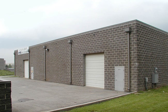
10415 Ns Nt Rd, Lenexa, KS 66219

Property Detail
10415 Ns Nt Rd
IP57600005-000A
PARK-LEN II INDUSTRIAL ESTATESPT BLK 5 BG 100 E NW CR 9-13-24 E 230 TO W RTWY/L HWYSE 124.5 & 355.10 SW 305.80W 75 NW 126.7 N 220.8 NE 344.61 TO BG EX BG 330 E & 124.5 SE NW CR 9-13-24 SE 83SW 302.9 W 75 N 30.80 NE 378.6 TO BG EX BG 371.18 S 50 E NW
Commercialnec
JOHNSON
BP2
Kansas
B and X Area of moderate flood hazard, usually the area between the limits of the 100-year and 500-year floods.
1.41 AC
0
Olathe
2025
Kansas City
052415
Kansas City, MO-KS
10,000 SF
NEARBY LISTINGS FOR SALE OR LEASE
DEMOGRAPHICS near 10415 Ns Nt Rd
1 mile
3 mile
5 mile
2025 Total Population
407
76,490
230,822
2030 Population
412
79,090
238,063
Pop Growth 2025-2030
+ 1.23%
+ 3.40%
+ 3.14%
Average Age
39
41
40
2025 Total Households
188
33,251
95,518
HH Growth 2025-2030
+ 1.60%
+ 3.52%
+ 3.22%
Median Household Inc
$87,162
$92,526
$93,587
Avg Household Size
2.20
2.20
2.30
2025 Avg HH Vehicles
2.00
2.00
2.00
Median Home Value
$337,857
$354,852
$359,513
Median Year Built
1977
1989
1987
Nearby Places
Map Layers
Map Styles
 Street
 Aerial
Layers
 Traffic
 Biking
Places
Listings with unknown addresses are not visible on the map
- Restaurants
- Banks
- Shops
- Fitness
- Groceries
PUBLIC TRANSPORTATION
AIRPORT
Kansas City International
Drive
Walk
Distance
Kansas City International
42 min
33.5 mi
Freight Ports
Tulsa Port Of Catoosa
Drive
Walk
Distance
Tulsa Port Of Catoosa
255 min
227.9 mi
Nearby Properties
Address
Land Use
TOTAL SIZE
Lot Size
Zoning
Address
Land Use
TOTAL SIZE
Lot Size
Zoning
1,051,458 SF
74.32 AC
R-1
Address
Land Use
TOTAL SIZE
Lot Size
Zoning
787,363 SF
88.91 AC
RP5
Address
Land Use
TOTAL SIZE
Lot Size
Zoning
312,726 SF
13.73 AC
RP-4
Address
Land Use
TOTAL SIZE
Lot Size
Zoning
162,499 SF
38.74 AC
R-1
Address
Land Use
TOTAL SIZE
Lot Size
Zoning
247,991 SF
21.19 AC
R-1
Address
Land Use
TOTAL SIZE
Lot Size
Zoning
88,459 SF
15.13 AC
R-1
Address
Land Use
TOTAL SIZE
Lot Size
Zoning
635,676 SF
30.59 AC
BP2
Address
Land Use
TOTAL SIZE
Lot Size
Zoning
564,948 SF
27.40 AC
AG
Address
Land Use
TOTAL SIZE
Lot Size
Zoning
606,171 SF
31 AC
BP2
Address
Land Use
TOTAL SIZE
Lot Size
Zoning
208,693 SF
22.30 AC
BP1
Address
Land Use
TOTAL SIZE
Lot Size
Zoning
211,785 SF
35.56 AC
RP-3
Address
Land Use
TOTAL SIZE
Lot Size
Zoning
199,452 SF
29.81 AC
R-1
Address
Land Use
TOTAL SIZE
Lot Size
Zoning
133,932 SF
3.29 AC
CC
Address
Land Use
TOTAL SIZE
Lot Size
Zoning
144,755 SF
22.19 AC
BP2
Address
Land Use
TOTAL SIZE
Lot Size
Zoning
512,680 SF
18.03 AC
R-1
Address
Land Use
TOTAL SIZE
Lot Size
Zoning
304,926 SF
7.87 AC
CC
Address
Land Use
TOTAL SIZE
Lot Size
Zoning
166,039 SF
35.38 AC
R-1
Address
Land Use
TOTAL SIZE
Lot Size
Zoning
129,784 SF
36.15 AC
CPO
Address
Land Use
TOTAL SIZE
Lot Size
Zoning
202,726 SF
9.37 AC
R-1
Address
Land Use
TOTAL SIZE
Lot Size
Zoning
404,388 SF
21.55 AC
BP2
Address
Land Use
TOTAL SIZE
Lot Size
Zoning
49,029 SF
15.02 AC
BP1
Address
Land Use
TOTAL SIZE
Lot Size
Zoning
222,396 SF
14.76 AC
BP2
Address
Land Use
TOTAL SIZE
Lot Size
Zoning
69,872 SF
1.91 AC
CC
Address
Land Use
TOTAL SIZE
Lot Size
Zoning
89,226 SF
4.37 AC
R-1
Address
Land Use
TOTAL SIZE
Lot Size
Zoning
347,324 SF
18.16 AC
BP2
Address
Land Use
TOTAL SIZE
Lot Size
Zoning
146,143 SF
10.59 AC
CP-2
Address
Land Use
TOTAL SIZE
Lot Size
Zoning
107,857 SF
10.94 AC
C-2
Address
Land Use
TOTAL SIZE
Lot Size
Zoning
120,492 SF
10 AC
R1
Address
Land Use
TOTAL SIZE
Lot Size
Zoning
411,435 SF
17.41 AC
CP-2
Address
Land Use
TOTAL SIZE
Lot Size
Zoning
94,034 SF
6.96 AC
MXD
The World's #1 Commercial Real Estate Marketplace
Connect with us
© 2026 CoStar Group
The information above has been obtained from sources believed reliable. While we do not doubt its accuracy we have not verified it and make no guarantee, warranty or representation about it. It is your responsibility to independently confirm its accuracy and completeness. Any projections, opinions, assumptions, or estimates used are for example only and do not represent the current or future performance of the property. The value of this transaction to you depends on tax and other factors which should be evaluated by your tax, financial, and legal advisors. You and your advisors should conduct a careful, independent investigation of the property to determine to your satisfaction the suitability of the property for your needs.