Property Record
10415 Quebec Ave, Bloomington, MN 55438
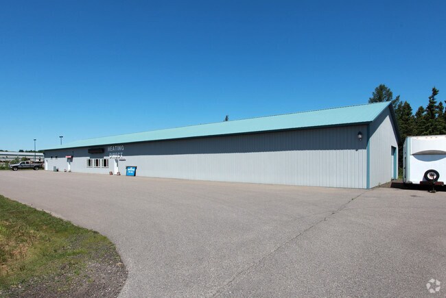


Property Detail
10415 Quebec Ave
387001004021
THAT PART OF G.L.6 DESCRIBED AS FOLLOWS COMMAT SE COR OF SEC 36 THENCE N ALONG E LINE OFSEC 36 1865.50 FT THENCE N70DEG44'00"W 422.65FT THENCE N 22.04 FT THENCE N75DEG32'34"W2.74 FT TO W LINE OF E 403.07 FT OF G.L.6 ANDPT OF BEG THENCE S75DEG32'34"E
Multifamilydwelling
Hennepin
A Areas with a 1% annual chance of flooding and a 26% chance of flooding over the life of a 30-year mortgage.
Minnesota
2026
1.20 AC
2024
North St Louis County
015502
Duluth
2,226 SF
Duluth, MN-WI
NEARBY LISTINGS FOR SALE OR LEASE
DEMOGRAPHICS near 10415 Quebec Ave
1 mile
3 mile
5 mile
2025 Total Population
1,623
10,318
15,013
2030 Population
1,615
10,342
15,083
Pop Growth 2025-2030
(0.49%)
+ 0.23%
+ 0.47%
Average Age
45
44
43
2025 Total Households
768
4,907
7,077
HH Growth 2025-2030
(0.52%)
+ 0.14%
+ 0.34%
Median Household Inc
$75,495
$50,321
$49,960
Avg Household Size
2.00
1.90
2.00
2025 Avg HH Vehicles
2.00
1.00
2.00
Median Home Value
$172,772
$149,251
$138,771
Median Year Built
1972
1954
1954
Nearby Places
Map Layers
Map Styles
 Street
 Aerial
Layers
 Traffic
 Biking
Places
Listings with unknown addresses are not visible on the map
- Restaurants
- Banks
- Shops
- Fitness
- Groceries
PUBLIC TRANSPORTATION
AIRPORT
Minneapolis-St Paul International/Wold-Chamberlain
Drive
Walk
Distance
Minneapolis-St Paul International/Wold-Chamberlain
22 min
13.9 mi
Freight Ports
Port Milwaukee
Drive
Walk
Distance
Port Milwaukee
391 min
351.0 mi
Nearby Properties
Address
Land Use
TOTAL SIZE
Lot Size
Zoning
Address
Land Use
TOTAL SIZE
Lot Size
Zoning
22,654 SF
5.22 AC
Address
Land Use
TOTAL SIZE
Lot Size
Zoning
461,748 SF
5.87 AC
Address
Land Use
TOTAL SIZE
Lot Size
Zoning
25,780 SF
5.24 AC
Address
Land Use
TOTAL SIZE
Lot Size
Zoning
114,152 SF
18.42 AC
Address
Land Use
TOTAL SIZE
Lot Size
Zoning
38.59 AC
Address
Land Use
TOTAL SIZE
Lot Size
Zoning
581,195 SF
37 AC
Address
Land Use
TOTAL SIZE
Lot Size
Zoning
105,658 SF
18.80 AC
Address
Land Use
TOTAL SIZE
Lot Size
Zoning
22,119 SF
4.02 AC
Address
Land Use
TOTAL SIZE
Lot Size
Zoning
45,147 SF
11.24 AC
Address
Land Use
TOTAL SIZE
Lot Size
Zoning
85,614 SF
11.77 AC
Address
Land Use
TOTAL SIZE
Lot Size
Zoning
88,213 SF
3.77 AC
Address
Land Use
TOTAL SIZE
Lot Size
Zoning
102,132 SF
15.02 AC
Address
Land Use
TOTAL SIZE
Lot Size
Zoning
436,995 SF
22.36 AC
Address
Land Use
TOTAL SIZE
Lot Size
Zoning
70,904 SF
17.42 AC
Address
Land Use
TOTAL SIZE
Lot Size
Zoning
83,736 SF
11.69 AC
Address
Land Use
TOTAL SIZE
Lot Size
Zoning
43,038 SF
10.81 AC
Address
Land Use
TOTAL SIZE
Lot Size
Zoning
310,400 SF
18.60 AC
Address
Land Use
TOTAL SIZE
Lot Size
Zoning
17.85 AC
Address
Land Use
TOTAL SIZE
Lot Size
Zoning
217,534 SF
18.77 AC
Address
Land Use
TOTAL SIZE
Lot Size
Zoning
59,036 SF
9.34 AC
RM25
Address
Land Use
TOTAL SIZE
Lot Size
Zoning
131,981 SF
15.18 AC
RM25
Address
Land Use
TOTAL SIZE
Lot Size
Zoning
47,509 SF
4.64 AC
Address
Land Use
TOTAL SIZE
Lot Size
Zoning
122,765 SF
4.58 AC
Address
Land Use
TOTAL SIZE
Lot Size
Zoning
Address
Land Use
TOTAL SIZE
Lot Size
Zoning
206,005 SF
13.97 AC
Address
Land Use
TOTAL SIZE
Lot Size
Zoning
153,796 SF
17.93 AC
Address
Land Use
TOTAL SIZE
Lot Size
Zoning
52,548 SF
1.86 AC
Address
Land Use
TOTAL SIZE
Lot Size
Zoning
216,770 SF
39.51 AC
Address
Land Use
TOTAL SIZE
Lot Size
Zoning
85,406 SF
6 AC
RM25
Address
Land Use
TOTAL SIZE
Lot Size
Zoning
15.86 AC
The World's #1 Commercial Real Estate Marketplace
Connect with us
© 2026 CoStar Group
The information above has been obtained from sources believed reliable. While we do not doubt its accuracy we have not verified it and make no guarantee, warranty or representation about it. It is your responsibility to independently confirm its accuracy and completeness. Any projections, opinions, assumptions, or estimates used are for example only and do not represent the current or future performance of the property. The value of this transaction to you depends on tax and other factors which should be evaluated by your tax, financial, and legal advisors. You and your advisors should conduct a careful, independent investigation of the property to determine to your satisfaction the suitability of the property for your needs.