Property Record
1042 Cainhoy Rd, Charleston, SC 29492


NEARBY LISTINGS FOR SALE OR LEASE
-
-
View all Charleston listings for sale on LoopNet.com
Property Detail
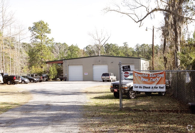
1042 Cainhoy Rd
263-00-01-011
East Cainhoy Commercial Values
Distributionwarehouseregional
ASSESSMENT DISTRICT: 914WAREHOUSE (DISTR)TR.A
X
Berkeley
45019C0340K
South Carolina
2025
0.63 AC
2025
Daniel Island
020405
Charleston/N Charleston
2,400 SF
Charleston-North Charleston, SC
DEMOGRAPHICS near 1042 Cainhoy Rd
1 Mile
3 Mile
5 Mile
2024 Total Population
1,531
12,780
31,095
2029 Population
1,816
14,299
34,303
Pop Growth 2024-2029
+ 18.62%
+ 11.89%
+ 10.32%
Average Age
39
40
41
2024 Total Households
588
4,648
11,394
HH Growth 2024-2029
+ 18.71%
+ 12.31%
+ 10.55%
Median Household Inc
$102,206
$124,882
$110,758
Avg Household Size
2.50
2.70
2.70
2024 Avg HH Vehicles
2.00
2.00
2.00
Median Home Value
$353,174
$484,801
$497,533
Median Year Built
2006
2006
2007
Nearby Places
Map Layers
Map Styles
 Street
 Aerial
- Restaurants
- Banks
- Shops
- Fitness
- Groceries
PUBLIC TRANSPORTATION
AIRPORT
Charleston AFB/International
DRIVE
WALK
Distance
Charleston AFB/International
30 min
19.1 mi
Freight Ports
Wando Welch Terminal
DRIVE
WALK
Distance
Wando Welch Terminal
21 min
13.5 mi
SALE & LEASE HISTORY
LISTING DATE
SALE/LEASE

Mar 31, 2022
For Sale
Jul 10, 2024
For Sale
Nearby Properties
Address
Land Use
TOTAL SIZE
Lot Size
Zoning
Address
Land Use
TOTAL SIZE
Lot Size
Zoning
349,670 SF
21.61 AC
CHARLESTON
Address
Land Use
TOTAL SIZE
Lot Size
Zoning
79,408 SF
3.11 AC
CHARLESTON
Address
Land Use
TOTAL SIZE
Lot Size
Zoning
48,057 SF
8.50 AC
CHARLESTON
Address
Land Use
TOTAL SIZE
Lot Size
Zoning
3,929 SF
2.35 AC
CHARLESTON
Address
Land Use
TOTAL SIZE
Lot Size
Zoning
92,361 SF
5.87 AC
BERKELEY C
Address
Land Use
TOTAL SIZE
Lot Size
Zoning
6,000 SF
4.35 AC
CHARLESTON
Address
Land Use
TOTAL SIZE
Lot Size
Zoning
17,200 SF
48.82 AC
BERKELEY C
Address
Land Use
TOTAL SIZE
Lot Size
Zoning
1,680 SF
6.97 AC
BERKELEY C
Address
Land Use
TOTAL SIZE
Lot Size
Zoning
160.87 AC
CHARLESTON
Address
Land Use
TOTAL SIZE
Lot Size
Zoning
4,250 SF
1.70 AC
CHARLESTON
Address
Land Use
TOTAL SIZE
Lot Size
Zoning
8,440 SF
2.68 AC
CHARLESTON
Address
Land Use
TOTAL SIZE
Lot Size
Zoning
3,834 SF
2.07 AC
CHARLESTON
Address
Land Use
TOTAL SIZE
Lot Size
Zoning
10,140 SF
3.32 AC
BERKELEY C
Address
Land Use
TOTAL SIZE
Lot Size
Zoning
6,205 SF
3.08 AC
BERKELEY C
Address
Land Use
TOTAL SIZE
Lot Size
Zoning
40,200 SF
5 AC
BERKELEY C
Address
Land Use
TOTAL SIZE
Lot Size
Zoning
31,720 SF
6.18 AC
BERKELEY C
Address
Land Use
TOTAL SIZE
Lot Size
Zoning
107.27 AC
CHARLESTON
Address
Land Use
TOTAL SIZE
Lot Size
Zoning
5,516 SF
CHARLESTON
Address
Land Use
TOTAL SIZE
Lot Size
Zoning
3.53 AC
CHARLESTON
Address
Land Use
TOTAL SIZE
Lot Size
Zoning
6,696 SF
2.06 AC
CHARLESTON
Address
Land Use
TOTAL SIZE
Lot Size
Zoning
2.87 AC
CHARLESTON
Address
Land Use
TOTAL SIZE
Lot Size
Zoning
2,128 SF
2.63 AC
BERKELEY C
Address
Land Use
TOTAL SIZE
Lot Size
Zoning
6,060 SF
1.57 AC
BERKELEY C
Address
Land Use
TOTAL SIZE
Lot Size
Zoning
4,980 SF
CHARLESTON
Address
Land Use
TOTAL SIZE
Lot Size
Zoning
4,812 SF
1.45 AC
CHARLESTON
Address
Land Use
TOTAL SIZE
Lot Size
Zoning
4,424 SF
0.65 AC
CHARLESTON
Address
Land Use
TOTAL SIZE
Lot Size
Zoning
9,825 SF
1.21 AC
CHARLESTON
Address
Land Use
TOTAL SIZE
Lot Size
Zoning
43.17 AC
CHARLESTON
Address
Land Use
TOTAL SIZE
Lot Size
Zoning
5,026 SF
2.41 AC
BERKELEY C
Address
Land Use
TOTAL SIZE
Lot Size
Zoning
12,000 SF
2.13 AC
BERKELEY C
The World's #1 Commercial Real Estate Marketplace
Connect with us
© 2025 CoStar Group
The information above has been obtained from sources believed reliable. While we do not doubt its accuracy we have not verified it and make no guarantee, warranty or representation about it. It is your responsibility to independently confirm its accuracy and completeness. Any projections, opinions, assumptions, or estimates used are for example only and do not represent the current or future performance of the property. The value of this transaction to you depends on tax and other factors which should be evaluated by your tax, financial, and legal advisors. You and your advisors should conduct a careful, independent investigation of the property to determine to your satisfaction the suitability of the property for your needs.